|
Maps & Land Index
If you have anything pertaining to Maps & Land for Henry County, please share!
Contact the county coordinator
|
|
Current Maps
 Henry County Cemetery Map Compiled and
contributed by Paul French for Henry County IAGenWeb, Dec 2014
Henry County Cemetery Map Compiled and
contributed by Paul French for Henry County IAGenWeb, Dec 2014
Historical Maps |
|
Bird's Eye View of the City of Mount Pleasant, Henry
County, Iowa 1869 |
|
1859 Henry County Map |
1870 Combination Atlas Map of Henry County, Iowa
- History
- Township and Town Maps
- Landowners
- Illustrations
- Business Owners
|
|
1875 Map of Henry County, State of Iowa |
|
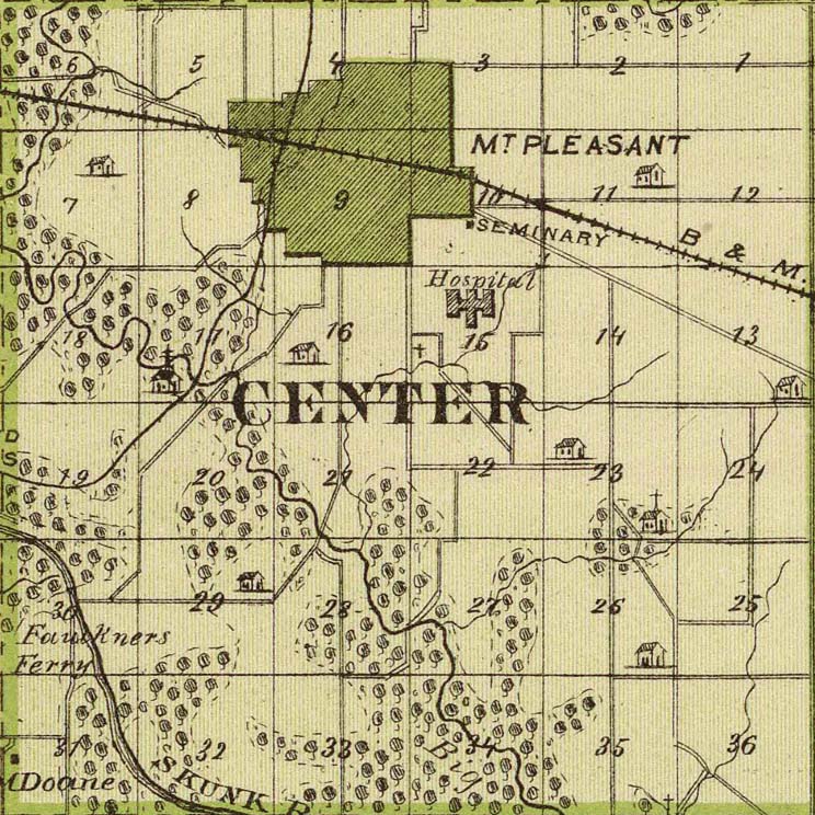
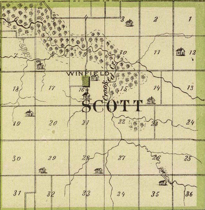
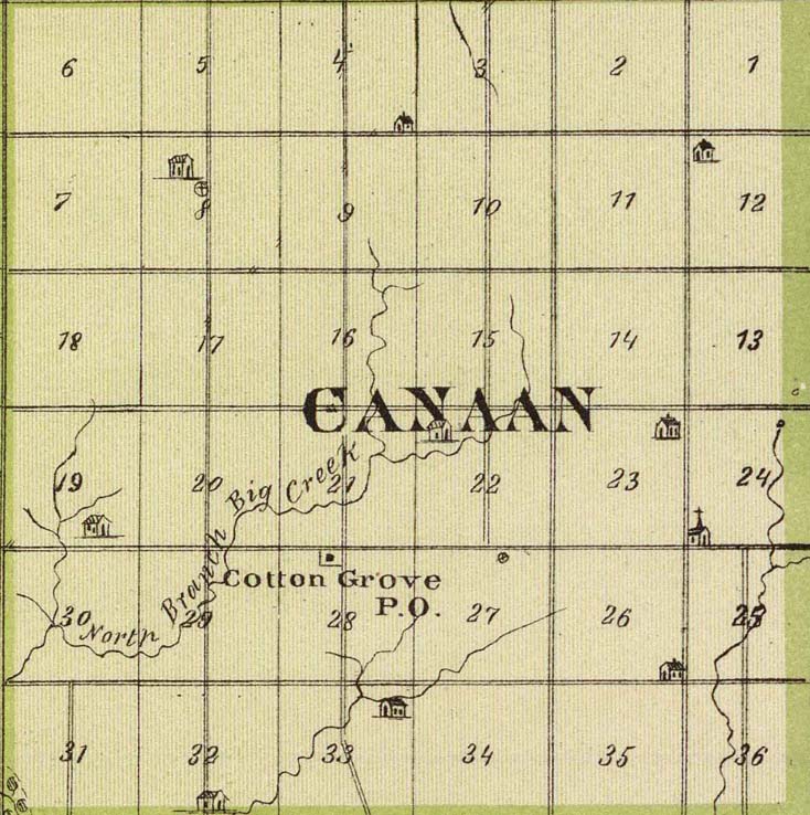
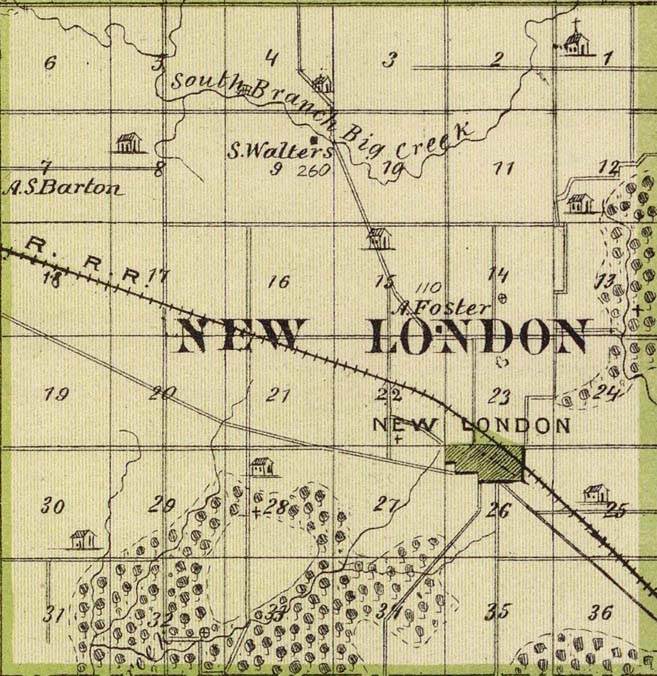
Township Maps, 1875, in great detail |
|
|
Jefferson
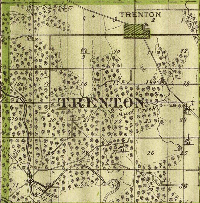
Trenton
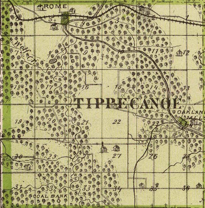
Tippecanoe
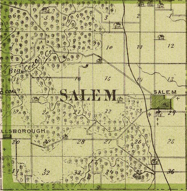
Salem |
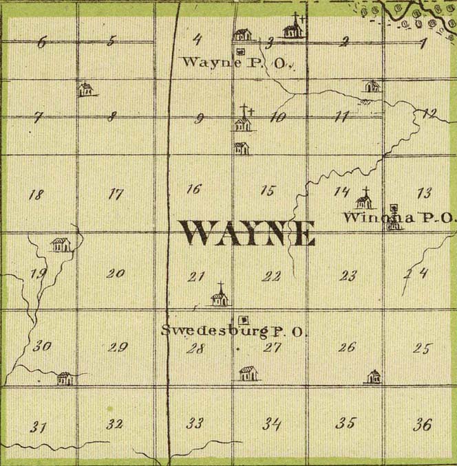
Wayne
Marion
Center
Jackson |
Scott
Canaan
New London
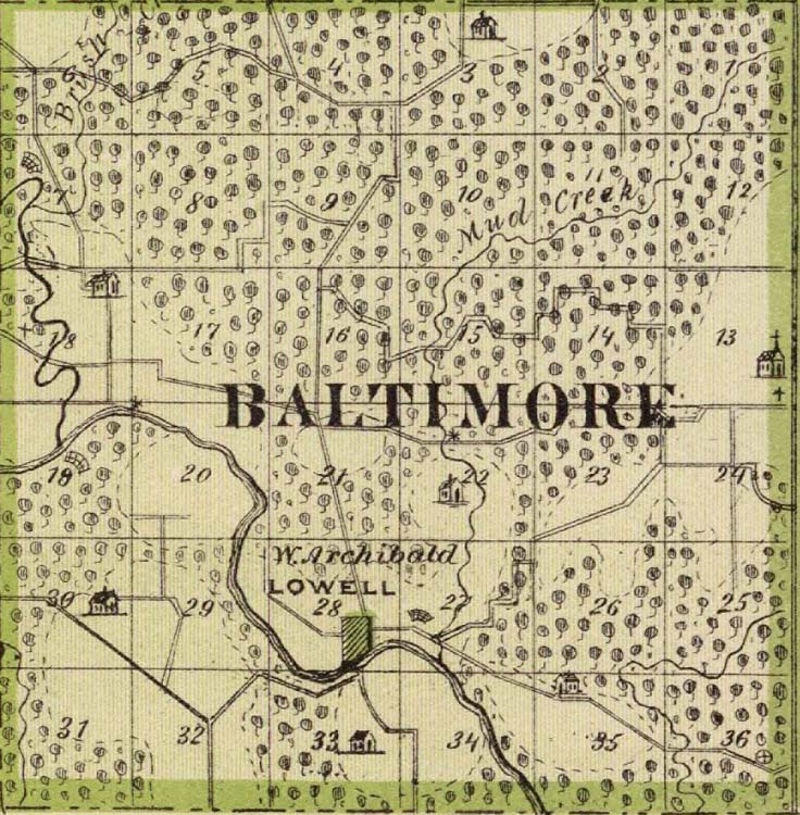
Baltimore |
|
1875 Map of Mt. Pleasant, Iowa |
1895 Map of Mt. Pleasant, Iowa
1900ish Map of Henry County, Iowa including township
maps |
|
|
Land Records |
|
First 100 Deeds of Henry County |
|
Land Patent Index |
|
Farmers Home Administration, Farm Ownership Case Files,
1939 |
|
1895 - Landowners |
|
|
Jefferson
Trenton
Tippecanoe
Salem |
Wayne
Marion
Center
Jackson |
Scott
Canaan
New London
Baltimore |
|
|
Iowa Century Farms - Henry County |
|
|
Henry County
IAGenWeb Home Page
Copyright © IAGenWeb. All rights reserved.
|
