| Henry County, IAGenWeb |
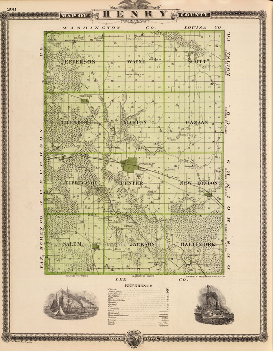
1875 Map of Henry County, State of Iowa
by Andreas, Alfred Theodore, 1839-1900
Click on images for larger views
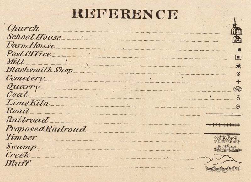
Reference
|
Publisher: Andreas Atlas Co. Chicago
Note: Col. lithographed map with 2 small views. Shows farm houses, landowners, schools, churches, mills, blacksmith shops, roads, railroads, proposed railroads, timber, swamps, bluffs, etc. Full Title: Map of Henry County, State of Iowa. Chas. Shober & co., props., Chicago Ith. Co. (Published by the Andreas Atlast co., Lakeside Building, Chicago, Ills. Engraved & printed by Chas. Shober & Co., Props. of Chicago Lithographing Co.) Engraver or Printer: Chas. Shober & Co.; Chicago Lithographing Co. Publication Author: Andreas, A . T. (Alfred Theodore), 1839-1900 Publication Date: 1875 Publication Title: A. T. Andreas' illustrated historical atlas of the State of Iowa, 1875. (7th Congressional District ed.). Published by the Andreas Atlas Co., Lakeside Building, Chicago, Ills. Engraved & printed by Chas. Shober & Co., Props. of Chicago Lithographing Co. Publication Reference: Checklist of Printed Maps of the Middle West to 1900, 8-0860; Ristow, American maps and mapmakers, p. 438-439; cf LeGear Atlases of the United States, L1136 and Phillips, 1639 (district not noted) Publication Note: Edition with views from the 7th Congressional District. Andreas made 9 separate editions of this atlas, one for each of the 9 Congressional Districts; each district ed. had special views of that district. See the reprint ed. by the Iowa Historical Society for a complete reproduction of all district views, as well as a discussion of the marketing technique in the preface. A second title page precedes the illustrated title page reading "A.T. Andreas' illustrated historical atlas of the State of Iowa. 1875. The Lakeside Press, Clark and Adams Streets, Chicago." Full color, both hand painted and printed. Bound in half leather embossed dark brown cloth covered boards with "Illustrated historical atlas of the State of Iowa 1875." in gilt; title is also blind stamped on the back cover. Not in Phillips Maps of America. Institution: Rumsey Collection Ownership Statement: Copyright 2005 We credit the David Rumsey Map Collection, www.davidrumsey.com. |
Map & Land Index *** Return to Home Page
Copyright © IAGenWeb, the submitters & IAGenWeb
Please read the IAGenWeb Terms, Conditions & Disclaimers
~all of which applies to the Henry county website.~