


Landowners of Calhoun County
Original Landowners from Federal Land Grants
|
(Click on map twice to enlarge) |
|
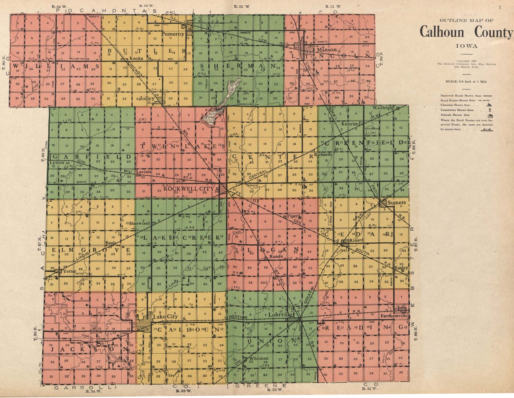
Original Land Entries Click on the Township & Range numbers to view an alphabetical list of owners, section, parcel description, date, and number of acres purchased. [Congressional land districts are square and include 36 sections with a township number and range number. The map to the left shows to Township numbers and range numbers on the sides.] Source: Bureau of Land Management |
|
Williams Township |
Butler Township |
Sherman Township |
Lincoln Township |
|
Garfield Township |
Twin Lakes Township |
Center Township |
Greenfield Township |
|
Elm Grove Township |
Lake Creek Township |
Logan Township |
Cedar Township |
|
Jackson Township |
Calhoun Township |
Union Township |
Reading Township |