The USGenWeb Project
Benton County, IAGenWeb Project
HOME SEARCH WHAT'S NEW SITE MAP
The IAGenWeb Project

Map of Benton County, Iowa
Map Last Updated: Friday, 23-Sep-2011 14:03:34 CDT
See: Map Legend

CLICK ON TOWNSHIP NAME FOR MORE INFORMATION
Township maps include numbered sections, identified groves of 1878 and country school districts of 1901.


Township map

Bruce Township Monroe Township Jackson Township Homer Township Kane Township Iowa Township Big Grove Township Union Township Leroy Township Eden Township Eldorado Township St. Clair Township Cedar Township Harrison Township Polk Township Taylor Township Benton Township Canton Township Fremont Township Florence Township


Benton County, Iowa Map created by Sue Soden.
Copyright © 1999-2009 by Sue Soden. All Rights Reserved.


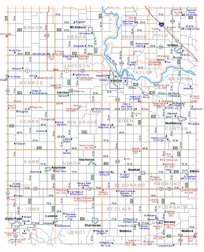
This map has been a "work in progress" for several years. It is the result of my studying
many old & new maps, long drives and information contributed by Benton County residents. I
don't claim to be an expert about Benton County's physical features and locales. Although I've
tried very hard to make it as accurate as possible, I don't guarantee that it is without errors.
Please e-mail me your comments, corrections and suggestions. Thank You!  Sue Soden


Go to Benton County:  Historical Place Names  Cemetery Locations Historical Maps


If you note any corrections, changes, additions, or  find any links provided on this web site that are
not  functioning properly please notify  John Shuck, your Benton County Website Coordinator.

Copyright © 1997-2024. This web site was created solely for the
use and benefit of the IAGenWeb Project
a part of the USGenWeb Project.
All Rights Reserved.