1871 Lockridge Township
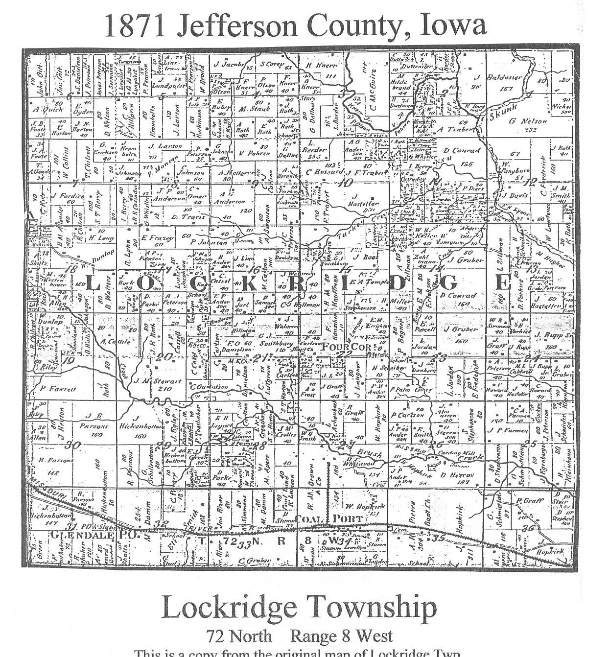
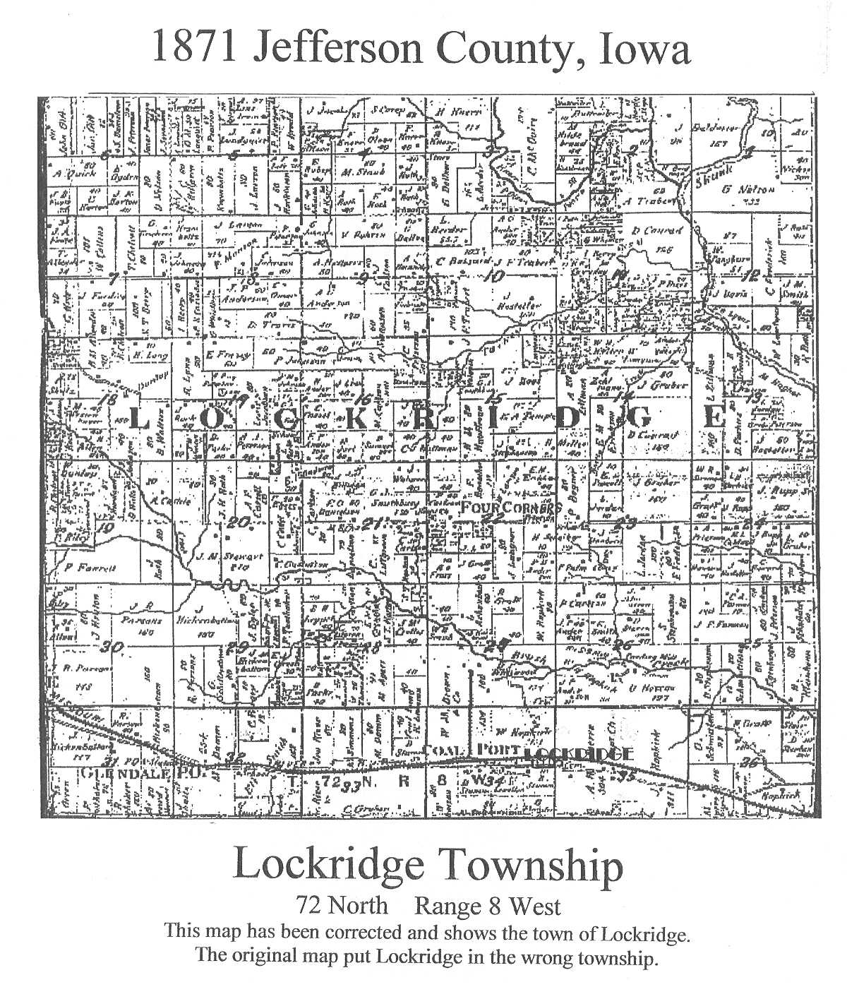
Map of Jefferson County
Property Owners

This map of Lockridge Township in Jefferson County, Iowa, comes from a copy of an 1871 map provided by Janet Roberts of the Jefferson County Genealogical Society.  A book and Atlas of these maps and the listings is available in the Fairfield Public Library or may be purchased from the Jefferson County Genealogical Society.

Please note:  There are two maps on this page.  The first is the original image.  The original image mistakely locates the town of Lockridge at the location for the village of Parsonsville in Buchanan Township and omits it at the correct location in Lockridge Township.  The second image was created to correct that error.

Names of the county's property owners, including those appearing on this map, have been listed on the Listing of Property Owners page. This map image will print out on an 8 1/2 x 11 sheet of paper.

Township originally surveyed on May 2, 1837.

RETURN TO TOP OF PAGE

Return to 1871 Township Maps Page


I am the County Coordinator and the Webmaster, the one who is responsible for the IAGenWeb project for Jefferson County, Iowa.  Please contact me if you would like to contribute to this database or if you note any problems with these pages.

Return to the Jefferson County Main Page