Our Lady of Lourdes Cemetery Table

Welcome to the Our Lady of Lourdes Cemetery Pages. This document summarizes data for 1181 graves and is mainly based on a 100% Photo survey of the Our Lady of Lourdes cemetery conducted by Bill Waters on August 21, 2014. This photo survey resulted in 1179 IGPP records. These IGPP records and 22 IAGenWeb Howard county Board obituary records are incorporated in these cemetery tables. This table contains 25 pointers to photos of the deceased. The left columns of the tabulation indicate the source of the summary data GPP (G) and Obits (O). A camera Icon indicates that either an obit or a GPP record or both display a photo of the deceased. Note that some records have more than one source; this is because in many cases the information is redundant. If there is a disagreement, your county coordinator has used his best judgment about which information to include in the compilation. This summary contains a wealth of information that was made available by volunteers taking pictures and transcribing data. Those volunteers are to be applauded, keep up the good work!
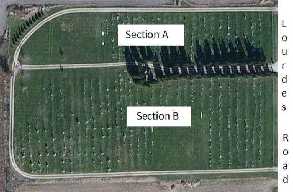
The sections as noted below are those that were used for the photo survey. The Grave Id's
referenced in the cemetery tables are those that were used
for the photo survey. A2 was the first grave photographed and it is located in the Lourdes
Road end of Section A. A473 is the last grave photographed
in section A and it is located in section A the furthest from Lourdes Road. B474 is the first grave photographed in section B and is
in section B the
furthest from Lourdes Road. B1182 is the last grave photographed and is located
in the Lourdes Road end of section B.


