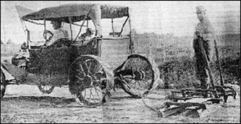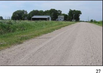
Sticky mud when it rained and dusty as face powder when it was dry. The roads of Milford Twp were no different than those of any other portion of Iowa in the early history of the State. In many places, near extra soft spots, the road would be simply moved over when it would become axle deep with ruts. Gradually, starting around the time of the First World War, these roads were stabilized and graveled and by the time of Second World War, there only remained four miles of dirt road within Milford Twp or on its borders. The dirt road between Secs 8 and 17, informally or perhaps humorously call "Lovers Lane", was closed in the early fifties. It was a pretty road with its overhanging branches and a strip of vegetation between the tire tracks, but on the other hand, when there was a pond across the road or water collected in the ruts, it was time to turn around. In 1926 there were only eight and three quar- ters miles of road that had been graveled within Milford Twp; however the six mile common road with Richland Twp, now S14, had gravel as did the south three miles of Dayton Rd (R-63) which borders Franklin Twp The roads within Milford Twp that had gravel were the Hartland Road (190th) (Done in 1925 or 1926) and the two and three quarter miles from (S-14 or 620th) to the county farm.
In the summer of 1929, the six mile road going south from Roland (R-77 or 600 Ave) was graveled to the Hartland Road. (E-29 or 190 Street)
1 Jan 1930 saw the transfer of control of township roads in Story County to the County Road system: ie; from the township trustees to the County Supervisors.
By 1935 there were about 28 miles (of the approximately 60 miles of roads within Milford Twp) of graveled road within Milford Township and eleven more that were common to other townships.
Currently, 2009, there are two roads of 3/4 mile and one road of one mile length that are still dirt.
Then, following the Korean War, in 1954 the first hard surfaced road in Milford Twp was lain atop the existing gravel from the cemetery corner in west Nevada north for four miles (actually the north three miles were in Milford Twp) to the Hartland Road. (now 190th or E-29) This road replaced four miles of gravel road that generally had 3-1/2 miles of wash board gravel that had a distinct tendency to turn a car sideways if the speed were very high. But the new surface was smooth and conducive to higher speeds which meant dashing past and missing the beauty of the growing corn and weeds, the attractive, well maintained-precisely painted farmsteads; seemingly speeding up the entire commu- nity, even the birds must flee with faster reaction.
In the fifties, and perhaps earlier and as late as 1964, there was a different system of identifying the main roads. The Hartland Road (E-29) was labeled "E". Dayton Road, south of Dayton Park, was also labeled "E". R-77 (600 Ave) was labeled "C" and the road in
