 |
A part of the IAGenWeb and USGenWeb Projects Maps of the County |
 |
|
|
A part of the IAGenWeb and USGenWeb Projects Maps of the County |
|
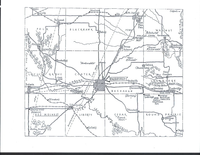
Jefferson County Map (ca. 1970) Showing Townships, Communities, & Other Interesting Features
The U.S. Geological Survey has pinpointed 374 Places of Interest in Jefferson County, but is somewhat out of date. A revised list can be found here. This list can help you find locations where an ancestor may have lived, churches, cemeteries, etc., using GPS coordinates.
I am the County Coordinator and the Webmaster, the one who is responsible for the IAGenWeb project for Jefferson County, Iowa. Please contact me if you would like to contribute to this database or if you note any problems with these pages.