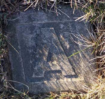
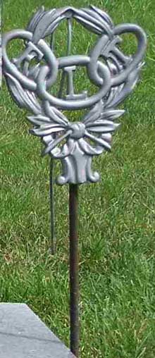
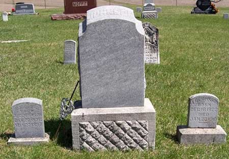
| D14 | | | | | | | "A" plot marker |
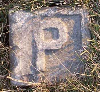
| N15 | | | | | | | "P" plot marker; faded /chipped |
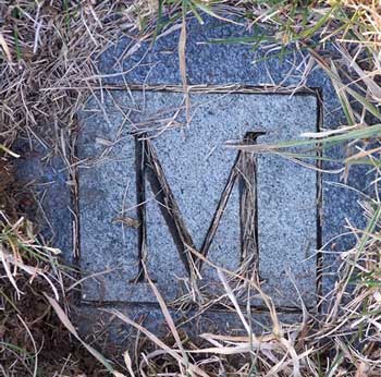
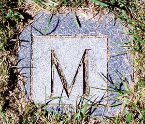
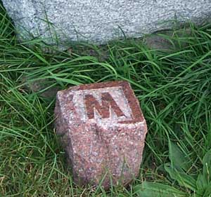
| K19 | | | | | | | "M" plot marker- south & West of Bradford Furman |
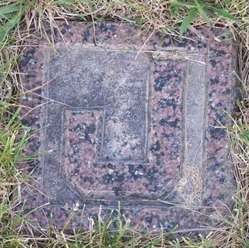
| D27 | | | | | | | "J" plot marker; North of their stone (in row line) |
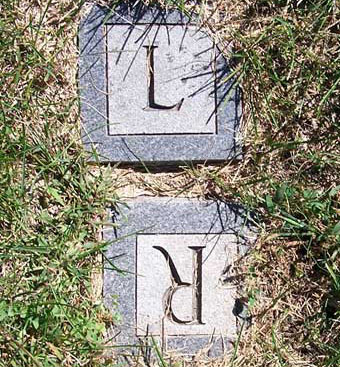
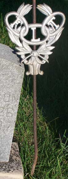
| H31 | | | | | | | 4 empty plots then an "L" marker(L faces south /W faces east -right beside each other |
| I25 | | Aunt | | | | | stone labeled Aunt only- sits south of Josiah & Mary Maule stone-"foot stone" |
| B22 | | | | | | | "P" plot marker in front of P.Roberts stone |
| I06 | | | | | | | unmarked grave |
| N05 | | | | | | | unmarked grave |
| O35 | | | | | | | unmarked grave. Reported first grave - Piersol - depression of tree, large rock, and grave. |
| P13 | | | | | | | unmarked grave |
| B23 | | | | | | | unmarked grave |
| C10 | | | | | | | unmarked grave |
| C14 | | | | | | | unmarked grave |
| D05 | | | | | | | unmarked grave; stone marker- |
| G07 | | | | | | | unmarked grave |
| G14 | | | | | | | unmarked grave |
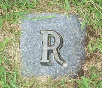
| G26 | | | | | | | unmarked grave; R marker |
| H12 | | | | | | | unmarked grave |
| H25 | | | | | | | unmarked grave; R marker |
| I11 | | | | | | | unmarked grave |
| I16 | | | | | | | unmarked grave |
| O02 | | | | | | | unmarked grave |
| B16 | | | | | | | J plot marker ahead north & then west Charles J (unknown) stone |
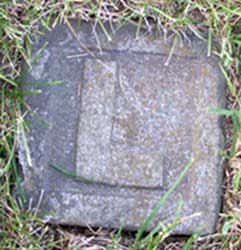
| B17 | | | | | | | L Plot marker (between Charles J (unknown) & Maggie Wade stone |
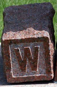
| L16 | | | | | | | Large gray colored "W" plot marker - was sitting next to L16 stone. |
| C16 | | | | | | | no plot space - "A" Plot marker |
| G03 | | | | | | | illegible stone |
| G04 | | | | | | | illegible stone |
| G05 | | | | | | | illegible stone |
| H10 | | | | | | | R marker |
| H30 | | | | | | | R & W plot markers |
| H35 | | | | | | | R & L plot marker |
| L20 | | | | | | | plot open? |
| L21 | | | | | | | Roberts? |
| M17 | | | | | | | no markings on stone |
| O03 | | | | | | | D marker |
| O20 | | | | | | | M marker |
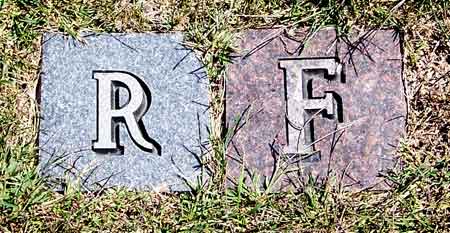
| O31 | | | | | | | F marker |
| K12 | (Illegible) | C. F. | | Jul 26, 1868 | 37y | | |
| ?E | (Johnston) Rowe | Lucy A. | Sep18, 1821 | Oct 5, 1929 | | | Notation: Per obituary, married Marvin Rowe on 14 May 1843-in Illinois. 1856 moved to Ia City, Ia. |
| K03 | (Tree) | | | | | | no plot space |
| L01 | (Tree) | | | | | | no plot space |
| F22 | Adams | Jack E. | Jul 15, 1936 | Dec 9, 1999 | | | "I am the eternal optimist. The best is yet to come." |
| F23 | Adams | Harry W. | Nov 6, 1905 | Nov 6, 1967 | | | shares stone with Orpha Adams |
| F23 | Adams | Orpha M. | Jul 12, 1917 | Aug 31, 1987 | | | "May you rest with a dream on your mind, a smile on your face & a love so kind" |
| C15 | Aggson | Cleties V. | Dec 21, 1913 | Apr 28, 1915 | 1y 3m 28d | | "daughter of H & M.C. Aggson" (back of stone); (per obit) Cledith Viola Aggson & also birth date -shares stone with Nina Netser. |
| C17 | Aggson | Henry | Apr 5, 1869 | Jan 9, 1941 | | | Share stone with Mary Aggson. |
| C17 | Aggson | Mary C. | Apr 23, 1892 | Jan 16, 1944 | | | Maiden name Netser; Children: Leland, William D., Leota, Cleties V. |
| M18 | Aggson | Mattie | Aug 26, 1874 | Apr 27, 1946 | | | per obit-given/ maiden name Martha Wade-daughter of James & Christina (Fry) Wade. |
| M18 | Aggson | Sherman | Dec 29, 1865 | Jun 27, 1943 | | | Shares stone with Mattie Aggson |
| C15 | Aggson | | | | | | A plot marker - Aggson - directly in front of N.Netser & Cleties shared stone |
| G16 | Berry | Francis M. | Dec 19, 1832 | Feb 6, 1927 | | | Small Father stone by main stone. (Francis Marion) Shares stone with Margaret. |
| G16 | Berry | Margaret | Oct 7, 1832 | Jan 19, 1913 | | | maiden name is Lemley - Small mother stone by main stone. |
| G18 | Berry | Addie | Oct 21, 1874 | Mar 14, 1941 | | | (Took care of her brother James A. Berry) |
| H18 | Berry | John W. | Jan 26, 1860 | Sep 14, 1865 | 5y 7m 18d | | son of F.M. & M. Berry - stone is broken at base (2006) |
| H19 | Berry | George T. | | May 5, 1866 | 6y 4m 9d | | son of F.M. & M. Berry |
| H20 | Berry | Thomas M. | | Dec 5, 1866 | 9y 9m 7d | | son of F.M. & M. Berry |
| H21 | Berry | Dora E. | Sep 22, 1917 | Jul 11, 1892 | 20y 9m 19d | | "Dearest loved one, we must lay you in the peaceful grass embrace - But thy memory will be cherished - Till we see they heavenly face"; Daughter of F.M & M. Berry |
| N01 | Berry | Henry | | May 20, 1880 | 82y 7m 20d | | Mother/Father engraved on south side of stone. Shares stone with Mary Berry. |
| N01 | Berry | Mary | | Aug 11, 1877 | 73y 8m 28d | | Father and Mother are gone.They lie beneath the sod.Our parents tho we miss you, we know you rest with God! |
| N02 | Berry | Harmon H. | | May 17, 1873 | 5m 9d | | son of H.G. & M.L. Berry |
| N02 | Berry | Henry G. | | Feb 12, 1877 | 36y | | shares stone with Harmon H & Margaret E. Berry |
| N02 | Berry | Margaret E. | | Jan 11, 1872 | 11y | | Daughter of H. G. & M. L. Berry |
| G17 | Berry | James A. | Aug 1, 1853 | Sep 16, 1945 | | | James Alf Berry (was blind) |
| A23 | Blair | James M. | Sep 18, 1950 | Sep 19, 1950 | | | |
| A24 | Blair | Ramona | | | | | "In memory of"; "Rest in peace"; unusual stone |
| B27 | Blair | Esther J. | 1922 | 1992 | | | Shares stone with Francis Blair |
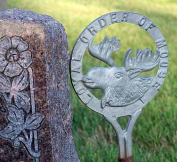
| B27 | Blair | Francis O. | 1917 | 1956 | | | Royal Order of Moose marker- broken 9/2007 |
| B29 | Blair | Jessie M. | 1897 | 1982 | | | Shares stone with Oscar Blair. |
| B29 | Blair | Oscar M. | 1887 | 1975 | | | |
| I14 | Boothe | Chesley Harlan | | Jul 26, 1864 | 4m 11d | | "Son of T.D. & L.A. Boothe"; stone set back in row |
| I15 | Boothe | Lucy A | | Mar 9, 1870 | 27y 1m 3d | | "wife of Truman D. Boothe"; stone set back in row |
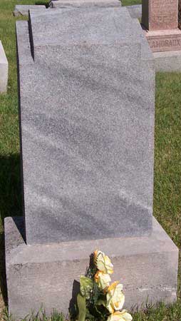
| D14 | Bucher | Alice | May 18, 1868 | Sep 28, 1907 | | | Shares stone with Richard Bucher |
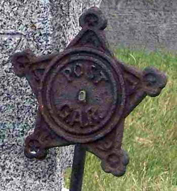
| D14 | Bucher | Richard | Nov 5, 1846 | Feb 7, 1908 | | | G.A.R. marker |
| I25 | Burwood | Elizabeth | | Mar 17, 1888 | 71y | | shares stone with Mr. & Mrs Josiah Maule - small aunt stone south of large Maule gravestone |
| D01 | Carter | Katie M. | Oct 14, 1893 | Jul 18, 1962 | | | per obit-maiden name: Hardy- married Wallace M. Carter on Jan 17,1912 |
| D01 | Carter | Wallace M. | Sep 24, 1891 | Nov 24, 1975 | | | per obit- Wallace Melvin Carter -Shares stone with Katie Carter |
| M21 | Chittick | Ellen Wade | Oct 21, 1917 | | | | married Feb 11, 1937- Wade is her maiden name |
| M21 | Chittick | Everett E. | Aug 1, 1914 | Dec 8, 1997 | | | Shares stone with Ellen Chittick |
| O01 | Chittick | Irmgard | Jun 6, 1947 | Sep 19, 1994 | | | married June 19, 1968- shares stone with Sanford Chitick |
| O01 | Chittick | Sanford | Jun 27, 1945 | | | | parents of Michaela |
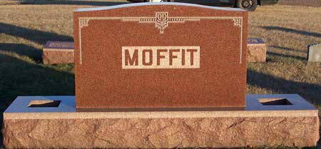
| C03 | Claypool | Ruth M. | Jun 17, 1928 | Jan 30, 2004 | | | "Mother of Wanda, Carolyn, Gary, Debra, Suzanne"; maiden name Moffit, divorced Don in 1972, was a twin, twin died at birth. |
| J24 | Claypool | Daisy D. | 1874 | 1930 | | | Maiden name "Moffit" |
| J24 | Claypool | Henry W. | 1864 | 1933 | | | shares stone with Daisy Claypool |
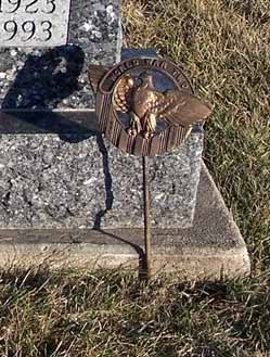
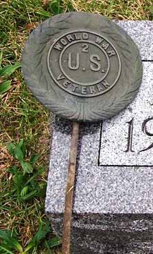
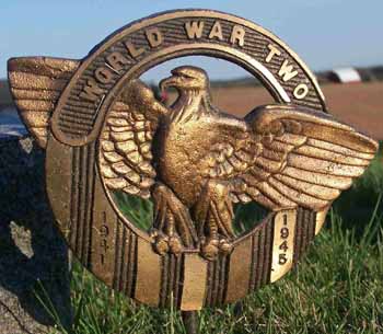
| J25 | Claypool | Ralph P. | Apr 14, 1899 | Apr 18, 1936 | | | Foster son - WWI veteran marker |
| E26 | Cobb | Kathryn Pearl | Feb 19, 1952 | | | | Kept maiden name Cobb- Shares stone with Wm. Musser |
| E27 | Cobb | Dorthy V. | Jul 29, 1915 | Nov 13, 1981 | | | Shares stone with Raymond Cobb |
| E27 | Cobb | Raymond L. | May 7, 1917 | | | | |
| N15 | Cobb | Estill A. | 1908 | 1996 | | | married Jan 27, 1932 |
| N15 | Cobb | Lucille M. | 1914 | | | | Shares stone with Estill Cobb |
| O10 | Connelly | Willie Elmo | | Dec 27, 1893 | 1y 2m 2d | | "Only sleeping"; son of P.L. & L.C. Connelly |
| F16 | Cramer | G.E. | 1856 | 1939 | | | |
| I21 | Crofford | Elexader B.G. | | Sep 26, 1864 | 5m 8d | | son of Cyrus & Rhoda |
| K05 | Dean | Mary M. | | May 22, 1890 | 58y 10m 19d | | wife of S.J.F. Dean |
| K06 | Dean | Seth A | | Aug 26, 1883 | 22y 7m 20d | | "Was from our household ___ voice we loved is stilled. A place is vacant in our heart, which never can be filled"; son of J.F. & M.M. Dean; Eccl:21;7_1-200:_(_?unknown lines) |
| K10 | Dean | Florance A. | | Feb 19, 1876 | 16y 3m 21d | | daughter of S.J.F. & M.M. Dean |
| N14 | Denison | Bessie M. | Sep 5, 1897 | Dec 3, 1979 | | | Shared stone of Bessie, George, and Helen Denison |
| N14 | Denison | George W. | Nov 8, 1892 | Nov 28, 1974 | | | |
| N14 | Denison | Helen M. | Apr 19, 1928 | Jan 23, 1991 | | | |
| N14 | Denison | | | | | | "D" plot marker |
| O23 | Denison | Phyllis R. | May 26, 1931 | | | | "parents of Eric"; maiden name Hediger |
| O23 | Denison | Ross Dale | Sep 3, 1923 | Aug 23, 1993 | | | Obit states Ross Dale-Pvt, USMCR -wounded during WWII (per U.S.National Archives- WWII Causualities) |
| O06 | Dietze | James E. | Apr 10, 1940 | | | | Shares stone with Jane Ann Dietz |
| O06 | Dietze | Jane Ann | Mar 13, 1942 | | | | parents of Larry David |
| H09 | Dixon | Edwin S. | | Aug 12, 1868 | 1y 11m 21d | | son of E.H. & S. Dixon |
| K20 | Douglas | Lina M. | | Nov 9, 1911 | | | wife of Roy Douglas |
| B30 | Duffy | Alverda Blair | Oct 26, 1915 | Jan 26, 1987 | | | Mother of Larry, Francis, Robert, and Judy |
| B31 | Duffy | Brandon M. | Dec 17, 1984 | Aug 23, 1989 | | | "We love you" |
| B31 | Duffy | Robert | Aug 29, 1940 | Nov 7, 2001 | | | small stone in front of Brandon Duffy |
| E01 | Emde | Chris | 1865 | 1952 | | | |
| E01 | Emde | Ora L. | 1881 | 1959 | | | |
| G06 | Foubert | Gertrude E. | 1903 | 1982 | | | parents of Bill, Doris, and Jean |
| G06 | Foubert | John F. | 1898 | 1964 | | | FLT marker |
| O27 | Foubert | Dorothy Polton | Nov 23, 1926 | | | | Parents of Jerry and Randy |
| O28 | Foubert | William Oren | Apr 21, 1927 | Jul 30, 1997 | | | Married Oct. 2, 1945 |
| O28 | Foubert | | | | | | Plot marker R & F present here |
| H14 | Furman | Gay | | Apr 10, 1899 | 23y 3m 7d | | shares stone with Harlan Furman |
| H14 | Furman | Harlan L. | | Sep 23, 1885 | 2m 4d | | children of F.J. & M.E. Furman |
| H15 | Furman | M. Ellen | Jan 14, 1851 | Sep 21, 1928 | | | |
| H16 | Furman | Rebecca | May 30, 1828 | Dec 21, 1865 | 37y 5m 21d | | wife of David D. |
| K18 | Furman | Matilda D. | | Feb 27, 1907 | 38y 5m 15d | | wife of B.L. Furman |
| K19 | Furman | Bradford L. | 1864 | 1938 | | | Father |
| K21 | Furman | Frances M. | 1904 | 1938 | | | |
| K22 | Furman | Harrison W. Sr. | 1888 | 1939 | | | Father |
| K23 | Furman | Harrison W. Jr. | | 1915 | | | |
| L22 | Garringer | Anna Ruth | Oct 1, 1924 | Apr 23, 2006 | | | |
| C05 | Hall | C.W. | Jun 15, 1859 | Sep 30, 1921 | | | |
| C06 | Hall | Dr. T.E. | | Apr 9, 1907 | 89y 10m 25d | | Small father stone by Main stone. Shares stone with Louise Hall |
| C06 | Hall | Louisa C. | | Oct 4, 1909 | 83y 11m 18d | | has small mother stone by large stone |
| C07 | Hall | Calla M. | | Jan 8, 1891 | 7m 25d | | "child of E. L. & A. M. Hall"; shares stone with Clarence Hall |
| C07 | Hall | Clarence | | Apr 18, 1884 | 18d | | "child of E. L. & A. M. Hall"; shares stone with Calla Hall |
| L01 | Hallet | Amanda | | Oct 25, 1859 | 18y 2m 23d | | daughter of Solomon & Sarah A. Hallet |
| L02 | Hallet | Elam | | Aug 21, 1859 | 21y 5m 11d | | "son of Solomon & Sarah A. Hallett"; Stone now standing 8-2007 |
| K24 | Halverson | Sarah Furman | 1895 | 1942 | | | |
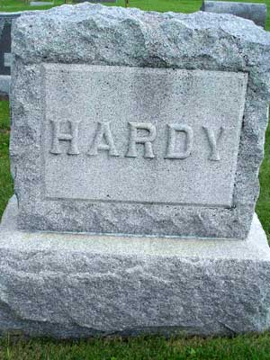
| D02 | Hardy | | | | | | Family Stone |
| D02 | Hardy | George | May 23, 1860 | Jun 26, 1929 | | | was murdered/stabbed to death per article |
| D03 | Hardy | Peter Myron | Mar 29, 1917 | Nov 3, 1918 | | | |
| D04 | Hardy | J.J. | Nov 27, 1888 | Aug 29, 1917 | | | |
| E04 | Hardy | Mary Emily | 1864 | 1949 | | | Shares stone with Peter Hardy |
| E04 | Hardy | Peter | 1858 | 1950 | | | |
| E05 | Hardy | Alma J. | | Feb 21, 1912 | 15y 5m 28d | | daughter of P. and M.E, Hardy |
| E06 | Hardy | Ira M. | | Mar 19, 1896 | 10y 5m 6d | | son of P & M.E. Hardy |
| E07 | Hardy | Anna C. | Jul 15, 1826 | Apr 20, 1919 | | | |
| E07 | Hardy | Jacob | Jun 30, 1825 | Sep 9, 1891 | | | Share stone with Anna Hardy |
| E17 | Hevern | Annie G. | May 5, 1856 | Nov 23, 1897 | 41y 6m 18d | | wife of H.B. Hevern |
| J12 | Hevern | Rebecca L. | | Feb 19, 1886 | 27 y 1m 7d | | wife of H.B. Hevern |
| J28 | Holmes | Beth | Aug 19, 1908 | Feb 10, 1984 | | | OES - Ladies VFW marker |
| J28 | Holmes | Harold B. | Jun 27, 1907 | Dec 24, 1986 | | | Mason- Shares stone with Beth Holmes |
| F03 | Hudson | Ella F. | Oct 3, 1875 | Apr 21, 1939 | | | |
| F04 | Hudson | Jesse F. | Feb 8, 1867 | Jan 31, 1944 | | | |
| G01 | Hudson | Mervin S. | Apr 11, 1927 | Apr 8, 1954 | | | |
| G02 | Hudson | Edna V. | 1905 | 1984 | | | Shares stone with Edward Hudson |
| G02 | Hudson | Edward L. | 1898 | 1951 | | | |
| H01 | Hudson | Charles D. | Sep 28, 1957 | Aug 21, 1994 | | | |
| H02 | Hudson | Lawrence | 1900 | 1959 | | | shares stone with Thelma Hudson |
| H02 | Hudson | Thelma | 1906 | 1997 | | | |
| H03 | Hudson | Leona | 1932 | 2004 | | | maiden name Thompson |
| H03 | Hudson | Merlin Eugene | Mar 12, 1928 | Mar 24, 1991 | | | US Army - Vietnam War marker |
| H04 | Hudson | Johnette L. | 1937 | | | | Nancy, Rick, Becky, Tommy, Terry, Kelly, John, Bruce,& Matt |
| H04 | Hudson | Thomas D. | 1934 | 1996 | | | married Oct 20, 1954- parents of Vick, Cindy, Delbert, |
| I02 | Hudson | Evelyn Marie | Dec 26, 1940 | | | | Married Nov. 20, 1959 |
| I03 | Hudson | Arnold Ray | May 31, 1936 | Nov 2, 2005 | | | Father of Charles-shares stone with Evelyn |
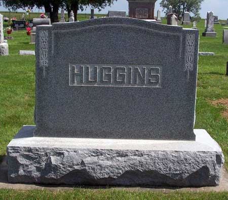
| B05 | Huggins | Hattie A. | 1862 | 19?? | | | small Hattie stone - no date of death recorded |
| B06 | Huggins | Edward M. | 1866 | 1928 | | | small Edward stone |
| B05 | Huggins | | | | | | Large Huggins family stone in front of Hattie & Edward's individual stones |
| C | illegible | | | | | | white stone -south of J.J. Hardy |
| C | illegible | | | | | | white stone-south of J.J. Hardy (gone as of 9/15/2007) |
| G19 | Johnson | Harriett | Jul 1, 1869 | Jan 27, 1965 | | | Maiden name "Berry" |
| G19 | Johnson | Thomas | Sep 2, 1859 | Mar 20, 1951 | | | |
| J13 | Johnson | Harriett G. | Jan 20, 1826 | Mar 27, 1897 | | | "Rest mother rest in peaceful sleep, But not in sorrow"; wife of A.G. Johnson; "Mother" written on top of stone |
| J13 | Johnson | | | | | | Large gray family stone with Johnson written on top. |
| J13 | Johnson | A.G. | Dec 16, 1822 | Jan 23, 1910 | | | FTL marker - Father written on top of stone |
| J16 | Johnson | Lucy P. | | Jan 17, 1859 | | | wife of Tho. Johnson |
| J16 | Johnson | Tho. | | Apr 17, 1861 | 67y | | |
| J17 | Johnson | Caroline A. | Aug 24, 1864 | Sep 16, 1864 | | | daughter of A.P. & M.F. Johnson |
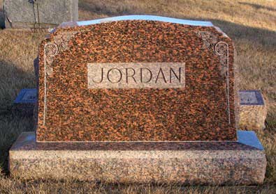
| A09 | Jordan | Mariam M. | Aug 3, 1914 | Mar 29, 1915 | | | |
| A10 | Jordan | Mamie | 1895 | 1956 | | | |
| A11 | Jordan | Ray | 1890 | 1934 | | | |
| A13 | Jordan | Frank | 1893 | 1916 | | | |
| A14 | Jordan | Martha | 1857 | 1920 | | | |
| A15 | Jordan | Thomas | 1851 | 1922 | | | |
| C27 | Jordan | Clara | Nov 2, 1923 | | | | Parents of Frederick, James, Eugene |
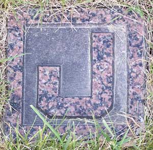
| C27 | Jordan | Keith | Mar 29, 1918 | Mar 16, 2000 | | | "J" marker- shares stone with Clara Jordan |
| D27 | Jordan | Charles R. | Mar 10, 1916 | Nov 19, 2002 | | | Married Oct. 14, 1939- Shares stone with M.Marie Jordan |
| D27 | Jordan | M. Marie | Jan 17, 1920 | | | | Parents of Bill R., Rita Ann, J. B. Lloyd |
| D28 | Jordan | Harry T. | Sep 12, 1927 | Jan 28, 1991 | | | A3C US Air Force - Korea - Korean War marker |
| A11 | Jordan | | | | | | Family Stone; ahead & North of Ray & Mamie Jordan's stones. |
| A11 | Jordan | | | | | | Plot marker; to South of Ray & Mamie Jordan's Family stone. |
| A14 | Jordan | | | | | | Family Stone; ahead & North of Frank & Martha Jordan's stones. |
| A14 | Jordan | | | | | | "J" plot marker south of Frank & Martha Jordan Family stone. |
| L17 | L. | S.G. | | | | | "S.G.L." stone -unknown who it refers to (unknown if stone is related to Francis Wade family.) |
| G16 | Lamaroux | John Clark | | | | | "J.C.L" - Foot stone of John Clark Lamaroux |
| F11 | Lamoraux | Relia A. | 1855 | 1921 | | | |
| F12 | Lamoraux | Daniel | | Aug 8, 1896 | 88y | | Shares stone with Sylvia Lamoraux |
| F12 | Lamoraux | Sylvia A. | | Jul 6, 1889 | 72y | | wife of D. Lamoraux |
| F13 | Lamoraux | John Clark | | Jun 14, 1892 | 12y 8m 7d | | "It is well with the boy"; Son of George & Emily Lamoraux |
| F14 | Lamoraux | Emily J. | Feb 21, 1836 | Feb 16, 1925 | | | maiden name: Netser- Shares stone with George Lamoraux |
| F14 | Lamoraux | George S. | Apr 8, 1834 | Oct 7, 1916 | | | small mother/father stone beside large stone |
| F15 | Lamoraux | Edgar | Mar 16, 1857 | Dec 20, 1945 | | | |
| F15 | Lamoraux | Sarah Ellen | Apr 5, 1861 | Jul 22, 1941 | | | |
| K03 | Launraux | Alice Adel | Nov 17, 1861 | Dec 18, 1884 | 23y 1m 1d | | "Gone but not forgotten"; wife of Edward Launraux; daughter of Francis & Martha Wade |
| H31 | Le Fever | Joe Charles | Oct 6, 1915 | Jul 2, 1964 | | | WWII veteran marker- Shares stone with Luella LeFever |
| H31 | Le Fever | Luella E | May 7, 1922 | Aug 1, 2006 | | | per obit.Her maiden name was Wade - With her parents names Henry & Carrie (Long) Wade. |
| F01 | Lecker | Ora Adeline | May 16, 1899 | Oct 1, 1961 | | | Maiden name "Ponchaud" |
| G15 | Lemley | John | Aug 17, 1805 | Jan 19, 1872 | | | John & Mary Lemley share stone. |
| G15 | Lemley | Mary | Nov 20, 1802 | May 8, 1901 | | | |
| H17 | Lemley | Sina C. | Jul 29, 1844 | Oct 16, 1865 | | | |
| E10 | Litzenberg | Nellie G. | Jan 12, 1853 | Jan 10, 1917 | | | |
| E11 | Litzenberg | Elizabeth H. | Aug 23, 1855 | Feb 3, 1945 | | | maiden name "Hardy" |
| E11 | Litzenberg | William C. | Oct 16, 1850 | Mar 28, 1931 | | | Shares stone with Elizabeth Litzenberg. |
| E12 | Litzenberg | R.G. | Jan 29, 1886 | Aug 28, 1977 | | | Brothers~Shares stone with John Litzenberg |
| E12 | Litzenberg | John J. | Oct 25, 1884 | Aug 25, 1962 | | | Brothers |
| E08 | Litzenberger | Mary E. | | Dec 28, 1889 | 12d | | "Beautiful, lovely she was but, amen. I fall bud to earth to blossom in heaven"; daughter of W.C. & L.H. Litzenberger |
| E09 | Litzenberger | Katie | Feb 5, 1888 | Dec 1, 1891 | 3y 9m 26d | | "__has taketh to his __ and carieth them in his bosom"; daughter of W.C. & L.H. Litzenberger. Inscription are illegible due to chipping. |
| B13 | Long | Charles S. | Oct 2, 1869 | Nov 17, 1952 | | | IOOF marker |
| B13 | Long | Mattie | Jan 9, 1876 | Mar 21, 1911 | | | Shares stone with Charles Long |
| C19 | Long | George W. | 1865 | 1937 | | | shares stone with George Long |
| C19 | Long | Mary A. | May 5, 1873 | Apr 16, 1918 | | | |
| C22 | Long | Gerald | 1918 | 1926 | | | son of John & Louise Long |
| C23 | Long | Richard | 1934 | 2001 | | | son of John & Louise Long; L marker |
| F05 | Long | Mary E. | 1875 | 1949 | | | Shares stone with Oren Long |
| F05 | Long | Oren A. | 1867 | 1935 | | | IOOF markers- # 525 |
| F06 | Long | J.W. | Feb 27, 1836 | Jun 2, 1914 | | | |
| F06 | Long | Sarah J. | Jul 7, 1844 | Nov 11, 1915 | | | Shares stone with J.W. Long |
| F24 | Long | Hugh J. | 1897 | 1979 | | | |
| F24 | Long | Irma M. | 1908 | 1974 | | | Shares stone with Irma Long |
| F27 | Long | Clarence L. | Sep 6, 1908 | May 17, 1975 | | | Parents of Mervyn, Shirley, Gary, John & Linda; married Oct. 6, 1928 |
| F27 | Long | Dorothy E. | Sep 19, 1913 | Feb 2007 | | | Shares stone with Clarence Long |
| F29 | Long | Mervyn L. | Sep 9, 1930 | Feb 23, 2007 | | | Shares stone with Norma Long |
| F29 | Long | Norma L. | Mar 23, 1933 | | | | parents of Sandi, Becky, Debbie, Kim, and Christi |
| G29 | Long | Charles E. | 1899 | 1965 | | | Shares stone with Ida Long |
| G29 | Long | Ida S. | 1902 | 1987 | | | married Nov 19. 1923 |
| G30 | Long | Grace Elizabeth | 1926 | 1926 | | | |
| F31 | Long | | | | | | L marker |
| B13 | Long | | | | | | Family Stone & a "L" plot marker north of Mattie & Charles Long |
| N06 | Manville | George W. | | Jan 25, 1858 | 1m 10d | | son of G.L. & S.M. Manville |
| I20 | Maule | William H. | | Apr 13, 1864 | | | son of David & Beata Maule 31y 10m 16d |
| I22 | Maule | David | | Mar 27, 1866 | 63y 5m 17d | | "Dearest Father, thou hath left us. Here thy last our deeply fret. But tis God that hath bereth us. We can all our sorrows heal" |
| I23 | Maule | Thomas | | May 13, 1876 | 92y | | "I'll never leave thee nor forsake thee" |
| I24 | Maule | Edward | Nov 30, 1834 | Sep 20, 1900 | | | Father; GAR marker- father stone behind large gravestone- Share Large stone. |
| I24 | Maule | Ermilda | Jul 27, 1844 | Sep 7, 1879 | | | Mother; wife of Edw. - mother stone behind large gravestone |
| I25 | Maule | Josiah | | Dec 19, 1886 | 77y | | "I want to go to sleep"; small father stone behind shared large stone. |
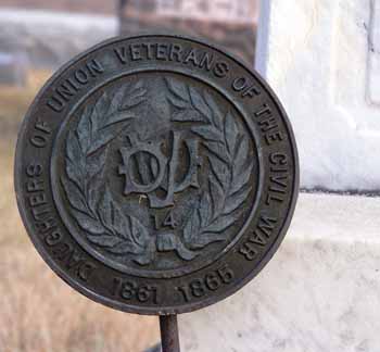
| I25 | Maule | Mary S. | | Jan 15, 1883 | 82y | | wife - mother-small mother stone behind shared large stone. Daughters of Union Civil War Veterans 1861-1865 marker. |
| I26 | Maule | Benton | Jan 1893 | Jul 1893 | | | |
| I27 | Maule | Jesse | 1896 | 1902 | | | |
| I28 | Maule | Esther | 1903 | 1906 | | | |
| I29 | Maule | Ermilda L. | 1894 | 1930 | | | |
| I30 | Maule | John J. | 1866 | 1939 | | | Father- Shares stone with Myrtle Maule |
| I30 | Maule | Myrtle S. | 1869 | 1931 | | | Mother |
| I31 | Maule | John Jr. | 1901 | 1953 | | | |
| I32 | Maule | Thomas John II | Dec 5, 1918 | May 3, 1985 | | | Cpl US Army WWII - American Legion marker |
| J22 | Maule | Mary S. | Jan 15, 1863 | Oct 26, 1908 | | | Hosta Planter - shape of bed |
| J23 | Maule | Elizabeth B. | Apr 16, 1861 | Mar 29, 1926 | | | daughter of Edward & Ermilda Maule |
| J26 | Maule | Charles | Mar 18, 1868 | Feb 20, 1937 | | | son of Edw. & Ermilda Maule |
| J27 | Maule | Thomas | Apr 8, 1878 | Apr 11, 1950 | | | son of Edw. & Erm. Maule |
| P05 | Merchant | Jennifer | Dec 15, 1979 | Jan 6, 2006 | | | Forever in our hearts |
| C02 | Meyers | Emmagene | Aug 10, 1915 | Aug 19, 1985 | | | Maiden name "Moffit" |
| C02 | Meyers | Joseph W. | Dec 29, 1912 | Sep 6, 1985 | | | Shares stone with Emmagene Meyer |
| F28 | Middleton | George E. | May 4, 1946 | | | | parents of Jeremy & Heather |
| F28 | Middleton | Linda L. | Dec 26, 1951 | | | | married Apr 5, 1969- shares stone with George Middleton |
| O15 | Milder | Travis C. | Jul 7, 1983 | Dec 9, 1993 | | | "placed in loving memory by Wayne, Loretta, Dirck & Jacob, Kimberly" |
| O15 | Milder | Travis C. | | | | | "M" plot Marker to North of stone "Milder" |
| F07 | Miller | Elizabeth | | Nov 19, 1883 | 57y 5m 4d | | "Lovely in the silent grave We've laid our gentle mother Sweetly will she sleep now dream Of aught of care above her"; wife of R.R. |
| F08 | Miller | Robert R. | Nov 9, 1821 | Jan 16, 1894 | | | |
| N13 | Miller | Ida P.E. | | Nov 22, 1865 | 2y 6m 16d | | daughter of James & M.C. Miller |
| B01 | Moffit | Dean A. | Apr 24, 1913 | Aug 3, 1972 | | | Share stone with Sarah M. Moffit |
| B01 | Moffit | Sarah M. | Jan 8, 1919 | Nov 24, 1976 | | | |
| B02 | Moffit | Bessie C. | Feb 12, 1889 | Apr 13, 1967 | | | Shares stone with William Moffit |
| B02 | Moffit | William S. | May 14, 1886 | May 7, 1965 | | | |
| B03 | Moffit | Martha | Jan 6, 1918 | | | | Parents of Robert F. - Shares stone with Wayne Moffit |
| B04 | Moffit | Wayne | Jul 30, 1917 | Aug 21, 2006 | | | Known as "Sliver" Moffit, caretaker of Piersol/Berry cemetery |
| K13 | Moffit | Carrie Frances | Aug 11, 1867 | Aug 23, 1868 | | | Children of Jas. & Helen G. Moffit; shares stone with Purley Dale Moffit |
| K13 | Moffit | Purley Dale | Sep 6, 1873 | Nov 12, 1874 | | | Children of Jas. & Helen G. Moffit; shares stone with Carrie Moffit |
| N03 | Moffit | M.J. Ann | | Oct 10, 1868 | 2y 2m 8d | | Daughter of J. & E. Moffit |
| N04 | Moffit | Bertha | Mar 26, 1878 | Apr 30, 1884 | | | Children of G.W. & A. Moffit; shares stone with Aleck Moffit |
| N07 | Moffit | Catharine C. | 1854 | 1936 | | | Large Moffit Grave stone, individual names behind large stone |
| N07 | Moffit | Hugh | 1846 | 1926 | | | Large Moffit Grave stone, individual names behind large stone |
| N07 | Moffit | Thomas J. | 1872 | 1885 | | | |
| N08 | Moffit | Eliza | | Dec 4, 1892 | 68y 7m 16d | | |
| N08 | Moffit | John | | Mar 8, 1893 | 78y 10d | | |
| N11 | Moffit | Lorin A. | Feb 11, 1884 | Oct 26, 1967 | | | Shares stone with Louise |
| N11 | Moffit | Louise A. | Apr 8, 1875 | Jan 23, 1952 | | | maiden name Ruegsegger- |
| N12 | Moffit | Alva Lorin | Jul 1, 1911 | Jul 15, 1953 | | | Share stone with Elna Moffit |
| N12 | Moffit | Elna Ruth | Apr 8, 1917 | Dec 17, 2003 | | | Buried in N. E. Cemetery |
| M05 | Moffit | | | | | | E.M. (marker for Eliza Moffit?) |
| N10 | Moffit | John | | | | | "J.M." marker |
| N04 | Moffit | Aleck | Nov 18, 1890 | May 18, 1891 | | | children of G.W. & A. Moffit; shares stone with Bertha Moffit |
| E25 | Musser | William Thompson | Sep 17, 1946 | Oct 16, 2005 | | | Shares stone with Kathryn P. Cobb |
| A06 | Netser | Mary E. | Aug 14, 1847 | Nov 30, 1922 | | | maiden name Lamoraux- |
| A06 | Netser | W.G. | Feb 1, 1841 | Jun 5, 1918 | | | (William G.Netser)- shares stone with Mary Netser |
| A07 | Netser | Lillie E. | 1873 | 1966 | | | per obituary: b.12-29-1873, d. 10-30-1966; maiden name Moffit- shares stone with Daniel Netser |
| A07 | Netser | Daniel S. | 1865 | 1949 | | | per obituary: b.10-11-1865 d. 9-29-1949 |
| A08 | Netser | Boyd M. | 1911 | 1982 | | | per obit: Boyd Moffit; b.3-9-1911 d. 3-2-1982; married Maxine Kindig on 12-24-1942 |
| A08 | Netser | Maxine | 1913 | 2001 | | | per obit: b. 6-23-1913 d. 9-24-2001, maiden name: Kindig~Shares stone with Boyd Netser |
| C15 | Netser | Nina L. | | Feb 2, 1910 | 6m 17d | | daughter of M.C. Netser; shares stone with Cleties V. Aggson |
| D08 | Netser | Robert E. | | 1923 | | | son of Ira D. & E.B. Netser |
| D09 | Netser | infant dau. | | 1917 | | | infant daughter of Ira D. and E.B. Netser |
| D10 | Netser | Ethel B. | Feb 27, 1895 | Sep 30, 1987 | | | shares stone with Ira D Netser |
| D10 | Netser | Ira D. | Feb 26, 1894 | Sep 20, 1966 | | | |
| D12 | Netser | Donald W. | Jul 27, 1920 | Jul 18, 1993 | | | Parents ofFred, Donald Jr., Janice, Gary, Becky, Debra, and Jeff |
| D12 | Netser | Elsie L. | Jan 31, 1924 | | | | married 4-5-1942- shares stone with Donald Netser |
| D09 | Netser | infant dau. | | 1917 | | | infant daughter of Ira D. and E.B. Netser |
| L03 | Parker | Mary L. | | Dec 28, 1866 | 1y 6m | | "She holds her wings on a sunny Isle" |
| L04 | Parker | Sanford R. | | Mar 30, 1862 | 23y 6d | | He was a member of the 2nd Iowa Cavalry - Co. H - GAR |
| L10 | Parker | Elizabeth J. | | Apr 28, 1857 | 31y 6m 18d | | wife of Orrin Parker |
| L11 | Parker | Rockena D. | | Mar 3, 1861 | 2y 3m 13d | | daughter of _ & S.E. Parker |
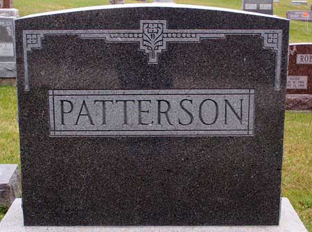
| A16 | Patterson | | | | | | Large family stone |
| A16 | Patterson | | | | | | P plot marker |
| A16 | Patterson | Addie M. | 1887 | 1927 | | | |
| A17 | Patterson | Charles A. | 1886 | 1967 | | | |
| A18 | Patterson | Dean W. | 1921 | 1944 | | | WWII markers |
| A19 | Patterson | S/Sgt. Roy J. | 1915 | 1945 | | | Staff STG., Co. A 121st Inf. WWII marker |
| A20 | Patterson | Jean E. | 1921 | 2005 | | | per obit.-b.11-1-1921 d. 9-20-2005 (in Washington Co., Ia) |
| A21 | Patterson | Larry D. | 1946 | 1946 | | | Son of D. & C. Patterson |
| A22 | Patterson | Carl T. | 1913 | 2000 | | | Share stone with Doris Patterson |
| A22 | Patterson | Doris M | 1926 | 1969 | | | |
| D17 | Patterson | Bruce J. | 1887 | 1964 | | | |
| D17 | Patterson | Letha B. | 1886 | 1970 | | | |
| D20 | Patterson | Gladys I. | | | | | "children of B. J. & L. E. Patterson"; shares stone with Sadie. |
| D20 | Patterson | Sadie A. | | | | | "children of B. J. & L. E. Patterson"; shares stone with Gladys |
| D20 | Patterson | | | | | | P plot marker- south of Gladys & Sadie Patterson stone |
| C03 | Perrin | Donna O. | Apr 21, 1924 | Sep 24, 1988 | | | maiden name -Moffit |
| F02 | Ponchaud | Jess | Jan 1, 1863 | Feb 25, 1941 | | | |
| F02 | Ponchaud | Lillie M. | Sep 17, 1871 | Jun 5, 1954 | | | shares stone with Jess Ponchaud |
| C01 | Popham | Sarah M. | Oct 30, 1901 | | | | |
| C01 | Popham | Wayne B. | Dec 7, 1901 | Jan 5, 1967 | | | Shares stone with Sarah Popham |
| L14 | Popham | Charley C. | | Apr 10, 1859 | 2d | | son of Wm & R. Popham |
| L15 | Popham | Elias | | Aug 27, 1863 | 2y 2d | | son of Wm & R. Popham |
| M14 | Quiggins | Freddy | | Mar 24, 1865 | | | "Our Little Freddy"; son of J.J. & S.J. Quiggins |
| H11 | Ray | Emily E. | 1856 | 1922 | | | Mother; wife of George L. Ray - small mother stone to side of larger stone. |
| H11 | Ray | George L. | 1848 | 1923 | | | Father stone to side of large stone. shares stone with Emily Ray |
| B21 | Roberts | Oliver | May 16, 1900 | Sep 14, 1960 | | | |
| B21 | Roberts | Sadie | Mar 5, 1905 | Jul 25, 1994 | | | Shares stone with Oliver Roberts |
| B22 | Roberts | Phyllis Jean | | Oct 1, 1929 | | | |
| L21 | Roberts | Carroll | Sep 1, 1937 | Aug 17, 2007 | | | |
| E20 | Rock | Florence A. | | Mar 26, 1907 | 62y 11m 9d | | maiden name Rowe |
| E21 | Rock | Frank M. | Jan 26, 1872 | Mar 28, 1931 | | | |
| E23 | Rock | Archie C. | Jun 6, 1867 | Jul 22, 1940 | | | Share stone with Katie Rock |
| E23 | Rock | Katie A. | Jul 25, 1867 | Jun 4, 1944 | | | maiden name Gaffney |
| O26 | Romine | | | | | | R plot marker |
| A01 | Rowe | Mearle C. | Dec 29, 1933 | May 31, 2000 | | | "In memory of"; ET2 U. S. Navy (per obit, m.Eva Ann Brown on 12-29-1967; Mearle Clayton Rowe, b. Rural Ia County, Iowa.; Son of Edward James Rowe & Velma Gladys Maplethorpe); Children of Mearle & Eva Ann Brown: Kathryn, Kimberly, Kandi; Divorced & remarried 26 April 1976, Rockwall, Texas- cremated. |
| A02 | Rowe | Ralph E. | Oct 28, 1931 | Dec 16, 1979 | | | E MCM US Navy - Korea - Korean War Marker- d. Pensicola, Florida |
| A03 | Rowe | Beverly J. | Mar 18, 1932 | Mar 1, 1975 | | | Shares stone with Russell Rowe |
| A03 | Rowe | Russell R. | Apr 24, 1929 | Jun 5, 1986 | | | Full name: Russell Royce Rowe per obit |
| A04 | Rowe | Edward J. | Mar 13, 1891 | Nov 27, 1986 | | | full name:Edward James Rowe m. Velma G.Maplethorpe Sept.16, 1924. Shares stone with Velma Rowe. |
| A04 | Rowe | Velma G. | Oct 2, 1897 | May 14, 1969 | | | Full maiden name: Velma Gladys Maplethorpe- Shares stone with Edward Rowe |
| A05 | Rowe | F.M. | Sep 28, 1853 | Jun 19, 1912 | | | smaller father stone present; Fredrick Marvin Rowe per obit- Shares stone with Mary Catherine. |
| A05 | Rowe | Mary Catherine | Feb 1, 1859 | Apr 10, 1943 | | | smaller mother stone present - Maiden name Berry |
| E14 | Rowe | | | | | | Family stone |
| E14 | Rowe | Marvin | Jul 23, 1810 | Apr 28, 1885 | | | Father |
| E16 | Rowe | Edward J. | Sep 25, 1848 | Jun 5, 1894 | | | son of M and L.A. Rowe |
| B07 | Ruegsegger | Mary L. | Aug 10, 1877 | Jun 27, 1959 | | | |
| B08 | Ruegsegger | Fred R. | Sep 11, 1873 | Jan 18, 1944 | | | |
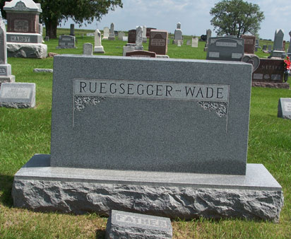
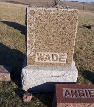
| B08 | Ruegsegger-Wade | | | | | | Large family stone, "W" plot marker, & small father/mother stone. |
| G22 | Rugg | Mary M. | | Apr 8, 1900 | 77y 2m 28d | | "Mother"; wife of J.A. Rugg |
| G23 | Rugg | | | | | | R marker - Rugg |
| J29 | Shaw | Betty J. | Mar 31, 1924 | Apr 11, 1997 | | | Shares stone with W. Wayne Shaw |
| J29 | Shaw | W. Wayne | Jul 2, 1917 | Sep 13, 1991 | | | Parents of Becky, Vicky, Rick, Terry |
| E26 | Snare | Gay Carlos | Dec 22, 1892 | Jul 20, 1963 | | | |
| E26 | Snare | Pearl Edna | Sep 6, 1899 | Dec 3, 1974 | | | Shares stone with Gay Carlos Snare |
| I07 | Suiter | Catherine E. | | May 6, 1873 | 29y | | wife of J.M. Suiter; stone broken in 3 places in 2007 |
| E28 | Thompson | | | | | | "T" plot marker |
| E28 | Thompson | C. Vince | Apr 1, 1925 | Mar 1, 1990 | | | |
| E28 | Thompson | Shirley | Nov 24, 1934 | | | | |
| I01 | Thompson | Marilyn L. | Oct 25, 1929 | Nov 21, 1991 | | | |
| I01 | Thompson | Wayne T. | Aug 4, 1916 | Jan 9, 1979 | | | Vietnam War marker |
| E29 | Thompson | | | | | | T marker - Thompson |
| E30 | Thompson | | | | | | T marker - Thompson |
| K04 | Trusler | Lillie E. | | May 27, 1881 | 26 y 6m 11d | | wife of John H. Trusle; shares stone with Bessie N. Trusler- |
| K04 | Trusler | Bessie N. | | Oct 11, 1880 | 1y 6m | | Dau. of J.H. & L.E. Trusler |
| K09 | Trusler | infant son | | Aug 25, 1878 | | | Infant son of J.H. & L.E. Trusler |
| B16 | Unknown | Charles J. | | | | | surname possible Wade or Jordan |
| ? | W | W.E. | | | | | stone is broken & the only writing on the stone is "W.E.W.", its original location is also unknown. Presently lying on it's side on another stone. |
| B09 | Wade | Catherine A. | Aug 16, 1845 | Mar 11, 1909 | | | "Mother" |
| B10 | Wade | James R. | Mar 1, 1830 | Sep 23, 1909 | | | "Father" |
| B16 | Wade | | | | | | W plot marker south of family stone |
| B17 | Wade | Maggie E. | | Feb 8, 1913 | 7m 22d | | daughter of E.F. and L.E. |
| B18 | Wade | Charles J. | Nov 13, 1913 | Apr 17, 1932 | | | shares stone with Edward E & Laura E. Wade |
| B18 | Wade | Edward E. | Jan 15, 1883 | Nov 25, 1972 | | | |
| B18 | Wade | Laura E. | Feb 3, 1884 | May 6, 1977 | | | |
| B19 | Wade | | | | | | unmarked grave of Laura Wade's grandchild |
| C09 | Wade | B.F. | 1858 | 1905 | | | "Brothers"- Shares stone with William |
| C09 | Wade | William E. | 1820 | 1900 | | | "Brothers" |
| G27 | Wade | Carrie | May 24, 1902 | Sep 14, 1981 | | | Share stone with Henry Wade |
| G27 | Wade | Henry | Mar 8, 1879 | Jun 4, 1966 | | | Marker present |
| G28 | Wade | Henry Lee | 1924 | 1995 | | | WWII marker |
| J04 | Wade | Bridget J. | May 1, 1881 | Jun 16, 1967 | | | |
| J04 | Wade | William F. | Mar 15, 1879 | Feb 20, 1940 | | | |
| J05 | Wade | Alonzo E. | May 16, 1893 | Oct 6, 1914 | | | Information is on family stone only. |
| J06 | Wade | Lillian E. | Mar 22, 1896 | Apr 28, 1902 | | | Has small individual stone. Information is on family stone |
| J07 | Wade | David E. | Jun 20, 1897 | Apr 7, 1902 | | | Has small stone behind family stone. Information on Family stone. |
| J08 | Wade | Ida L. | Mar 13, 1878 | Mar 25, 1896 | | | Has small individual stone to the North of family stone with her name on it. Information is on Family stone. |
| J09 | Wade | Alonzo E. | Mar 29, 1852 | Jan 7, 1902 | | | New stone - IOOF marker |
| J10 | Wade | | | | | | Family marker stone |
| J11 | Wade | Mary C. | Oct 13, 1854 | Aug 25, 1938 | | | |
| J18 | Wade | Fannie | Apr 12, 1871 | Sep 20, 1960 | | | Mother- shares stone with Francis Wade |
| J18 | Wade | Francis | Nov 9, 1866 | Mar 22, 1918 | | | Father; IOOF marker |
| J19 | Wade | Milo F. | Sep 15, 1906 | Aug 5, 1932 | | | |
| K01 | Wade | Anna M. | 1868 | 1955 | | | |
| K01 | Wade | William E. | 1862 | 1949 | | | share stone with Anna Wade |
| K02 | Wade | Ethel | | Jun 26, 1888 | 7m 25d | | daughter of W.E. & A.M. Wade |
| K16 | Wade | Allen | | May 21, 1912 | 10m 11d | | son of Francis & Fannie Wade |
| K17 | Wade | Sadie | | Sep 5, 1901 | 1y 7m 23d | | daughter of Francis & Fannie Wade |
| L16 | Wade | Christiana | May 9, 1853 | Jan 25, 1917 | | | Share main stone with individual name stones behind it. |
| L16 | Wade | James A. | Apr 9, 1849 | Nov 7, 1903 | | | W plot marker north of their stone |
| L17 | Wade | Francis | | Jan 1, 1895 | 85y | | small father stone behind large shared stone. |
| L17 | Wade | Martha | | Mar 16, 1907 | 79y 11m 28d | | "Our parents have gone to a mansion of rest, to the glorious land and by the Diety blest"; small mother stone behind large stone. |
| L18 | Wade | Angie Chapman | Jul 9, 1856 | Sep 30, 1926 | | | Angie on smaller stone beside large one- plot marker stone "W" set on large gravestone. |
| L18 | Wade | Dick | Feb 10, 1857 | Dec 15, 1930 | | | Dick on small stone by larger gravestone- F.T.L. marker #355 at gravesite.- Shares large Stone with information with Angie Wade. |
| L19 | Wade | Harrison | Mar 25, 1893 | Nov 8, 1966 | | | Shares stone. |
| L19 | Wade | Margaret | Dec 11, 1893 | Nov 9, 1983 | | | |
| M19 | Wade | Lovon | 1909 | 1918 | | | |
| M20 | Wade | Catherine | 1886 | 1922 | | | Shares stone Frank Wade |
| M20 | Wade | Frank | 1885 | 1966 | | | |
| O07 | Wade | Carroll J. | Feb 23, 1912 | Sep 16, 1981 | | | Shares stone with Goldie Wade |
| O07 | Wade | Goldie O. | Sep 26, 1920 | Jun 22, 2005 | | | "parents of Joan, Jane, David, and Samuel"; maiden name Longwell |
| L17 | Wade | | | | | | Family stone; W plot marker directly in front of stone. |
| I08 | Watkins | Mary E. | | Sep 16, 1863 | 8y 9m | | dau of Wm. J. & S.J. |
| I09 | Watkins | James F. | | Mar 1, 1862 | 14y 5m 7d | | son of Wm. J.& S.J. Watkins; stone on ground - 2007 |
| I10 | Watkins | William S. | | Sep 12, 1867 | 1y 10m 29d | | son of Wm. J.& S.J. Watkins |


