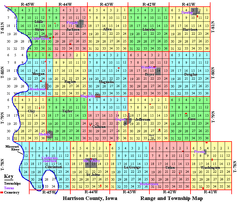
This above is a combination map, representing both Civil Townships (colored areas), and PLSS Townships and Ranges (squares outlined in red).
|
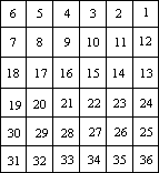
There are two types of township. A Civil Township is the geographic unit used in the U.S. Census. The Township and Range is the geographic unit of the Public Land Survey System (PLSS), and is commonly used in descriptions of land ownership. The standard PLSS Township and Range (at left) contains 36 sections numbered "1" through "36", each section with 640 acres. As illustrated the section numbering system starts with section "1" in the northeast and ends with section "36" in the southeast corner. |
| . | . |
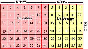
| Civil townships do not always match to the Public Land Survey System as in the case of La Grange and St. Johns civil townships (at right). St. John's includes a portion of T-78N / R-43W. |
|
| . | . |
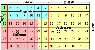
| Calhoun civil township is another example. Calhoun represents only a portion of T-79N / R-43W, and also includes three sections in T-79N / R-44W. |
|
Contributed by Dennis Walsh