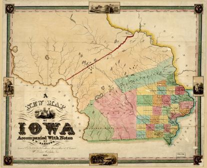
| Early Iowa Territory | W. Barrows | 1845 | Link |
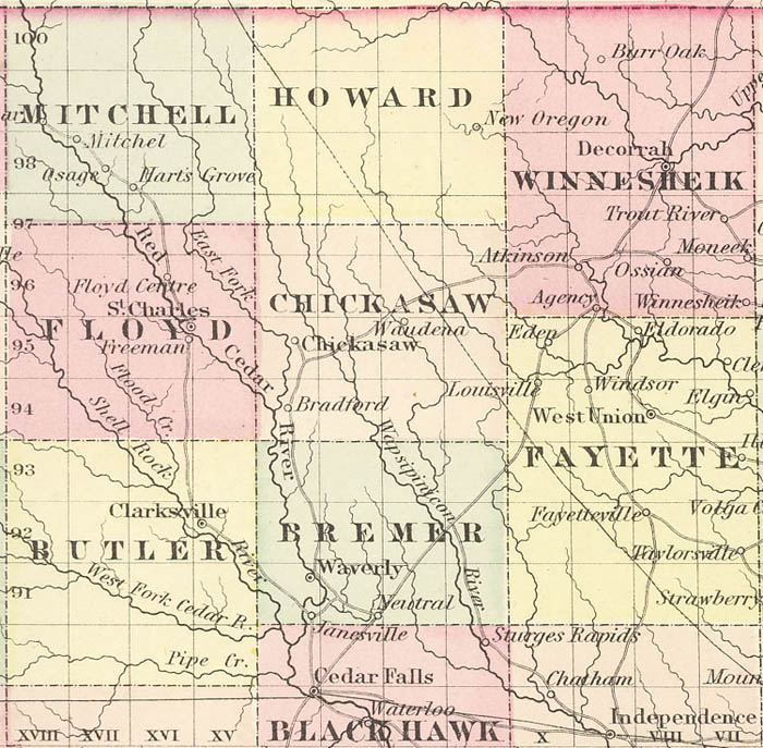
| Chickasaw and Surrounding Counties | J. H. Colton Maps | 1855 | Link |
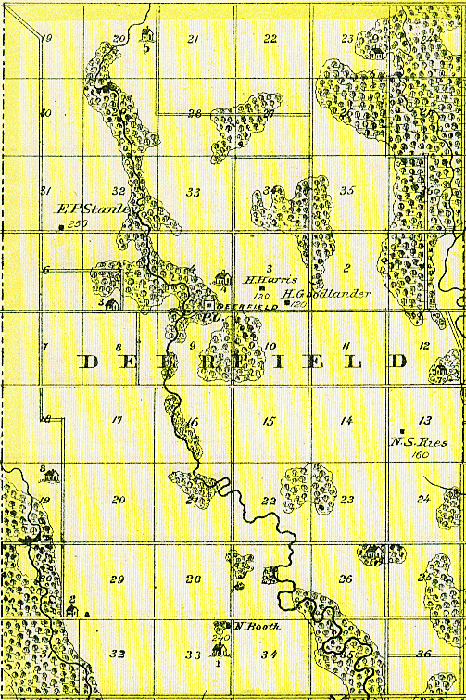
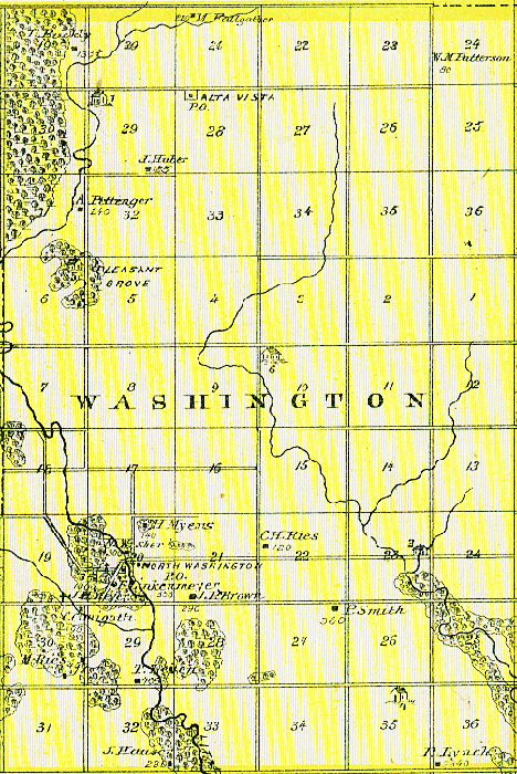
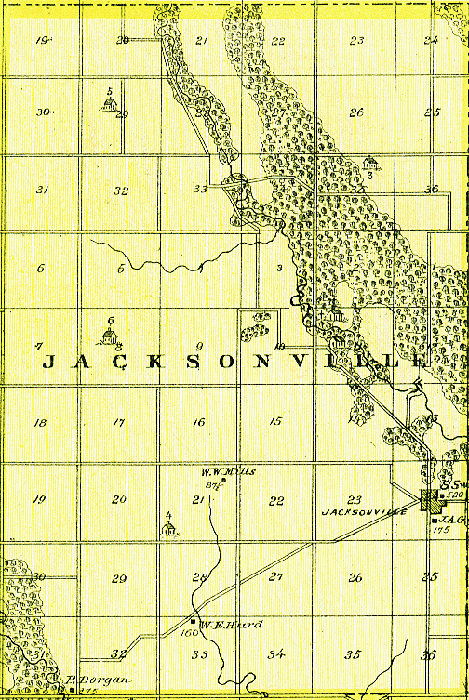
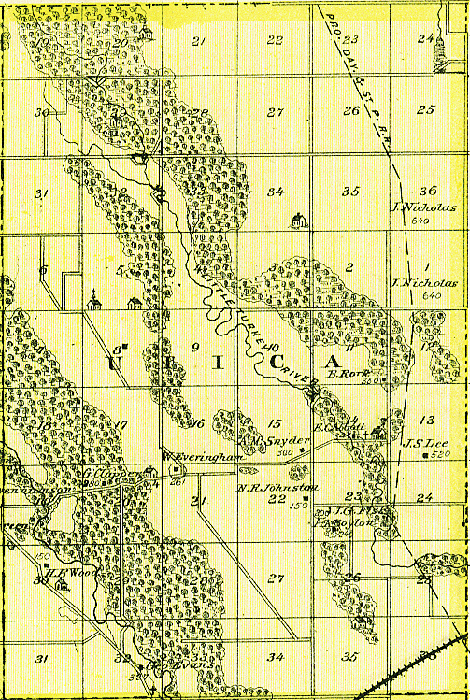
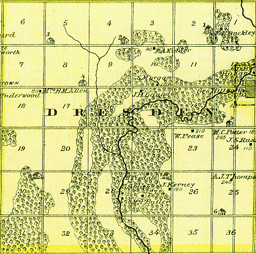
| Townships through the Early Years | Contributed by Mike Peterson | 1855-1895 | Link |
| Chickasaw County | Contributed by Mike Peterson | 1856 & 1895 | Link |
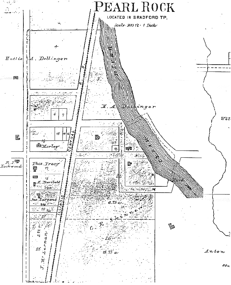
| Town of Pearl Rock | Unknown | 1874 | Link |
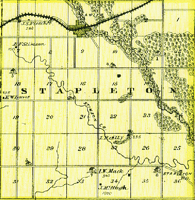
| Town of Lawler | A. T. Andreas | 1875 | Link |
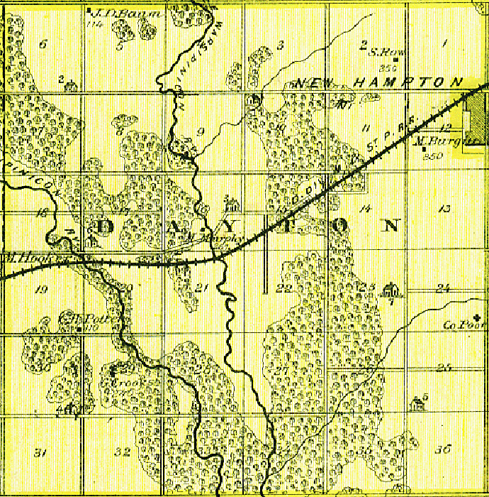
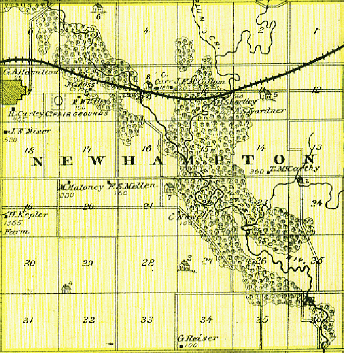
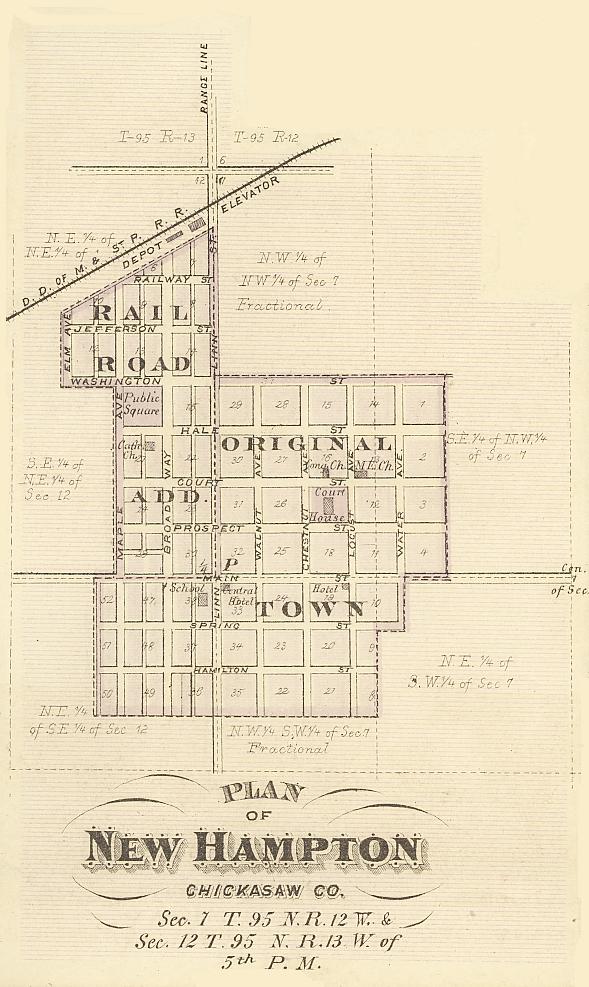
| Town of New Hampton | A. T. Andreas | 1875 | Link |
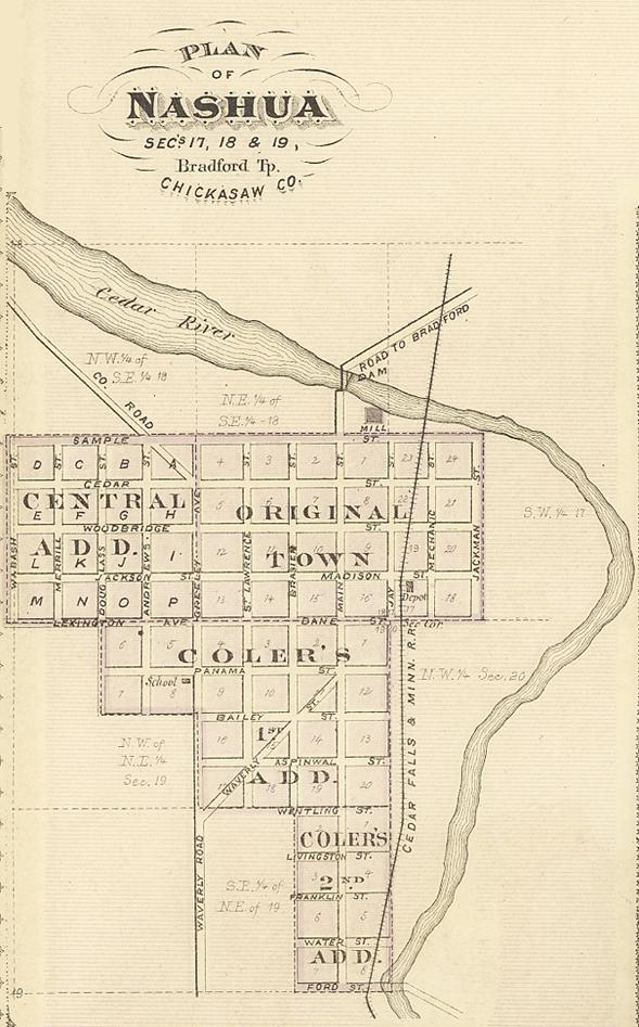
| Town of Nashua | A. T. Andreas | 1875 | Link |
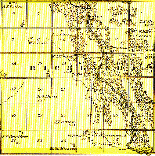
| Richland Township Landowners | Bruce Kuennen (Map from A. T. Andreas) | 1892 | Link |
| Towns of Bradford, Nashua, & Pearl Rock | Unknown | Unknown | Link |
| Railway Mail Service | Frank H. Galbraith Railway Mail Service Map | 1897 | Link |
| Railroad Maps | Paul Vasold & Iowa Department of Transportation | 1899 and 2003 | Link |
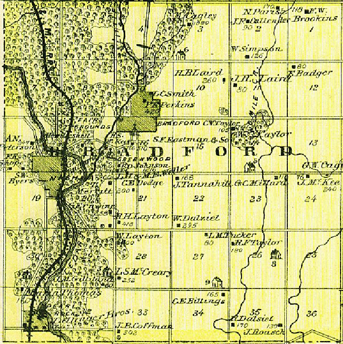
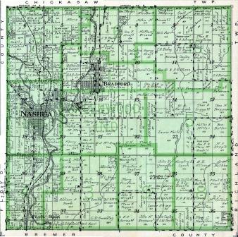
| Bradford Township | Contributed by Paul Vasold | 1915 | Link |
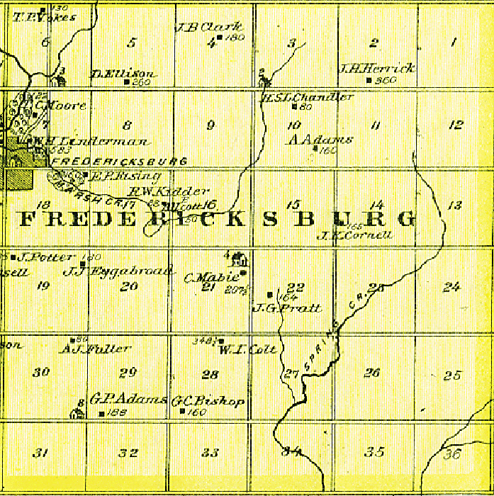
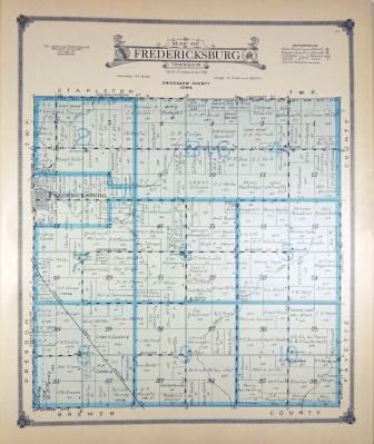
| Fredericksburg Township | Anderson Publishing Co. | 1915 | Link |
| Topographical Chickasaw County | Anderson Publishing Co. | 1915 | Link |
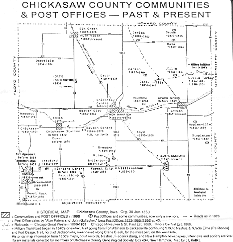
| Communities and Post Offices | From the book, Where We Were by J. L. Kottke, used with permission of the author | 1996 | Link |
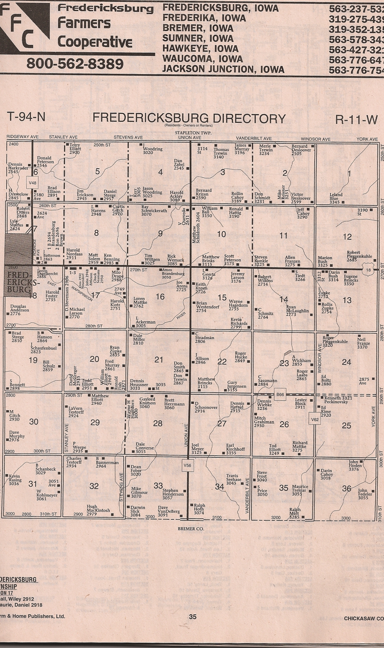
| Fredericksburg Township | Alberta (Hackman) Bouska | Circa 2006 | Link |
