
Rural Schools Locations
Source: Cedar Land; Vol. 1 pgs 267-276
Submitted by Jacie Thomsen.

|
| Cedar County, Iowa Rural Schools Locations Source: Cedar Land; Vol. 1 pgs 267-276 |
|
| CASS TOWNSHIP |
| Cass #1 – located in the NE ¼ of Section 22-81-4 - Was open from 1856 until 1952 |
| Cass #2 – located in the SW corner of Section 26-81-4 - Open from 1856-1954 |
| Cass #3 – is undocumented, but said to be on the Gunsolus farm. |
| Cass #4 – located in the NE ¼ of SE ¼ of Section 25-81-4 – Open from 1861-1944 |
| Cass #5 or Buchanan – located in SE ¼ of SE ¼ of Section 36-81-4 - Closed in 1954 |
| Cass #6 – located in the SE ¼ of SE ¼ of Section 7-81-4 – Opened from 1893-1929 |
| CENTER TOWNSHIP |
| Center #1 or Evergreen – located in NE ¼ of Section 2-80-2 – Open from 1854-1921 |
| Center #2 or Burr Oak – located in NE corner of Section 19-80-2 – District joined Tipton Consolidated in 1920 |
| Center #3 or Eureka – located in NW ¼ of NE ¼ of Section 23-80-2 |
| Center #4 or Union – First school was located in Section 27, and then it was moved to SW ¼ of SE ¼ of Section 28-80-2, located on the Andrew Nebergall farm. (school was still on site until the 1990’s) |
| Center #5 – located in NW ¼ of NW ¼ of Section 10-80-3 |
| Center #6 – located in NW ¼ of NE ¼ of Section 5-80-3 |
| Center #7 or Rock Creek – located in the NW ¼ of NW ¼ of Section 24-80-3 |
| Center #8 or Four Corners – located in SE ¼ of SW ¼ of Section 16-80-2 (also known as the Bolton School) |
| Center #9 or Virginia Grove – located just west and south of the church in the SE corner of SW ¼ of NE ¼ of Section 9-80-2 |
| Center #10 – located at NW corner of NE ¼ of NW ¼ of Section 33-81-3 – school closed in 1917 |
| Center #11 or Sandhill - located in SW corner of Section 26-81-3 |
| Center #12 – located in SW ¼ of SW ¼ of Section 1-80-3, next to the Tipton Masonic cemetery, to the west |
| Center #13 or Mt. Zion – located in SE ¼ of NW ¼ of Section 15-80-3 – school burnt down on 6 Jan 1937 |
| Center #14 or Wright – located in the NW corner of Section 11-80-2 –Wright cemetery is west of the school site. |
| Center #15 or East Fork – located in the SW ¼ of SW ¼ of Section 25-80-2 |
| Center #16 or Morton – located in NW ¼ of SW ¼ of Section 16-80-3 |
| DAYTON TOWNSHIP |
| Dayton #1 or Onion Grove – located in SE ¼ of NW ¼ of Section 14-82-2 – school was destroyed by a |
| tornado in 1898 and students were transferred to Dayton #3 |
| Dayton #2 or Dayton Valley – located in NE corner of NW ¼ of NE ¼ of Section 1-81-2 |
| Dayton #3 or Bixler – located in SW corner of the SW ¼ of SE ¼ of Section 3-82-2 |
| Dayton #5 or Hoffner – located in NE corner of Section 35-82- |
| Dayton #6 also known as Fell or Gortner – located in NW corner of NW ¼ of NE ¼ of Section 33-82-2 |
| Dayton #7 also known as Claney Corners and later as Dutch Corners – located in NW corner of Section 8-82-2 |
| Dayton #8 also known as Sylvester or Dayton Center – located in SE corner of SE ¼ of SW ¼ of Section 16-82-2 |
| Dayton #9 or Klinkhammer – located in SE corner of SW ¼ of SE ¼ of Section 18-82-2 |
| Dayton #10 or Britcher – located in the extreme SE corner of Section 30-82-2 |
| FAIRFIELD TOWNSHIP |
| Fairfield #1 also known as Hawthorne or Devil’s Den – located in NW ¼ of NE ¼ of Section 26-81-2 |
| Fairfield #2 or Oak Hill – located in NW ¼ of NW ¼ of Section 12-81-2 – open from 1863-1935 |
| Fairfield #3 or Harmony Point – located in SW corner of Section 11-81-2 – open from 1871-1950 |
| Fairfield #4 or Prairie Flower – located in NE corner of SW ¼ of NW ¼ of Section 8-81-2 |
| Fairfield #5 or Dublin College – first located in Section 19-81-2 in 1865. Later moved to SW corner of SW ¼ of SE ¼ of section 17-81-2 |
| Fairfield #6 or Bunker Hill – located in NE corner of Section 29-81-2 |
| Fairfield #7 or Hollow Horn – located in SW corner of SW ¼ of SW ¼ of Section 33-81-2 |
| Fairfield #8 or White Cloud – located in SW corner of SW ¼ of SE ¼ of Section 4-81-2 |
| Fairfield #9 or Willow Point – located in SW corner of Section 26-81-2 |
| FARMINGTON TOWNSHIP |
| Farmington #1 or Burr Oak – located first in NW ¼ of SW ¼ of Section 29-79-1 then moved to SW ¼ of SW ¼ of Section 29-79-1 |
| Farmington #2 – first school was conducted in a hotel room in 1857. In Durant, the fractional block north of the west public square was donated for the school site in 1858. In 1867 the school became the Durant Independent School. |
| Farmington #3 or Elkhorn – located first in NE ¼ of SE ¼ of Section 9-79-1, later moved to SE corner of Section 4-79-1 |
| Farmington #4 or Bunker Hill – located in NE ¼ of NE ¼ of Section 23-79-1 |
| Farmington #5 or Pleasant Valley – located in NE corner of Section 19-79-1 |
| Farmington #6 or Palestine – located in SW corner of Section 5-79-1 |
| Farmington #7 or Sunbury – located in NW corner of Section 12-79-1 |
| Farmington #8 – located in SW corner of SW ¼ of SW ¼ of Section 27-79-1 |
| Farmington #9 or Center – located NE corner of NE ¼ of Section 21-79-1 |
| FREMONT TOWNSHIP |
| Fremont #1 or Maple Grove – located NE corner of Section 11-82-3 – merged with Stanwood Consolidated in 1919 |
| Fremont #2 or Evergreen – located in SW corner of Section 3-82-3 |
| Fremont #3 – located in NE corner of NE ¼ of NE ¼ of Section 7-82-3 – merged with Mechanicsville Consolidated in 1920 |
| Fremont #4 – located in SW corner of SW ¼ of SW ¼ of Section 17-82-3 |
| Fremont #5 or Fremont Center – located in extreme SE corner of Section 16-82-3 |
| Fremont #7 or Cameron – located in NE corner of Section 35-82-3 |
| Fremont #8 or Davidson – located in NE ¼ of NE ¼ of Section 33-82-3 |
| Fremont #9 or Onstott – located in NW corner of Section 32-82-3 |
| GOWER TOWNSHIP |
| Gower #1 or Owl Point – located in SW corner of NW ¼ of NE ¼ of Section 10-80-4 |
| Gower #2 or Rose Hill – located in the NE corner of Section 7-80-4 |
| Gower #3 or Honey Grove – located in the NW corner of Section 20-80-4. In 1885, it was moved to the SW corner of the NW ¼ of SW ¼ of Section 17-80-4 – closed in 1942 |
| Gower #4 or Plato – located in the NW corner of Section 22-80-4 |
| Gower #5 – located in SW ¼ of SW ¼ of Section 13-80-4 |
| Gower #6 – located in SE ¼ of NE ¼ of Section 26-80-4 |
| Gower #7 or Mattison – located in the extreme corner of Section 28/-80-4, merged with West Branch consolidated in 1918 |
| Gower #8 or Prairie Dale – located in the SW corner of NW ¼ of SW ¼ of Section 29-80-4 |
| Gower #9 or Cedar Valley – Built about 1894, district consists of only Section 19 and the town of Cedar Valley, located northeast of the hotel |
| INLAND TOWNSHIP |
| Inland #1 or Inland School – located in the NE corner of NE ¼ of NW ¼ of Section 11-80-1, school was moved in 1911 to SW ¼ of SW ¼ of Section 1-80-1 |
| Inland #2 or Marsh – located at the intersection of Sections 3,4,9 and 10 |
| Inland #3 or Center – located at the southern border of SW ¼ of Section 15-80-1 |
| Inland #4 or Shiloh – located in the SE corner of Section 26-80-1 |
| Inland #5 or Unity – located in SW corner of Section 29-80-1 |
| Inland #6 or Olive Branch – located in SW corner of Section 17-80-1 |
| Inland #7 or Willow Shade - located in SE corner of Section 14-80-1 – school merged with Bennett in 1943 |
| Inland #8 or Summit – located in SE corner of SE ¼ of SE ¼ of Section 28-80-1 |
| Inland #9 or Smith – located in the extreme SE corner of Section 31-80-1, moved to SW corner of Section 5-80-1 in 1896 |
| IOWA TOWNSHIP |
| Iowa #1 or Oak Hill – located in the NW corner of the NE ¼ of Section 23-79-3 |
| Iowa #2 or Cedar Hill – located in the SW corner of the SE ¼ of SE1/4 of Section 27-79-3 |
| Iowa #3 or North Liberty – located in the NE corner of SE ¼ of NW ¼ of Section 32-80-3 |
| Iowa #4 or Union Valley – located in the NE corner of Section 32-79-3 |
| Iowa #5 or Cedar Vale, and also known as LaRue and Thomas Crees – Original site unknown, but was later moved to the Isaac Crees farm, located at the NE corner of the NW ¼ of NE ¼ of Section 21-79-3 |
| Iowa #6 or PeeDee – located at the SW corner of SE ¼ of NW ¼ of Section 9-79-3 |
| Iowa #7 or Prairie Grove – located in the SE ¼ of SE ¼ of Section 18-79-3, school burnt down 16 Jan 1914 |
| Iowa #9 or Hartapee – located in the SW corner of Section 30-79-3 |
| LINN TOWNSHIP |
| Linn #1 – located in NE corner of NE ¼ of SE ¼ of Section 12-81-4, building was erected in 1868 and was also used as a church from 1886-1888. The school was destroyed by fire on 24 Dec 1888. A new building was erected and later closed in 1944 |
| Linn #2 or Park – Original site was in S ½ of Section 2-81-4 on the southern border of Section 2. Later it was moved to the NW corner of NE ¼ of NW ¼ Section 11-81-4 on the George Park farm |
| Linn #3 – located in the NW corner of NW ¼ of SE ¼ of Section 9-81-4 |
| Linn #4 or Coon Creek – located in SW corner of SW ¼ of NW ¼ of Section 8-81-4 |
| MASSILLON TOWNSHIP |
| Massillon #1 or Goose Creek – located in NE part of SW ¼ of NW ¼ of Section 10-82-1 |
| Massillon #2 or Butternut – located in NW ¼ of NE ¼ of Section 36-82-1 |
| Massillon #3 or Massillon Village – located at the NW corner of SE ¼ of NE ¼ of Section 14-82-1, later moved to the SW corner of the same section about 1898 |
| Massillon #4 – located in the extreme NW corner of Section 20-82-1 |
| Massillon #5 – located in the SW corner of SE ¼ of SW ¼ of Section 5-82-1 |
| Massillon #6 or Hickey – located in NE corner of Section 31-82-1 |
| Massillon #7 – located in NW corner of Section 22-82-1 (Massillon Center Cemetery is just on the south side of the school site) |
| Massillon # 8 or Quail Trap – located first at the SW corner of NW ¼ of NW ¼ of Section 27-82-1 and later at the NW corner of SW ¼ of SW ¼ of Section 27-82-1 |
| PIONEER TOWNSHIP |
| Pioneer #1 or Pioneer – located in SE ¼ of NW ¼ of Section 11-82-4 |
| Pioneer #2 or Valley Chapel, also known as Weeks – located in SW ¼ of NW ¼ Section 9-82-4 |
| Pioneer #3 or Spring Creek – located in NW ¼ of SW ¼ of Section 7-82-4 |
| Pioneer #4 or Brush College – located in SE corner of NE ¼ of SE ¼ of Section 19-82-4 |
| Pioneer #5 or Bittle – located in NE corner of NW ¼ of SE ¼ of Section 33-82-4, later moved to SE corner of SW ¼ of NW ¼ of Section 34-82-4 |
| Pioneer #6 or Puffer – located in NW corner of SW ¼ of SW ¼ of Section 23-82-4, on land owned by Charles Puffer |
| Pioneer #7 or Oak Grove – located in SW corner of NE ¼ of Section 31-82-4 |
| Pioneer #8 or Rhoads – located in NW corner of NE ¼ of Section 36-82-4 |
| RED OAK TOWNSHIP |
| Red Oak #1 or Bedbug – originally located in NW corner of NW ¼ of NE ¼ of Section 24-79-3, now located on the grounds of the Cedar County Historical Society Museum’s Pioneer Village, north of Tipton |
| Red Oak #2 or Prairie Union – located in SW corner of SE ¼ of SE ¼ of Section 5-81-3 |
| Red Oak #3 or Big Linn – located in NW ¼ of SW ¼ of Section 17-81-3 |
| Red Oak #4 – located in NE corner of Section 21-81-3 |
| Red Oak #5 or The Brick – located in NW ¼ of SE ¼ of Section 10-81-3 |
| Red Oak #6 or Towhead, also known as College Hill – located in the NE corner of NE ¼ of NW ¼ of Section 12-81-3 |
| ROCHESTER TOWNSHIP |
| Rochester #1 – located in lot 5, block 19 in the village of Rochester. The school building was later converted into a grocery store and after that, a home, where Bill Lovell lived for many years |
| Rochester #2 or Snaggy Ridge – located in SE corner of SW ¼ of SW ¼ of Section 26-80-3. Was later converted into a home |
| Rochester #3 or Hebron – located in SW corner of SW ¼ of SE ¼ of Section 30-80-2. Was later converted into a home |
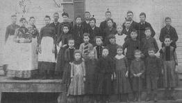
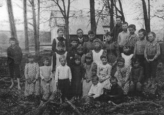
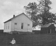
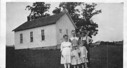
| Rochester #4 or Sandy Hook – located first in NE corner of NE ¼ of SW ¼ of Section 7-79-2, later moved to SE ¼ of Section 6-79-2, on the Ridenour farm, and was moved again, to sit in the center of the district, on the section line of 5 and 6-79-2, still on the Ridenour farm |
 |
 |
 |
 |
|
| Sandy Hook 1889 | Sandy Hook 1892 | Sandy Hook 1912 | Sandy Hook 1915 |
| Rochester #5 or Prairie Bell – located in SW ¼ of SW ¼ of Section 17-79-2 |
| Rochester #6 or South Union – location unknown |
| SPRINGFIELD TOWNSHIP |
| Springfield #1 – located in SE corner of SE ¼ of NE ¼ of Section 11-81-1 |
| Springfield #2 – located in NW corner of SW ¼ of SE ¼ of Section 4-81-1 |
| Springfield #3 – located first in NE corner of NW ¼ of Section 20-81-1, later moved to SW corner of NW ¼ of Section 21-81-1, then finally at the SE corner of N ½ of NE ¼ of Section 21-81-1 |
| Springfield #4 or Brooklyn, also known as Wischmann – located in NE corner of NW ¼ of Section 23 |
| Springfield #5 or Limerick – located in NE corner of Section 35-81-1 |
| Springfield #6 or Rosette – located in SE corner of Section 28-81-1, after school burned, it was moved to the NW corner of NE ¼ of SW ¼ of Section 27-81-1. In 1930, the school was destroyed again, and again the school was moved to the SE corner of SW ¼ of SW ¼ of Section 27-81-1 |
| Springfield #7 – located in SW corner of Section 32-81-1, later moved to SE corner of Section 30-81-1 |
| Springfield #8 or Fairview – located in NE corner of Se ¼ or NE ¼ of Section 19-81-1 |
| Springfield #9 – located in SE corner of Section 6-81-1 |
| SPRINGDALE TOWNSHIP |
| Springdale #1 or Linn Grove – located SW corner of NW ¼ of NW ¼ of Section 34-79-4 |
| Springdale #2 or Highland, also known as Yankee Corner – located in NE ¼ of NE ¼ of Section 9-79-4 |
| Friends School or Scattergood – located in the extreme NW corner of NW ¼ of SW ¼ of Section 10-79-4 |
| Springdale #3 or North Prairie, also known as Snake Hollow – located in SE corner of Section 35-79-4 |
| Springdale #4 or Prairie Knoll – located in NW corner of Section 20-79-4 |
| Springdale #5 or Centerdale - located in SW ¼ of SW ¼ of Section 15-79-4, later moved to NE ¼ of NE ¼ of Section 21-79-4 |
| Springdale #6 or Peat Vale – located in SW corner of Section 13-79-4 |
| SUGAR CREEK TOWNSHIP |
| Sugar Creek #1 or White Pigeon – located in NE ¼ of SE ¼ of Section 11-79-2, also used as a church |
| Sugar Creek #2 or Pleasant Hill – located first in Section 9-79-2. After the Civil War, it was moved to SW corner of Section 3-79-2, and then again moved to the SE corner of Section 4-79-2 |
| Sugar Creek #3 or Sugar Creek – the first school house was built of red brick and called Sugar Nook, located in NE ¼ of SE ¼ of Section 28-79-2 |
| Sugar Creek #4 or Sharon – located in SE ¼ of SE ¼ of Section 23-79-3 |
| Sugar Creek # 5 or Osage and later known as Lime City – district was composed of sections 15,16,21, and 22 of township 79-2. Later it was moved to the NW ¼ of SW ¼ of Section 15-79-2 |