INDIANA.
Pg 242
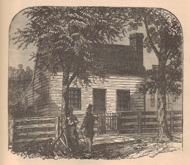
The profile of Indiana forms a nearly exact parallelogram, occupying one of the most fertile portions of the great Mississippi Valley. The greater extent of the surface embraced within its limits consists of gentle undulations rising into hilly tracts toward the Ohio bottom. The chief rivers of the State are the Ohio and Wabash, with their numerous affluents. The soil is highly productive of the cereals and grasses—most particularly so in the valleys of the Ohio, Wabash, Whitewater, and White Rivers. The northeast and central portions are well timbered with virgin forests, and the west section is notably rich in coal, constituting an offshoot of the great Illinois carboniferous field. Iron, copper, marble, slate, gypsum, and various clays are also abundant. From an agricultural point of view, the staple products are maize and wheat, with the other cereals in lesser yields; and besides these, flax, hemp, sorghum, hops, etc., are extensively raised. Indiana is divided into 92 counties, and counts among her principal cities and towns, those of Indianapolis (the capital), Fort Wayne, Evansville, Terre Haute, Madison, Jeffersonville, Columbus, Vincennes, South Bend, etc. The public institutions of the State are many and various, and on a scale of magnitude and efficiency commensurate with her important political and industrial status. Upward of two thousand miles of railroads permeate the State in all directions, and greatly conduce to the development of her expanding manufacturing interests. Statistics for the fiscal year terminating October 31, 1870, exhibited a total of receipts, $3,896,541 as against disbursements, $3,532,406, leaving a balance, $364,135 in favor of the State Treasury. The entire public debt, January 5, 1871, $3,971,000. This State was first settled by Canadian voyageurs in 1702, who erected a fort at Vincennes; in 1763 it passed into the hands of the English, and was by the latter ceded to the United States in 1783. From 1788 till 1791, an Indian warefare prevailed. In 1800, all the region west and north of Ohio (then formed into a distinct territory) became merged in Indiana. In 1809, the present limits of the State were defined, Michigan and Illinois having previously been withdrawn. In 1811, Indiana was the theater of the Indian War of Tecumseh, ending with the decisive battle of Tippecanoe. In 1816 (December 11), Indiana became enrolled among the States of the American Union. In 1834, the State passed through a monetary crises owing to it having become mixed up with railroad, canal, and other speculations on a gigantic scale, which ended, for the time being, in a general collapse of public credit, and consequent bankruptcy. Since that time, however, the greater number of the public . . .
Pg 243
. . . works which had brought about that imbroglio—especially the great Wabash and Erie Canal—have been completed, to the great benefit of the State, whose subsequent progress has year by year been marked by rapid strides in the paths of wealth, commerce, and general social and political prosperity. The constitution now in force was adopted in 1851. Population, 1,680,637.
IOWA.
In shape, Iowa presents an almost perfect parallelogram; has a length, north to south, of about 300 miles, by a pretty even width of 208 miles, and embraces an area of 55,045 square miles, or 35,228,800 acres. The surface of the State is generally undulating, rising toward the middle into an elevated plateau which forms the “divide” of the Missouri and Mississippi basins. Rolling prairies, especially in the south section, constitute a regnant feature, and the river bottoms, belted with woodlands, present a soil of the richest alluvion. Iowa is well watered; the principal rivers being the Mississippi and Missouri, which form respectively its east and west limits, and the Cedar, Iowa, and Des Moines, affluents of the first named. Mineralogically, Iowa is important as occupying a section of the great Northwest coal field, to the extent of an area estimated at 25,000 square miles. Lead, copper, zinc, and iron, are also mined in considerable quantities. The soil is well adapted to the production of wheat, maize, and the other cereals, fruits, vegetables, and esculent roots; maize, wheat, and oats forming the chief staples. Wine, tobacco, hops, and wax, are other noticeable items of the agricultural yield. Cattle-raising, too, is a branch of rural industry largely engaged in. The climate is healthy, although liable to extremes of heat and cold. The annual gross product of the various manufactures carried on in this State approximate, in round numbers, a sum of $20,000,000. Iowa has an immense railroad system, besides over 500 miles of water-communication by means of its navigable rivers. The State is politically divided into 99 counties, with the following centers of population: Des Moines (capital), Iowa City (former capital), Dubuque, Davenport, Burlington, Council Bluffs, Keokuk, Muscatine, and Cedar Rapids. The State institutions of Iowa—religious, scholastic, and philanthropic—are on a par, as regards number and perfection of organization and operation, with those of her Northwest sister States, and education is especially well cared for, and largely diffused. Iowa formed a portion of the American territorial acquisitions from France, by the so-called Louisiana purchase in 1803, and was politically identified with Louisiana till 1812, . . .
Pg 244
. . . when it merged into the Missouri Territory; in 1834 it came under the Michigan organization, and, in 1836, under that of Wisconsin. Finally after being constituted an independent Territory, it became a State of the Union, December 28, 1846. Population in 1860, 674,913; in 1870, 1,191,792, and in 1875, 1,353,118.
MICHIGAN
United area, 56,243 square miles, or 35,995,520 acres. Extent of the Upper and smaller Peninsula—length, 316 miles; breadth, fluctuating between 36 and 120 miles wide. Aggregate lake-shore line, 1,400 miles. The Upper, or North, Peninsula consists chiefly of an elevated plateau, expanding into the Porcupine mountain-system, attaining a maximum height of some 2,000 feet. Its shores along Lake Superior are eminently bold and picturesque, and its area is rich in minerals, its product of copper constituting an important source of industry. Both divisions are heavily wooded, and the South one, in addition, boasts of a deep, rich, loamy soil, throwing up excellent crops of cereals and other agricultural produce. The climate is generally mild and humid, though the Winter colds are severe. The chief staples of farm husbandry include the cereals, grasses, maple sugar, sorghum, tobacco, fruits, and dairy-stuffs. In 1870, the acres of land in farms were: improved, 5,096,939; unimproved woodland, 4,080,146; other unimproved land, 842,057. The cash value of land was $398,240,578; of farming implements and machinery, $13,711,979. In 1869, there were shipped from the Lake Superior ports, 874,582 tons of iron ore, and 45,762 of smelted pig, along with 14,188 tons of copper (ore and ingot). Coal is another article largely mined. Inland communication is provided for by an admirably organized railroad system, and by the St. Mary’s Ship Canal, connecting Lake Huron and Superior. Michigan is politically divided into 78 counties; its chief urban centers are Detroit, Lansing (capital), Ann Arbor, Marquette, Bay City, Niles, Ypsilanti, Grand Haven, etc. The Governor of the State is elected biennially. On November 30, 1870, the aggregate bonded debt of Michigan amounted to $2,385,028, and the assessed valuation of land to $266,929,278, representing an estimated cash value of $800,000,000. Education is largely diffused and most excellently conducted and provided for. The State University at Ann Arbor, the colleges of Detroit and Kalamazoo, the Albion Female College, the State Normal School at Ypsilanti, and the State Agricultural College at Lansing, are chief among the academic institutions. Michigan (a term of Chippeway origin, and . . .
Pg 245
. . . signifying “Great Lake), was discovered and first settled by French Canadians, who, in 1670, founded Detroit, the pioneer of a series of trading-posts on the Indian frontier. During the “Conspiracy of Pontiac,” following the French loss of Canada, Michigan became the scene of a sanguinary struggle between the whites and aborigines. In 1796, it became annexed to the United States, which incorporated this region with the Northwest Territory, and then with Indiana Territory, till 1803, when it became territorially independent. Michigan was the theater of warlike operations during the war of 1812 with Great Britain, and in 1819 was authorized to be represented by one delegate in Congress; in 1837 she was admitted into the Union as a State, and in 1869 ratified the 15th Amendment to the Federal Constitution. Population, 1,184,059.
WISCONSIN
It has a mean length of 260 miles, and a maximum breadth of 215. Land area, 53,924 square miles, or 34,511,360 acres. Wisconsin lies at a considerable altitude above sea-level, and consists for the most part of an upland plateau, the surface of which is undulating and very generally diversified. Numerous local eminences called mounds are interspersed over the State, and the Lake Michigan coast-line is in many parts characterized by lofty escarped cliffs, even as on the west side the banks of the Mississippi form a series of high and picturesque bluffs. A group of islands known as the Apostles lie off the extreme north point of the State in Lake Superior, and the great estuary of Green Bay, running far inland, gives formation to a long, narrow peninsula between its waters and those of Lake Michigan. The river-system of Wisconsin has three outlets—those of Lake Superior, Green Bay, and the Mississippi, which latter stream forms the entire southwest frontier, widening at one point into the large watery expanse called Lake Pepin. Lake Superior receives the St. Louis, Burnt Wood, and Montreal rivers; Green Bay, the Menomonee, Peshtigo, Oconto, and Fox; while into the Mississippi empty the St. Croix, Chippewa, Black, Wisconsin, and Rock Rivers. The chief interior lakes are those of Winnebago, Horicon, and Court Oreilles, and smaller sheets of water stud a great part of the surface. The climate is healthful, with cold Winters and brief but very warm summers. Mean annual rainfall 31 inches. The geological system represented by the State, embraces those rocks included between the primary and the Devonian series, the former containing extensive deposits of copper and iron ore. Besides these minerals, lead and zinc are found in great quantities, together with kaolin, plumbago, gypsum, . . .
Pg 246
. . . and various clays. Mining, consequently, forms a prominent industry, and one of yearly increasing dimensions. The soil of Wisconsin is of varying quality, but fertile on the whole, and in the north parts of the State heavily timbered. The agricultural yield comprises the cereals, together with flax, hemp, tobacco, pulse, sorgum, and all kinds of vegetables, and of the hardier fruits. In 1870, the State had a total number of 102,904 farms, occupying 11,715,321 acres, of which 5,899,343 consisted of improved land, and 3,437,442 were timbered. Cash value of farms, $300,414,064; of farm implements and machinery, $14,239,364. Total estimated value of all farm products, including betterments and additions to stock, $78,027,032; of orchard and dairy stuffs, $1,045,933; of lumber, $1,327,618; of home manufactures, $228,423; of all live-stock, $45,310,882. Number of manufacturing establishments, 7,136, employing 39,055 hands, and turning out productions valued at $85,624,966. The political divisions of the State form 61 counties, and the chief places of wealth, trade, and population, are Madison (the capital), Milwaukee, Fond du Lac, Oshkosh, Prairie du Chien, Janesville, Portage City, Racine, Kenosha, and La Crosse. In 1870 the total assessed valuation reached $333,209,838, as against a true valuation of both real and personal estate aggregating $602,207,329. Treasury receipts during 1870, $886,696; disbursements, $906,329. Value of church property, $4,749,983. Education is amply provided for. Independently of the State University at Madison, and those of Galesville and of Lawrence at Appleton, and the colleges of Beloit, Racine, and Milton, there are Normal Schools at Platteville and Whitewater. The State is divided into 4,802 common school districts, maintained at a cost, in 1870, of $2,094,160. The charitable institutions of Wisconsin include a Deaf and Dumb Asylum, an Institute for the Education of the Blind, and a Soldiers’ Orphans’ School. In January, 1870, the railroad system ramified throughout the State totalized 2, 779 miles of track, including several lines far advanced toward completion. Immigration is successfully encouraged by the State authorities, the larger number of yearly new-comers being of Scandinavian and German origin. The territory now occupied within the limits of the State of Wisconsin was explored by French missionaries and traders in 1639, and it remained under French jurisdiction until 1703, when it became annexed to the British North American possessions. In 1796, it reverted to the United States, the government of which latter admitted it within the limits of the Northwest Territory, and in 1809, attached to that of Illinois, and to Michigan in 1818. Wisconsin became independently territorially organized in 1836, and became a State of the Union, March 3, 1847. Population in 1870, 1,064,985, of which 2,113 were of the colored race, and 11,521 Indians, 1,206 of the latter being out of tribal relations.
Pg 247
MINNESOTA
Its length, north to south, embraces an extent of 380 miles; its breadth one of 250 miles at a maximum. Area, 84,000 square miles, or 54,760,000 acres. The surface of Minnesota, generally speaking, consists of a succession of gently undulating plains and prairies, drained by an admirable water-system, and with here and there heavily-timbered bottoms and belts of virgin forest. The soil, corresponding with such a superfices, is exceptionally rich, consisting for the most part of a dark, calcareous sandy drift intermixed with loam. A distinguishing physical feature of this State is its riverine ramifications, expanding in nearly every part of it into almost innumerable lakes—the whole presenting an aggregate of water-power having hardly a rival in the Union. Besides the Mississippi—which here has its rise, and drains a basin of 800 miles of country—the principal streams are the Minnesota (334 miles long), the Red River of the North, the St. Croix, St. Louis, and many others of lesser importance; the chief lakes are those called Red, Cass, Leech, Mille Lacs, Vermillion, and Winibigosh. Quite a concatenation of sheets of water fringe the frontier line where Minnesota joins British America, culminating in the Lake of the Woods. It has been estimated, that of an area of 1,200,000 acres of surface between the St. Croix and Mississippi Rivers, not less than 73,000 acres are of lacustrine formation. In point of minerals, the resources of Minnesota have as yet been very imperfectly developed; iron, copper, coal, lead—all these are known to exist in considerable deposits; together with salt, limestone, and potter’s clay. The agricultural outlook of the Sate is in a high degree satisfactory; wheat constitutes the leading cereal in cultivation, with Indian corn and oats in next order. Fruits and vegetables are grown in great plenty and of excellent quality. The lumber resources of Minnesota are important; the pine forests in the north region alone occupying an area of some 21,000 square miles, which in 1870 produced a return of scaled logs amounting to 313,116,416 feet. The natural industrial advantages possessed by Minnesota are largely improved upon by a railroad system. The political divisions of this State number 78 counties; of which the chief cities and towns are: St. Paul (the capital), Stillwater, Red Wing, St. Anthony, Fort Snelling, Minneapolis, and Mankato. Minnesota has already assumed an attitude of high importance as a manufacturing State; this is mainly due to the wonderful command of water-power she possesses, as before spoken of. Besides her timber-trade, the milling of flour, the distillation of whisky, and the tanning of leather, are prominent interest, which in 1869, gave returns to the amount of $14,831,043. . . .
Pg 248
. . . Education is notably provided for on a broad and catholic scale, the entire amount expended scholastically during the year 1870 being $857,816; while on November 30 of the preceding year the permanent school fund stood at $2,476,222. Besides a University and Agricultural College, Normal and Reform Schools flourish, and with these may be mentioned such various philanthropic and religious institutions as befit the needs of an intelligent and prosperous community. The finances of the State for the fiscal year terminating December 1, 1870, exhibited a balance on the right side to the amount of $136,164, being a gain of $44,000 over the previous year’s figures. The earliest exploration of Minnesota by the whites was made in 1680 by a French Franciscan, Father Hennepin, who gave the name of St. Antony to the Great Falls on the Upper Mississippi. In 1863, the Treaty of Versailles ceded this region to England. Twenty years later, Minnesota formed part of the Northwest Territory transferred to the United States, and became herself territorialized independently in 1849. Indian cessions in 1851 enlarged her boundaries, and, May 11, 1857, Minnesota became a unit of the great American federation of States. Population, 439,706.
NEBRASKA
Maximum length, 412 miles; extreme breadth, 208 miles. Area, 75,905 square miles, or 48,636,800 acres. The surface of this State is almost entirely undulating prairie, and forms part of the west slope of the great central basin of the North American continent. In its west division, near the base of the Rocky Mountains, is a sandy belt of country, irregularly defined. In this part, too, are the “dunes,” resembling a wavy sea of sandy billows, as well as the Mauvaises Terres, a tract of singular formation, produced by eccentric disintegrations and denudations of the land. The chief rivers are the Missouri, constituting its entire east line of demarcation; the Nebraska or Platte, the Niobrara, the Republican Fork of the Kansas, the Elkhorn, and the Loup Fork of the Platte. The soil is very various, but consisting chiefly of rich, bottomy loam, admirably adapted to the raising of heavy crops of cereals. All the vegetables and fruits of the temperate zone are produced in great size and plenty. For grazing purposes Nebraska is a State exceptionally well fitted, a region of not less than 23,000,000 acres being adaptable to this branch of husbandry. It is believed that the, as yet, comparatively infertile tracts of land found in various parts of the State are susceptible of productivity by means of a properly conducted system of irrigation. Few minerals of moment have so far been found within the limits of . . .
Pg 249
. . . Nebraska, if we may except important saline deposits at the head of Salt Creek in its southeast section. The State is divided into 57 counties, independent of the Pawnee and Winnebago Indians, and of unorganized territory in the northwest part. The principal towns are Omaha, Lincoln (state capital), Nebraska City, Columbus,
Grand Island, etc. In 1870, the total assessed value of property amounted to $53,000,000, being an increase of $11,000,000 over the previous year’s returns. The total amount received from the school-fund during the year 1869-70 was $77,999. Education is making great onward strides, the State University and an Agricultural College being far advanced toward completion. In the matter of railroad communication, Nebraska bids fair to soon place herself on a par with her neighbors to the east. Besides being intersected by the Union Pacific line, with its off-shoot, the Fremont and Blair, other tracks are in course of rapid construction. Organized by Congressional Act into a Territory, May 30, 1854, Nebraska entered the Union as a full State, March 1, 1867. Population, 122,993.