|
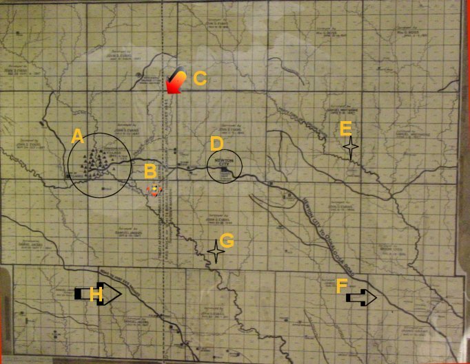
A - Large Indian Village of Chief Poweshiek |
B - Approximate location of current S. G. Cemetery |
|
C - Treaty Line that whites couldn't settle until after 1847 when the Indians had to be moved on west. |
D - Newton City - it had five houses |
|
E - North Skunk River |
F - Newton City to Oskaloosa Road |
|
G - South Skunk River |
H - Road to Fort Des Moines |
* Original map is located in the Iowa State Archives building in Des Moines, Iowa.
This image and page Copyright © 2002 by Barbara Lane Hug.All rights reserved.
 To inquire about volunteering for the IAGenWeb Project enter here and Join Our Team!
 |
 Server space for the IAGenWeb Project site is provided by the Friends of Iowa Gen Web
 |