
|
A.T. Andreas' illustrated historical atlas of the State of Iowa.
1875. (7th Congressional District ed.). Published by the Andreas Atlas Co., Lakeside
Building, Chicago, Ills. Engraved & printed by Chas. Shober & Co., Props. of
Chicago Lithographing Co.
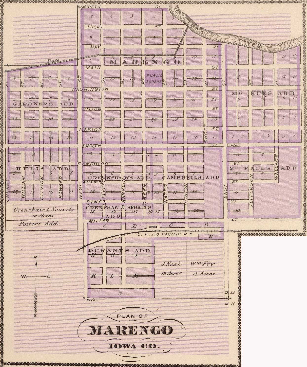
| Tracts & Landowners |
Streets |
Features |
Gardners Addition
Hulis Addition
Crenshaw & Snavely, 10 Acres
Potters Addition
Crenshaws Addition
Campbells Addition
Crenshaw & Serrins Addition
Durants Addition
J. Neal, 13 Acres
Wm Fry, 14 Acres
McKees Addition
McFalls Addition
|
Runing East & West
North
Lucas
May
Main
Washington
Hilton
Marion
South
Randolph
Adams
Pine
Miller
|
Runing North & South
Cherry
William
Clinton
Howard
West
Lafayette
Franklin
Green
Water
Clinton (again)
Short
East
Jefferson
Wallace
|
C.R.I.& Pacific R.R.
Race
Iowa River
Public Square
|
From the Rumsey
Collection. Image copyright © 2000 by Cartography Associates. This work is
licensed under a Creative
Commons License. Derivative work copyright © 2005 by Stephen D. Williams.
|