| Record:: Maps: Dubuque County Maps: 1850 | |
|
Serving Dubuque and Des Moines |
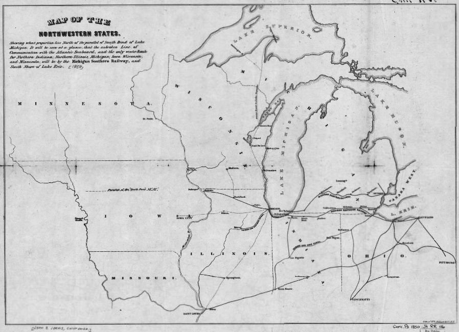
| "Map of the northwestern
states. Shewing [sic] what proportion lies north of the parallel of
South Bend of Lake Michigan. It will be seen at a glance, that the
unbroken line of communication with the Atlantic seaboard, and the
only winter route for northern Indiana, northern Illinois, Michigan,
Iowa, Wisconsin, and Minnesota, will be by the Michigan Southern
Railway, and south shore of Lake Erie. Summary Outline map of the north-central United States showing the canals and the railroad network and naming the Michigan Central and the Michigan Southern Railway. John B. Jervis was chief engineer on the Mohawk & Hudson Railroad in 1831." Created / Published, New York, [1850] |
 |
| From the Library of Congress Geography and Map Division, a.ka., Library of Congress American Memories. See Copyright and Restrictions at this link. Resized and manipulated for this site by Constance 2016 | |