"THE DRAGOON'S TRAIL" THROUGH WEBSTER COUNTY IN 1848
THE LOTT TRAGEDY
GOVERNMENT SURVEYS THE FIRST SETTLERS
REV. JOHN JOHNS THE FIRST MARRIAGE, BIRTH AND DEATH
MARKING THE GRAVE OF MRS. LOTT
POPULATION IN 1853.
The first white men upon the soil of Webster county, — at least so far as we have
any historic records, — were an exploring party of the First United States Dragoons,
who passed through the country in 1835. The Dragoons were a military organization
created by Congress in March, 1833. They were enlisted from nearly every state in
the Union. Their commanding officer was Colonel Henry Dodge. The Lieutenant Colonel
was Stephen W. Kearney. One of the captains was Nathan Boone, and Albert M. Lea
was a lieutenant. The rendezvous was Jefferson Barracks near St. Louis. Four distinct
exploring expeditions were made by the dragoons. The first was from Jefferson Barracks
to Fort Gibson. The second was from Fort Gibson to the Pawnee village on the Red
river and back. The third was from Fort Gibson to Fort Des Moines in Lee county,
Iowa ; and the fourth was from Fort Des Moines to Wabashaw's village in Minnesota
and back. It was this last expedition in the year 1835 that passed through what
is now Webster county on its return trip. It was a march of 1,100 miles by Companies
"B," "H" and "I," under the command of Lieutenant Colonel Kearney. On June 7, 1835,
this detachment left Fort Des Moines and marched between the Des Moines and Skunk
rivers to near the mouth of Boone river. Then taking a northeasterly course they
arrived at Wabashaw's village on the Mississippi river in Minnesota. After remaining
here about a week the company marched westwardly. Then taking a southerly course
they reentered Iowa in Kossuth county and reached the Des Moines river. Here at
the close of the day's march, Monday, August 3, 1835, they camped near the present
site of Rutland in Hum- boldt county. The next day they marched some twenty miles
and this time made camp on the North Lizard creek in Webster county. Descending
the river on its western side the dragoons reached Fort Des Moines August 19, 1835,
without a case of sickness or the loss of a single horse or man.
Fifteen years later this same route was followed by another body of United States
soldiers on their way north to establish a fort at the mouth of the Lizard creek,
and which afterwards became the fort and city of Fort Dodge. A few years more and
tne stage line followed the same path, which by this time had become known among
the early settlers as the "Dragoons' Trail."
Records of this expedition of the First United States Dragoons have survived
59
60
HISTORY OF WEBSTER COUNTY
in several geographical names in Iowa. Lieutenant Lea afterwards published an account
of his observations under the title of "Notes on Wisconsin Territory." In this work
he christened that part of the country lying west of the Mississippi river the "Iowa
District." His account of the richness and beauty of the upper Des Moines country
no. doubt had much to do with turning the attention of the immisfrant and settler
toward Iowa.
THROUGH WEBSTER COUNTY IN 1848
Among the papers of the late Edwin Goddard of Keosauqua, Iowa, there was found a
part of a journal descriptive of a journey along the Upper Des Moines valley in
the year 1848. The author is unknown, yet the journal is valuable for the minute
description which it gives of the country at that early date.
The opening lines of the journal give January 28, 1848, at nine o'clock in the morning
as the time of leaving Fort Des Moines. The party consisted of three, the unknown
author, A. Randall, and a man by the name of Lott. They followed the river very
closely in their journey. The journal mentions the party as having reached Mineral
Ridge in Boone county, and then makes the first men- tion of Webster county, which
they entered one mile north of the Ridge, at the township corners of townships 85
and 86, ranges 26 and 27. The trip through Webster county is best described in the
language of the writer, who says :
"One mile north of the Ridge the prairie again stretches several miles west toward
the Des Moines river. It is flat and has a great number of ponds, and the rout is
many times circuatous, at about 4 miles from the Ridge past an elevated mound 2^2
or 3 miles east in the flat prairie at 5 miles prairie runs up to bluff 150 feet
high generally not so abrupt as to prevent the growth of timber on it. The prairie
bear a N. E. course from this bluff', the river here lunning S. S. W. fine looking
prairie both bottom and bottom and upland on the opposite side interspersed with
groves of good timber fine spring along the Bluffs one mile north of this place
is the mouth of the East fork, or Boons, or as called on some maps Cottonwood, River,
not so large as Racoon river probably makes I/4 of the Des Moines below it. On the
Bottom above the mouth of this stream are two considerable mounds supposed to be
artificial one of an oblong shape the Bottoms are from one half to one mile in wedth
then the bluff rising to the level of the prairie so steep that it is not convenient
to ride up them. About one half mile above the East fork on the E. side of the desMoines
is the furthes up that any settlement has been made. Henry Lott settled here in
the spring of 46 and was robbed by the Sioux Indians in the latter part of that
year and has abandoned it for the present. On the top of the ridge east of the house
where Lott lived is a level prairie. I think it is one of the prettyest I have seen
on the river, it is dry so what (lower) in the middle and has the best quality of
timber around it. North after crossing a narrow belt of timber the prairie stretches
of N. E. between a small creek and the East fork. The prairie appear to be good
with fewer ponds. Above Lotts 2 miles is the mouth of a creek 20 feet wide falling
into the Des Moines, on the creek near the mouth the Sioux Indians robbed Henry
Nothington and Boman last fall. On mile farther up the river at the foot of a steep
hill 175 feet high is the line of the Neutral Land the present location of the Winebago
tribe of Indians. The course of River south on west side from 1/2 to 3/4
HISTORY OF WHISTORY OF WEBSTER COUNTY
61
wide but little timber on the bottom — back from river said to be of first rat quality
extending 3 or 4 miles west, one and a half miles further north the River make a
great bend to the west. Prairie bears N. E. up brushy creek. This prairie is of
better quality than any I have seen above the fork of Coon and Des Moines considering
its extent, though it would generally be thought to wet in many places for cultivation.
"There are many desirable locations around this prairie for making farms the best
quality of oak timber around the head of the ravines, all of which are abundently
supplied with springs. At a point 9 or 10 miles above the Neutral line the prairie
bears off N. W. where we presume the mouth of Lizard to be we will see however when
we reach it. All the points round this prairie with but few exceptions present fair
prospects for settlements The only thing objectionable is the number of little ponds
met with the moment yoti leave the timber in many parts of the country. The River
timber here is from 2 to 5 miles wide in most places and of good quality. After
leaving the point last spoken of we come some 5 or 6 miles N. W. to this point and
camped at the hed of ravine at the timber, quite a handsome location for a farm
provided a man wished to make one here. "July 1st, 1848. This morning we visited
the river from which we are now about one mile. The bottom on this side is not more
than y^ of a mile wide blufif on the west side washed by the river. Here on a small
Brook at an elevation of 80 feet above the river is deposits of Plaster Paris to
the depth of 18 or 20 feet which appear to be of good quality it is found in abundance
on both sides of the river and appears to be inexhaustible. The place may be known
by a bluff on the west side that has been nearly cut away by a brook the lower end
is elevated from the river about 30 feet, and up the river it rises abruptly present
an appearance of coal and Iron (bank) on that point is the (nearest plaster) that
is found to the river. The river at this point runs S. S. E. is about 250 or 300
feet wide from on to 2 feet deep brisk current, handsom banks and bottom, by a more
minute exanrination the Gypsum is found to extend farther up the brook on the East
said (side) and compose quite bluffs on each side of the same som places to the
height of 20 feet. A strata of soft sandstone lies a few feet below. The ridge between
the Brook & the river is flat and rich covered with a growth of hickory Lind Black
Walnut red oak & about the bluff's Lind white walnut sugar tree Iron- wood. On top
of flat white oak and near prairie bur oak & hickory. The Soil is better here than
general in timber and is mostly covered with pea vine and other vegetation denoting
good soil. "July 2nd. After making more thorough examination of the Plaster Paris
this morning which we find more abundant than had been anticipated, we travel N.
W'. 3 miles and passing two points of timber on our left a high grove on the right,
we strike the Des Moines bearing S. 30� E. this we suppose to be the point at which
the centre line of the Neutral Ground crosses the river, on its continuation towards
Lake Boyer. Round the points and the curves in the timber are some of the most desirable
locations for farms that I have met with on the DesMoines. The prairie rises buti
fully from the timber Surface undulating but very few of those basins or ponds so
commonly met with farther South. The soil is dry and rich and the timber adjoining
of the quality of white Bur and Red oak, some hickory, good water is found in all
the points of timber.
62 &nbs62
HISTORY OF WEBSTER COUNTY
"The prairie here runs up on both sides to the margin of the river, where it slopes
down to the waters edge making a bank of from i8 to 25 feet high to the level of
the bottom, the bottom are from 3 to 600 yards wide generally rising back towards
the hills dry & suitable for cultivation, the hills back of this rise from 75 to
90 or 100 feet but not so abruptly as to prevent travelling any direc- tion over
them.
"The scenery at this place is the finest I have seen on the river from the hills
the Des Moines is to be seen for 3 miles winding its course through the green prairie,
with a stripe of a deeper hue immeat the edge of the water. The current is brisk
but not rapid width 250 to 300 feet, opposite where we touched the river is a bluff
of dark courled slat or shale w'ith a small grove of timber extending a short distance
back, the prairie here bears N. W. we north to point one mile The prairie here bears
west to river which makes a considerable bend west. N. some West over rolling dry
prairie strike the river from north one mile along prairie bottom on both sides
reach a rocky Branch 12 or 15 feet wide not much water, above this a low bluff sets
in on the side for 1/2 mile limestone from 20 to 30 feet high, west side prairie
timber between the bluff and creek back some distance, here prairie comes again
to the river for 1/2 mile cours N. to a point of timber into prairie Timber on west
side of river running out some distance, from description must be the place where
the Sioux Indians murdered the Delawares in 1841. one mile strike river at the head
of prairie bottom at a rapid where the river fall probably 2 feet in 100 yards over
a bed of limestone, open prairie on the west and a sandstone bluff timber as far
as we can se upon this side. Think the East fork must be within a few miles.
"From here we followed a north west cours struck timber at the distance of }i. of
a mile and a Brook 8 or 10 feet wide from N. E. and one half mile travel north brought
us to the mouth of Lizard creek a small stream from the west* from 30 to 50 feet
wnde near the or at the mouth surrounded wath high hills and limestone bed and banks
to the height of several feet. This is a good mill stream and in the afternoon as
we traveled over the hills considerable bodies of timber were perceptible on and
about in vally.
"Cours from here N. E. at 1/4 mile bluff' approaches river at 130 feet high sand
stone shale, and here the plaster paris again makes it appearance though not in
such quantities as below. After ascending the bluff' and passing 1/4 mile over a
flat rich soil well timbered wnth Bur and red oak. Elm, Lind hackberry & some sugar
tree a butiful prairie of small extent streches of East rich dry and level surrended
except the S. E. end with the kind of timber spoken of of all the desirable places
I have seen this I think excels We passed the west end and con- tinuing our course
through the woods one mile struck the open prairie, con- siderable timber off east
on the head of brook passt below the mouth of Lizard.
"July 3d 1848. Start at 10 o'clock persue a N. E. course over the bluff through
timber the bluff is some 40 feet high the lind (land) running back level as far
as we could se for the thick growth of timber, good soil, covered with a tolerable
growth of Red & Bur oak Elm hickory some lind & Ironwood small brook from the East
rocky bottom but little water. 2 miles cross river and leave bottom course north
over dry rolling prairie Timber at points on E side of river
HISTORY OF WEBSTERHISTORY OF WEBSTER COUNTY
63
and at 3 miles appear to be a small creek falling in from east, could not tell the
size. About 5 miles reach the Moingonan or Brother fork it is difficult to tell
at the junction which is the larger of the two rivers." So far as Webster county
is concerned, there is nothing further in the journal.
THE LOTT TRAGEDY
By C. L. Lucas
Of all the men who acted a part in the early settlement of the Des Aloines valley,
there is no name around wdiich clusters so much thrilling history as that of Henry
Lott. Much has been said and written about him and his troubles and conflicts with
the Sioux Indians, and the death of his wife and son, that are more or less conflicting,
and as time goes on these divergent stories seem to become more numerous.
In writing up a sketch of history, great care should be taken to get the facts just
as they occurred, without additions or subtractions. If this were done there would
be but few conflicting stories going the rounds, and disputes about them would be
seldom heard.
Henry Lott was born in the state of Pennsylvania and grew to manhood and was married
there. His wife was a widow named, Huntingdon, and was the mother of a son by her
first husband, who acted a very prominent part in the subsequent history of the
Lott family. By the second marriage another son was born whose untimely death, and
the facts that surround it, make up the chief theme of this story.
We first heard of Lott in Iowa, in the spring of 1843, at which time he was acting
the role of an Indian trader at Red Rock, in what is now Alarion county, Iowa. At
that place, it is said, he did a thriving business until the nth of October, 1845,
at which date, according to the treaty of 1842, the Sac and Fox Indians bid adieu
to Iowa, and moved beyond the Missouri river.
So well pleased was Lott with his success as an Indian trader that in the summer
of 1846 he moved north from Red Rock, and located on the North bank of Boone river,
near its mouth. Here he expected to carry on a thriving business in traffic with
the Sioux Indians, but for some reason he did not get along so smoothly with them
as he did with the Sacs and Foxes at Red Rock. There are no less than three reasons
set forth as the origin of the trouble between Lott and Si-dom-i-na-do-tah and his
band of Sioux Indians.
The author of the Historic Atlas, in his sketch of Humboldt county, states that
the Sioux chief informed Lott that he was an intruder; that he had settled on the
Sioux hunting grounds, and that he gave Lott a certain time to get of. That his
refusal to go by the time set brought on the raid upon his family and stock. The
Union Historical company, in their sketch of the Indian chiefs of Iowa, make the
same statement.
If the Sioux chief made this statement to Lott, he either uttered a falsehood, or
else he did not know what he was talking about. Lott may have been a bad man, but
he was not an intruder, nor had he located upon the Sioux hunting grounds.
64
HISTORY OF WEBSTER COUNTY
According to W. S. Tanner's map, published in 1838, the Sioux hunting grounds did
not extend farther than the upper forks of the Des Moines river, at least thirty
miles north of where Lott had located.
Ex-Lieutenant Governor B. F. Gue, in his "Historic Sketch of Iowa," says that Lett's
cabin was the headquarters of a band of horse thieves, who stole horses from the
settlers in the valley below the mouth of Boone river, and ponies from the Indians
above it. and that they ran them across the state east to the Mississippi river,
and sold them. Mr. Gue seems to think that it was this wrong- ful taking of the
Indian ponies that brought the wrath of Si-dom-i-na-do-tah and his painted warriors
upon the Lott family. There is still another traditional story to the effect that
Lott had sold the Indians whiskey, upon which they became intoxicated and while
in that state the destruction of the property and the death of two innocent members
of the family was the result of their acts of cruelty.
Amid these conflicting statements it is next to impossible to get at the exact cause
which brought about the trouble, but it is certain that the horrible attack was
made, and that, too, by a band of Sioux Indians who were miles beyond the borders
of their hunting grounds, and intruders upon territory already ceded to the United
States by the Sac and Fox Indians, and open for settlement.
No statement has been made as to the manner in which the attack was made, but it
is safe to conclude that the savage warriors were painted in their usual hideous
style, and that as they approached the cabin the stillness of the moment was broken
by their piercing yells which never fail to send terror to the hearts of their defenseless
victims. Lott told Doras Eslick, who settled near the scene of this horror a few
years later, that he concealed himself across the river and watched the Indians
destroy his property for a while, but as he could do nothing in the way of defending
his family or property against a whole band of Indians, he and his stepson, a youth
about sixteen years old. fled to the nearest settlement to obtain help. This left
the wife and twelve year old son alone. The Indians ordered this twelve year old
boy to catch all the horses on the place and deliver them over, on the penalty of
death. This so frightened the. poor boy that he fled terror stricken down the Des
Moines river and was never seen alive again. The poor wife and mother was now left
alone to the mercy of the savage war- riors. Some say she fled into the thick timber
to escape the tomahawk, while others say she remained in the cabin and piteously
offered her plea for mercy. Be this as it may, her life for some reason was spared
by the Indians, so far as actual violence was concerned, but the shock upon her
nervous system, and the grief and exposure she suffered, carried her off within
a week or so later.
It was three days before Lott returned from the settlements below with twenty-six
friendly Indians belonging to Johnny Green's tribe of Musquawkies and Pottawattamies,
then camped on the river below Elk Rapids, and seven of the white settlers. The
names of those settlers were Dr. Spears, who lived on a claim near where the Rees
coal shaft is situated, and John Pea and Jacob Pea, his son, James Hull and William
Hull of Pea's Point, and John M. Crooks and William Crooks, who lived on the Myers
farm south of Boone.
When these settlers and the twenty-six friendly Indians reached the mouth of the
Boone river they found that Si-dom-i-na-do-tah, after plundering the cabin and killing
and wounding some of Lott's cattle, had retreated up the valley with his plunder
and all the horses he could lay hands on, and was now at a safe
HISTORY OF WEBSTERHISTORY OF WEBSTER COUNTY
65
distance. Thev found Mrs. Lott in a sorrowful condition, more dead than alive. She
had been left alone nearly three days in that wild country, not knowing what had
become of the rest of the family, nor what moment the Indians would return to the
cabin. We can never know how crushing was the grief and sorrow that fell to the
lot of this poor woman during those three lonely days and nights, with no one to
administer to her wants, or speak to her a word of cheer. In a short time death
came to her relief, and she was laid to rest on the Boone river bluff and her grave
is pointed out unto this day.
Finding that their services were not needed, the twenty-six friendly Indians and
all of the settlers except John Pea returned home. He remained behind to assist
Lott and his stepson in caring for the sick wife and mother, and in finding Milton
Lott. the twelve year old son, who had fled down the river.
It was the middle of December, 1846, when the raid was made upon the family ; the
weather was cold and the river was frozen over. There was snow both upon the ice
and on the ground and they followed the boy's tracks. He was thinlv clad when he
left home and without doubt suffered with cold from the start. Henry Lott. the father,
and John Pea followed his tracks until they reached a point about forty rods below
the mouth of a little creek which comes into the Des Moines river a short distance
below the village of Centerville, where they found the dead body of the unfortunate
boy, stiff" and still in the embrace of the piercing frost. At this place he had
attempted to climb the bench that separates the lower and upper bottoms, but was
so benumbed with cold that he fell backward and was unable to rise again. Not having
any way to convey the body to any of the settlements, they decided to place it in
a hollow log which they found near by and close the entrance with timbers so as
to prevent the wild animals from molesting it until such time as a burial in the
proper way could take place. The date on which the body was found was December 18,
1846.
The body remained in the log until the 14th of January, 1847, almost a month from
the time it was placed there. Henry Lott, the father, came down from Boone river
to Pea's Point on the 13th to attend the burial of his son. The 14th was Sunday;
the weather had moderated and the day was warm and beautiful, warmer by many degrees
than the day on which the poor boy met his death. At this date the county was not
organized and there was not an established road in its borders. With axes, spades
and guns, the men set out from Pea's Point afoot for the place of burial, a distance
of eight miles. The names of those making up the number who attended the funeral
were John Pea, Sr., John Pea, Jr., Jacob Pea, Thomas Sparks, John V. Crooks. William
Crooks and Henry Lott, the father of the boy. On arriving at the place where the
body had been left, a part of the men were detailed to dig the grave, while the
rest of them felled a tree, out of which they hewed enough of small pieces to construct
a rude coffin. The body was then taken from the hollow log, a sheet was wrapped
around it, and it was then lowered into the grave ; dirt was then thrown in, the
grave was filled and the little mound was rounded up. It was a funeral without ceremonial
word. There was no scripture read ; there was no prayer uttered and no hymn sung
; but there were tears in the eyes of those pioneers who stood around the grave
of Milton Lott and paid their last tribute of respect to him.
The tree near the grave on which the boy's name was cut has long since yielded to
the woodman's axe. No stone was set or stake driven to preserve the
66
HISTORY OF WEBSTER COUXTY
identity of the spot. As time passed on the little mound was brought to a level
with the surrounding surface and the identity of the grave was lost and forgotten.
After the death of his wife and son, Lott gathered up what property the Indians
had left him and moved south to the settlements. He built a cabin on O. D. Smalley's
claim in Dallas county, Iowa, about five miles southwest of Madrid, where he and
his stepson lived during the spring and summer of 1847. In the spring of that year
the first assessment of Dallas county was made. In the list of property owners appears
the name of Henry Lott, to whom were assessed thirteen head of cattle. The records
show that he was the largest cattle owner in the county at that time, owning one
more than any other man. These were the cattle that the Sioux Indians tried to kill
at the mouth of Boone river by shooting them with arrows. During the spring and
summer these cattle grew fat upon the range and in the fall were sold for beef.
A man named Ramsey bought one of these beeves and butchered it. Mr. Smalley bought
a front cjuarter of this beef and while carving it found one of the arrow heads
which the Indians had shot into it.
While living here Lott often spoke of his dead wife in a very sympathetic way, but
would usually wind up his talk by declaring that he would some day wreak vengeance
on the old Sioux chief who caused her death. In the fall of 1847 he moved to Fort
Des Moines and remained there over a year, during which time he was married to a
woman named McGuire. In the spring of 1849 he moved north and located at the mouth
of Boone river again, occupying the same log cabin in which his first wife died,
and from which his twelve year old son had fled from the Indians never more to be
seen alive. It was a place around which the gloomiest recollections hovered. While
living here three children were born to him and his second wife, the two oldest
being girls and the youngest a boy. At the birth of the boy the wife died, making
it necessary for him to find homes for the children. Her death occurred December
10, 1851, and she was buried on section 27, in Otho township, but all trace of her
grave is now obliterated. The infant boy was adopted by a family named White, in
whose care he grew to manhood and is now the head of a family, and is a citizen
of Boone, Iowa. The two girls were raised by a family named Dickerson in Boone county,
where they grew to womanhood and were married.
After finding homes for his children Lott sold his possessions at the mouth of Boone
river, and, with his stepson, in the fall of 1853, moved north forty-five miles
and located on a creek which still bears his name. Whether by purpose or by accident
he was once more a neighbor to Si-dom-i-na-do-tah, the old chief he so much hated.
By the terms of the treaty with the Sioux Indians their stay upon the territory
then occupied by them would expire the following spring, at which time they would
have to take up their line of march for regions farther west. If Lott was bent on
having revenge, the time was growing short in which to get it. Numerous times he
visited the chief in disguise and made himself agreeable by giving him presents.
During one of these visits to the wigwam of Si-dom-i-na- do-tah, the old chief unsuspectingly
exhibited to him the silverware which he took from Mrs. Lott at the mouth of Boone
river. By his actions and expressions it was plain that he regarded them as a trophy
of a great victory. The sight of this silverware brought vividly back to Lott's
mind the memory of his dead wife and immediately his thirst for vengeance was aroused.
HISTORY OF WEBSTERHISTORY OF WEBSTER COUNTY
67
This silverware consisted of a set of silver spoons and a set of silver knives and
forks, which were a present to Mrs. Lott by Mr. Huntington, her first hus- band.
Mrs. Lott had always prized them very highly.
It is not known whether the killing of Si-dom-i-na-do-tah and his family took place
then and there or not, but it is known that Lott got possession of the silverware,
for he exhibited it, when he reached the settlement, to John Pea, William Dickerson
and O. D. Smalley. He also told each of these men that the old Sioux chief would
never rob another house or cause the death of another innocent woman.
There are two stories told as to the manner in which Lott committed this crime of
murder, for murder it must be called. Some people have tried to palliate this act
by calling it justifiable killing, which may be true so far as the killing of Si-dom-i-na-do-tah
is concerned, but there is no justification in the killing of his family.
One story is that the killing was done on the evening the chief displayed the stolen
silverware. The other one is that early one moriiing he went to the wig- wam of
the old chief and reported to him that he had just seen in a beautiful valley not
far away a large flock of elk and urged the chief to go with him in pursuit of them.
This proposition so aroused his love for the chase that in a short time he was astride
his pony and on the way to the beautiful valley where the flock of elk was to be
found. But this story was only a ruse to get the chief a short distance from the
wigwam, where his life was taken and the pony upon which he rode passed into the
hands of a new owner. Lott then went back to the -wigwam and killed the chief's
family and he and his stepson made their escape to the settlements without being
detected by the other Indians camped near by.
So wily was the manner in which this crime was committed that it took several weeks
to find out who the perpetrators were, but in time the facts developed that Lott
and his stepson were the parties who did the killing. The chief's pony was found
in their possession and finally they were indicted by a grand jury at Des Moines.
Before the ofificers could take them in charge they left for regions farther west
and what became of them is not definitely known.
Granville Berkeley, pioneer lawyer of Webster City and also of the earlier town
of Homer, the first county seat of Webster county, secured the skull of Si-dom-i-
na-do-tah and kept it several years in his ofiice. This skull showed many fractures,
as though the head had been banged with a heavy club. Mr. Berkeley stated that he
kept this ghastly relic because the murdered man had been his friend.
In September, 1903, almost fifty-seven years after the death of Milton Lott, Mr.
C. L. Lucas started an inquiry through the press seeking to gain some information
as to the location of the grave of the son of Henry Lott. This inquiry developed
the fact that two men, John Pea and Thomas Sparks, who had been present and assisted
in the burial of the body of the dead boy, were still living in the city of Boone.
Independent of each other these men visited the locality where the grave was supposed
to be and agreed as to its location. The Madrid Historical Society then decided
to permanently mark the spot and December 18, 1905, erected a monument thereon.
The grave of Mrs. Lott in Otho township still remains unmarked.
68 &nbs68
HISTORY OF WEBSTER COUNTY
THE "NEUTRAL LINE" AND OTHER SURVEYS
The "Neutral Line," which was to separate the warring Sacs and Foxes and the Sioux
Indians, was surveyed by Captain Nathan Boone, who l)egan the survey April 19, 1832.
The line commenced at the mouth of Trout Run on the Iowa river, about six miles
below Decorah. His next point was in or near section 23-97-7, and thence to the
Des Moines river. The latter point was doubtless at the confluence of the east and
west forks of the Des 'Moines, some three miles below Dakota City. The remainder
of the treaty line to the Missouri river was never run. At the second Prairie du
Chien council of July 15, 1830, the neutral strip was established, being a tract
twenty miles in width each side of the "Neutral Line." The mere "line" had not been
sufficient to keep the Indian tribes apart. The survey of the southern boundary
of this strip was begun by Captain Boone. June 19, 1832. He. however, had proceeded
but a short distance when he was forced to stop because of the hostility of the
Indians. September 8, 1833, James Craig resumed the survey from where Captain Boone
left off and completed it to the Des Moines river. The southwest corner of the neutral
strip was in section 15-87-27. at McGuire's Bend.
In 1848 government surveys of the land purchased north- of the Raccoon Forks was
commenced. James Marsh of Dubuciue set out from that place to run the correction
line from a point on the Mississippi near Dubuque west to the Missouri river. He
progressed with his work without molestation until he and his company crossed the
Sioux, or Des Moines river, when they were met by the Sioux Indians, led by a chief
named Si-dom-i-na-do-tah (generally known afterwards by the name. "Two Fingers",
who ordered him to "pucachee," (clear out. be off), and gave him to understand that
the land belonged to them and that he should proceed no farther. The Indians then
left the surveying squad on the west bank of the river.
After some hesitation Mr. Marsh concluded to proceed. He and his company had not
proceeded a mile from the river, at a point at the head of a large ravine south
of the section line of section 30, when they were surrounded by the Indians in force.
The Sioux robbed them of everything, taking their horses, breaking their wagons
and surveying instruments. The savages pulled up the stakes set by the party, tone
down the mounds, and forced the party back across the river to find their way home
as best they could. This surveying party under Marsh was not provided with firearms
to make any resistance. The whole party had with them, it is said, but one or two
guns for the purpose of shooting game ; consequently they surrendered at discretion.
When the Indians surrounded them, Mrs. Marsh, who accompanied her husband, was the
only one of the party who urged resistance, or wanted to fight the savages. She
protested against sub- mission to the last.
THE FIRST SETTLERS
The first settlers in Webster county located in the neighborhood of the mouth of
the Boone river. At that time, there was no other settlement beyond in the entire
northwest. It was on the frontier of civilization. Henry Lott. who was the first,
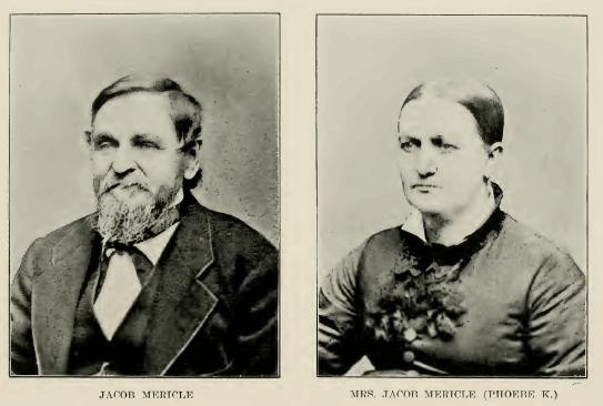
came in the summer of 1846. He was followed by Isaac Bell, L. Mericle, Jacob Mericle,
D. B. Spaulding, Osborn Brannon, John Tolman, Frank McGuire,
HISTORY OF WEBSTERHISTORY OF WEBSTER COUNTY
69
Squire McGuire. William Pierce, Tolman Woolsey, Samuel Eslick, Thomas Holliday,
E. Gatchell and Philemon Johnson. These settlers came principally from Missouri,
North Carolina and Indiana. Three or four came from New York. Very soon after the
settlement was begun at the mouth of the Boone a unique character came and made
his home among- them. He was the Rev. John Johns, an itinerant Baptist preacher,
and at one time coroner of Webster county. He was a hunter and a trapper. He could
preach a sermon or locate a bee tree with equal success. He was a strong Abolitionist.
As a delegate to the Republican state convention which met in Des Moines, in 18565
his speech was the ""hit" of the convention. He was dressed in his hunter's garb,
and this furnished some amusement for the rest of the delegates, an amusement which,
however, changed to admiration before his speech ended. He had a tiery eloquence
that compelled attention, and he was talking upon a theme which he felt deeply.
Although not a regular delegate to the national convention, yet so great was his
desire to attend that he walked from Border Plains to Dubuque, as he had no money
to pay for a ride on the stage. He still wore his coon skin cap and carried his
rifle, for he had hunted as he tramped his way across the state. At Dubuque he secured
a passage to Chicago. As a delegate at large, he was a member of the Iowa dele-
gation, and as such took part in the business of the convention.
The first child born in the county was Jackson Mericle, son of Jacob Mericle. The
first recorded marriage was that of John Jacob Holmes, hospital steward at the fort,
and Miss Emily Lyons, housekeeper for the officers, on May 14, 1853. The issuing
of the license was the first official act of Judge W illiam Pierce. The first death
was that of the first wife of Henry Lott, who died January i, 1847, and was buried
on the summit of the bluff overlooking the junction of the Boone and Des IMoines
rivers. In 1852 the spot was used as a public burying ground and became known as
Yegor's cemetery. The grave was marked by a grape vine, which it is said Lott himself
planted, and which was afterwards kept growing by people, who knew the location
of the grave. For sixty years the grave was unmarked, except in this way. At the
meeting of the Old Settlers' Picnic Asso- ciation of Bell's Mill, held in 1908,
a subscription was started to raise funds for the purpose of erecting a monument
over her grave. These plans, however, were not completed until three years later,
when the formal dedication took place, September 9, 191 1. The monument is an obelisk
of solid concrete, bearing upon one side an iron marker.
Fort Dodge, or as first named Fort Clarke, was established in 1850, chiefly because
of the annoyance which the Indians had caused the early settlers and the fear that
they might do worse. Outside of the troops at the fort the popu- lation of the county
in August. 1853. was but 150; and the election returns for the first election, held
the same month, show but sixty-three voters.
|