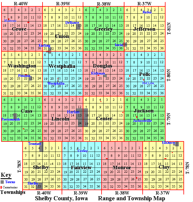
The rectangular areas outlined in red represent the federal townships as
defined by the Federal Range and Township System. For example, Range 38W and
Township 78N is Monroe township, and there are two cemetery locations
indicated in sections 7 and 25 on the map above. As a rule each of the
federal townships contain 36 sections, each consisting of 640 acres. For
Shelby County, the federal townships are the same as the civil townships of
the county.
|