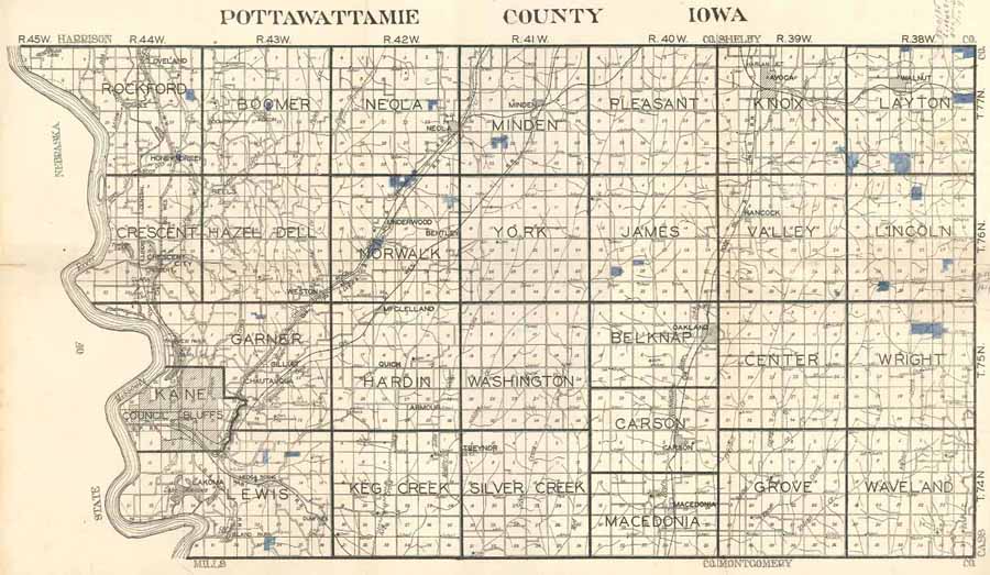
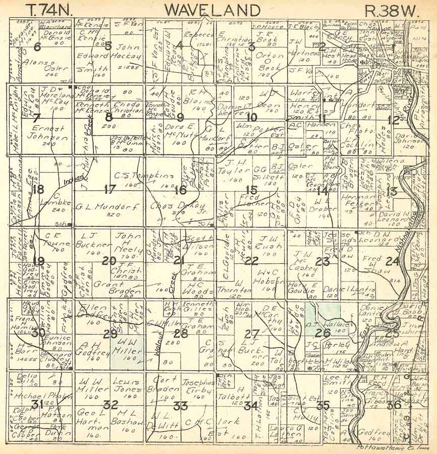
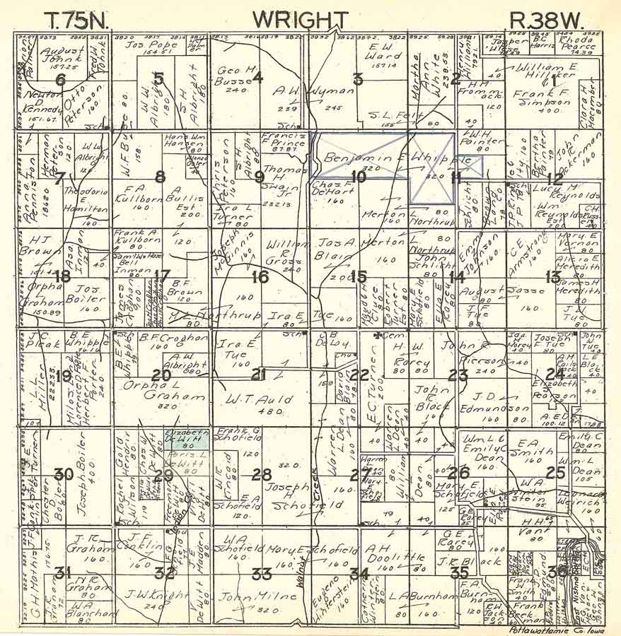
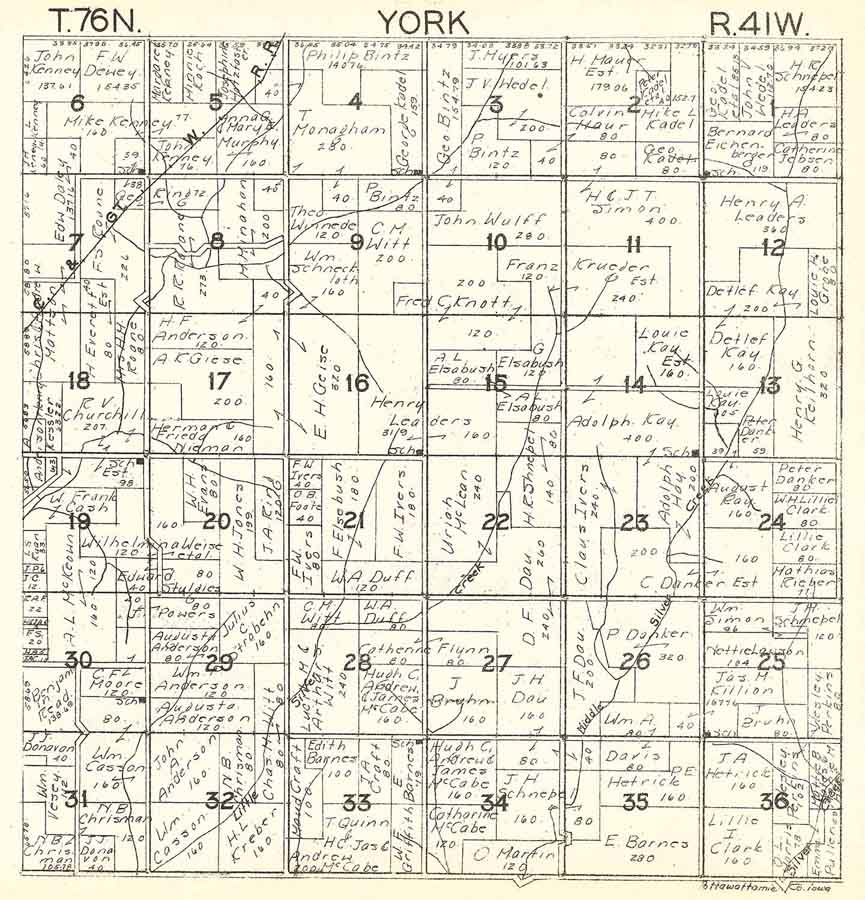
Click on map to enlarge, then click map again to see landowner's name.
Pottawattamie County
Townships
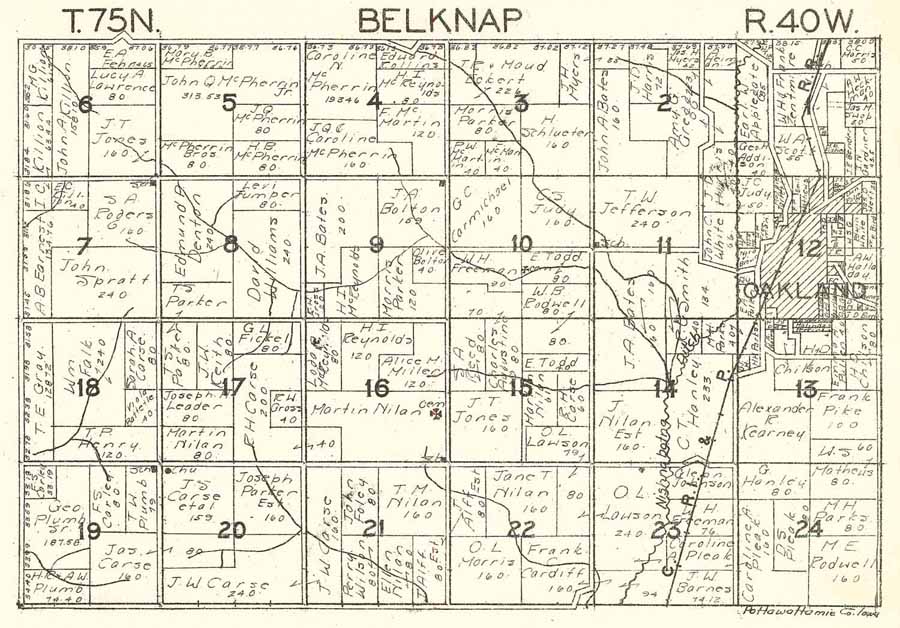
Belknap
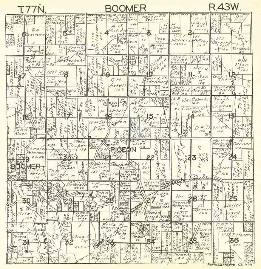
Boomer
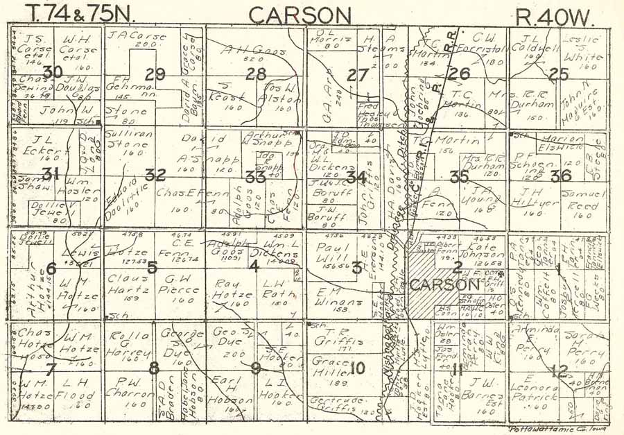
Carson
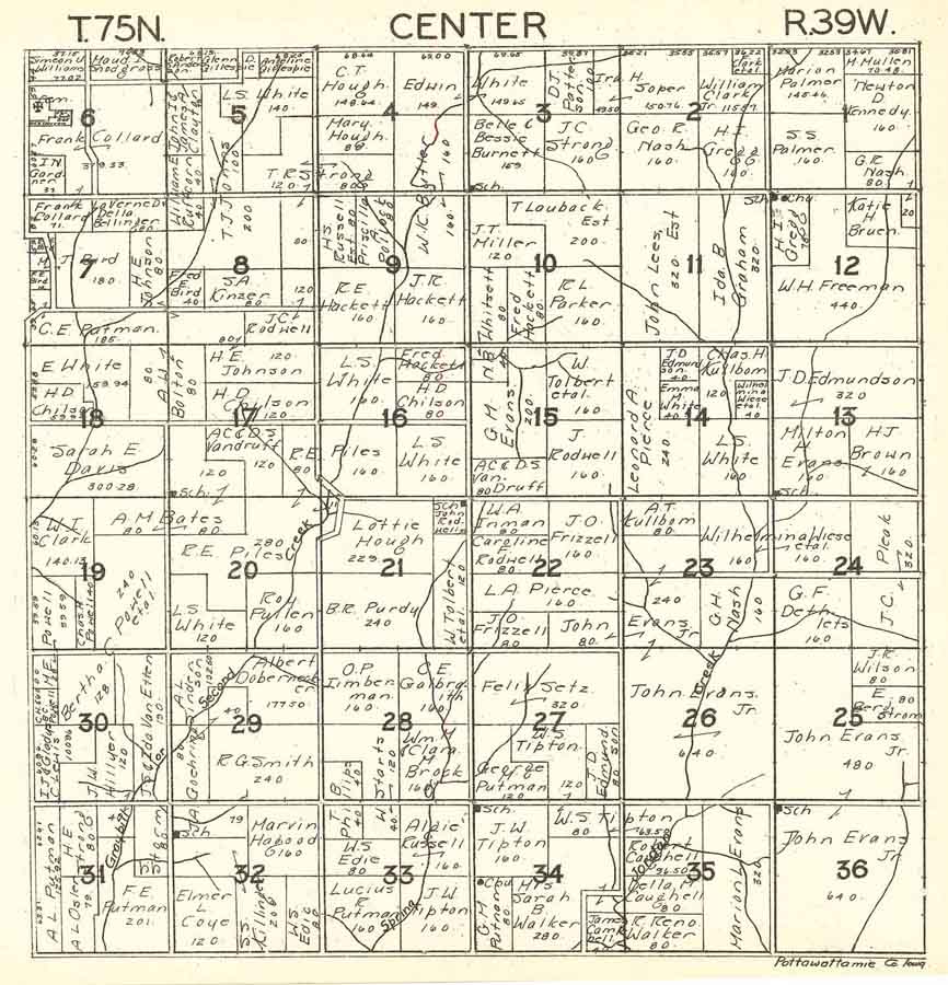
Center
Crescent
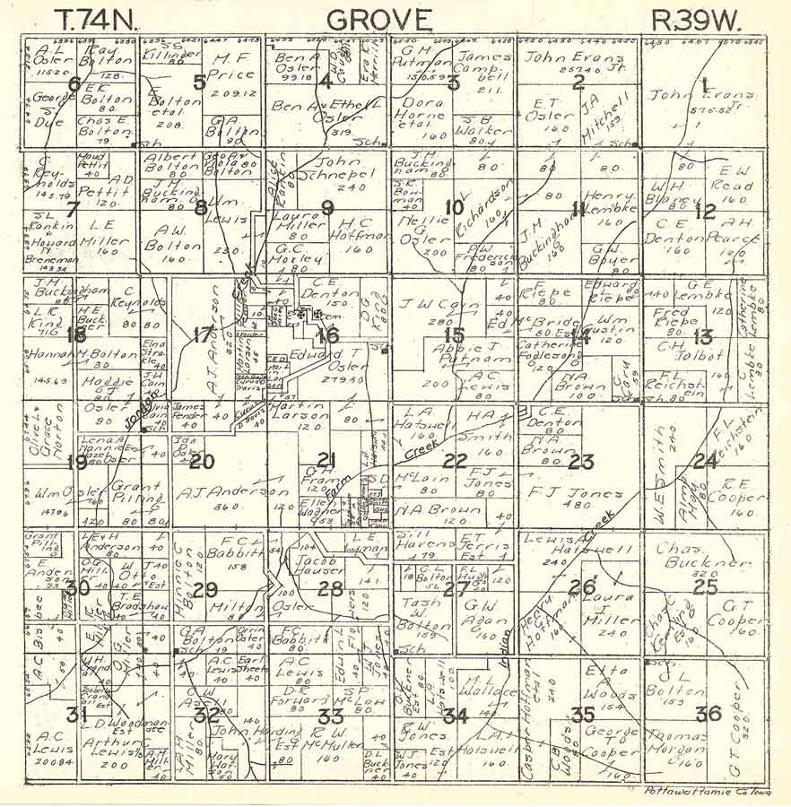
Grove
Hardin
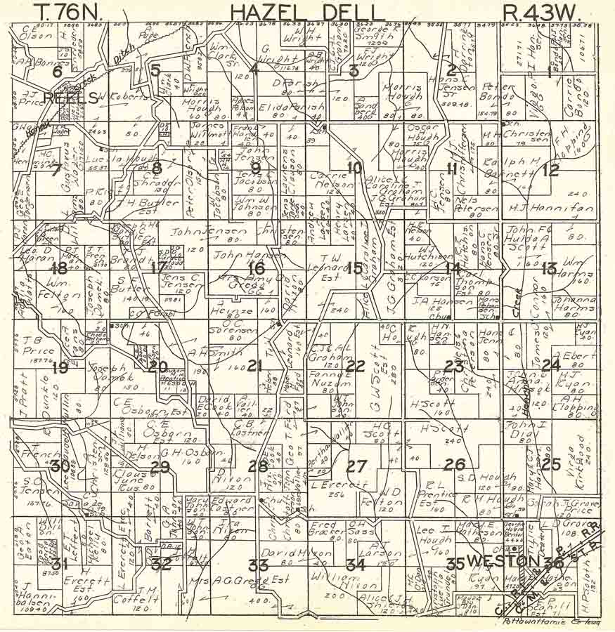
Hazel
Dell
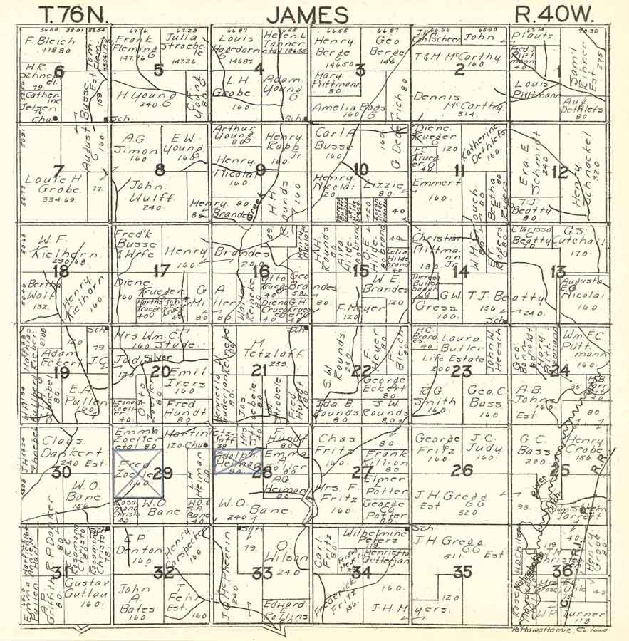
James
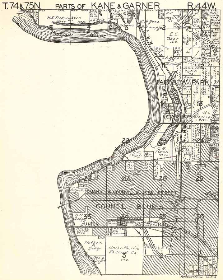
Parts
of Kane and Garner 1
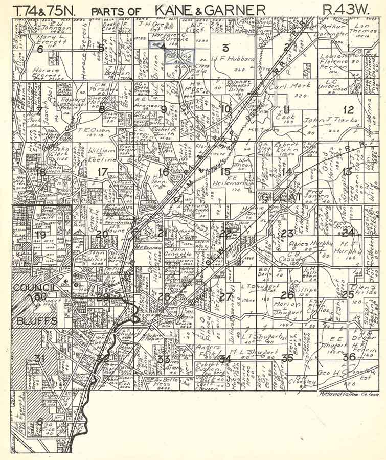
Parts
of Kane and Garner 2
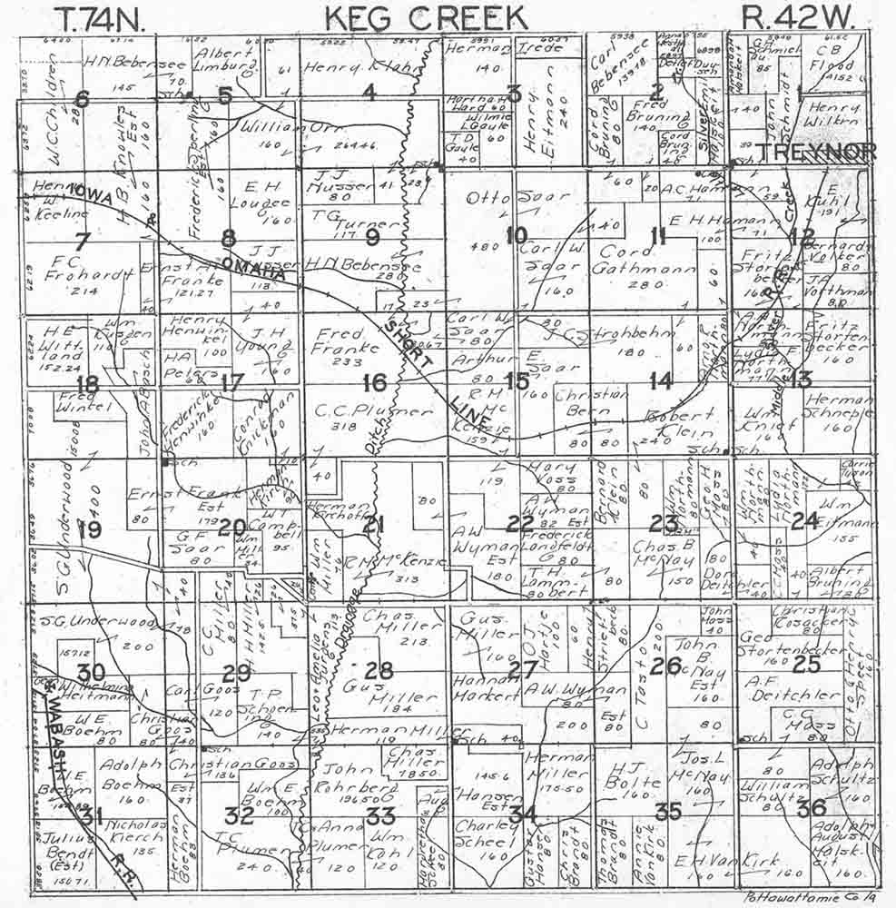
Keg
Creek
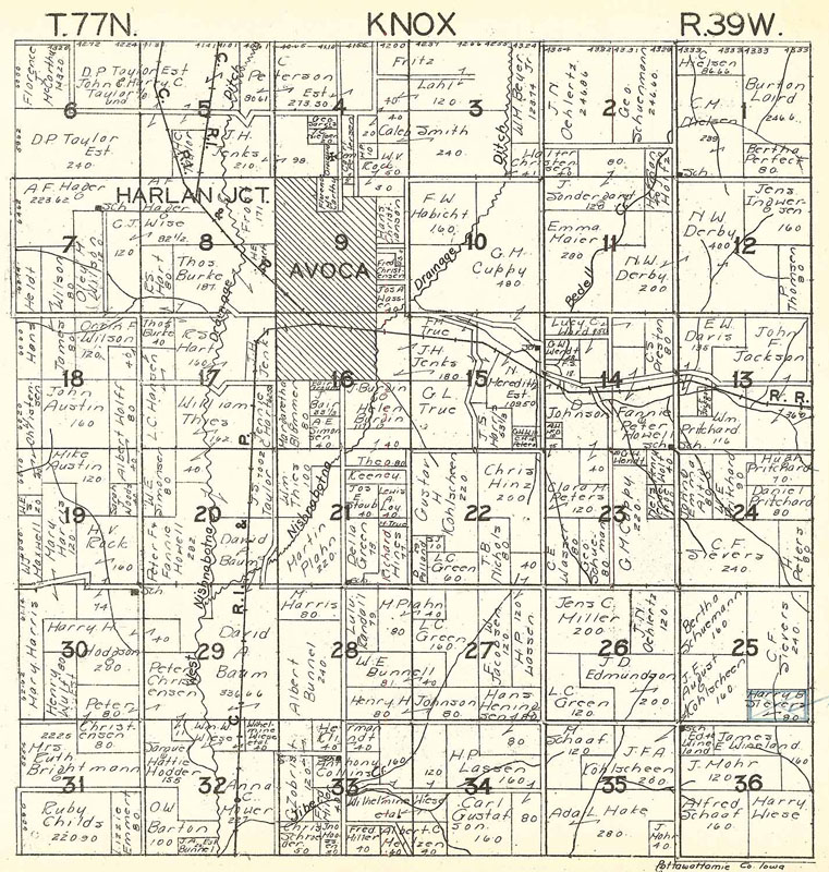
Knox
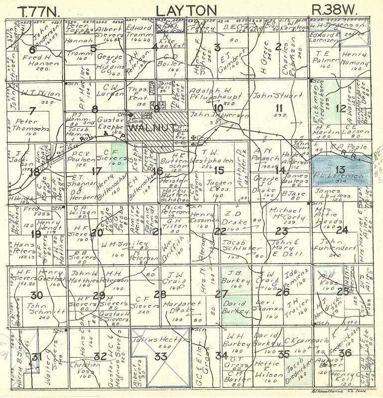
Layton
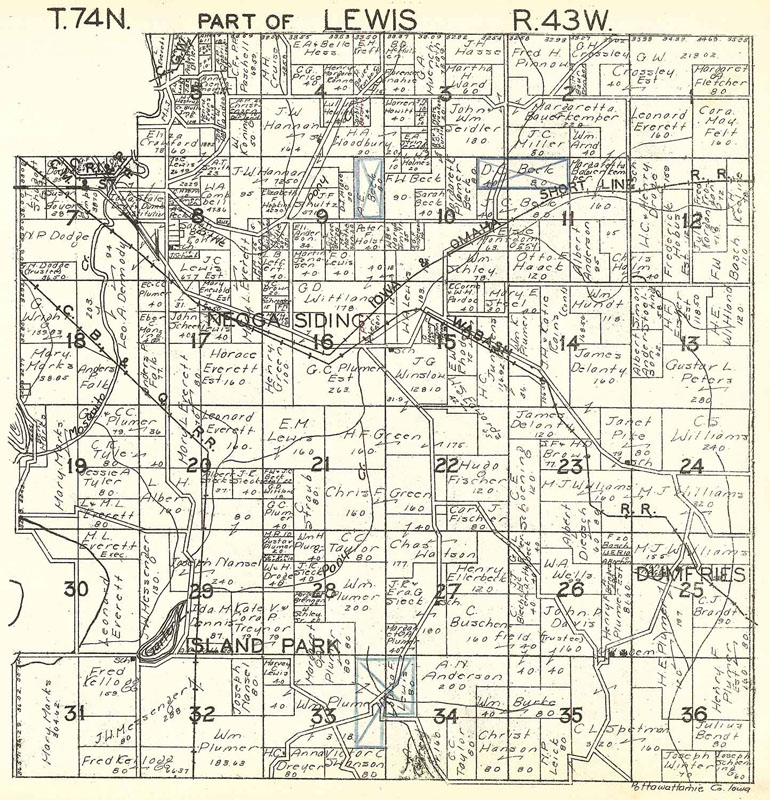
Parts
of Lewis 1
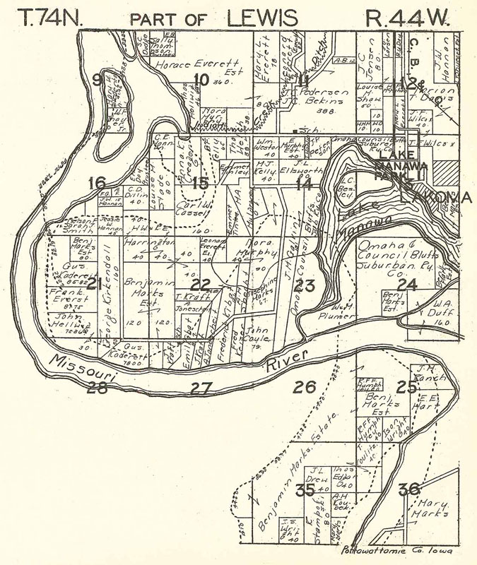
Parts
of Lewis 2
Lincoln
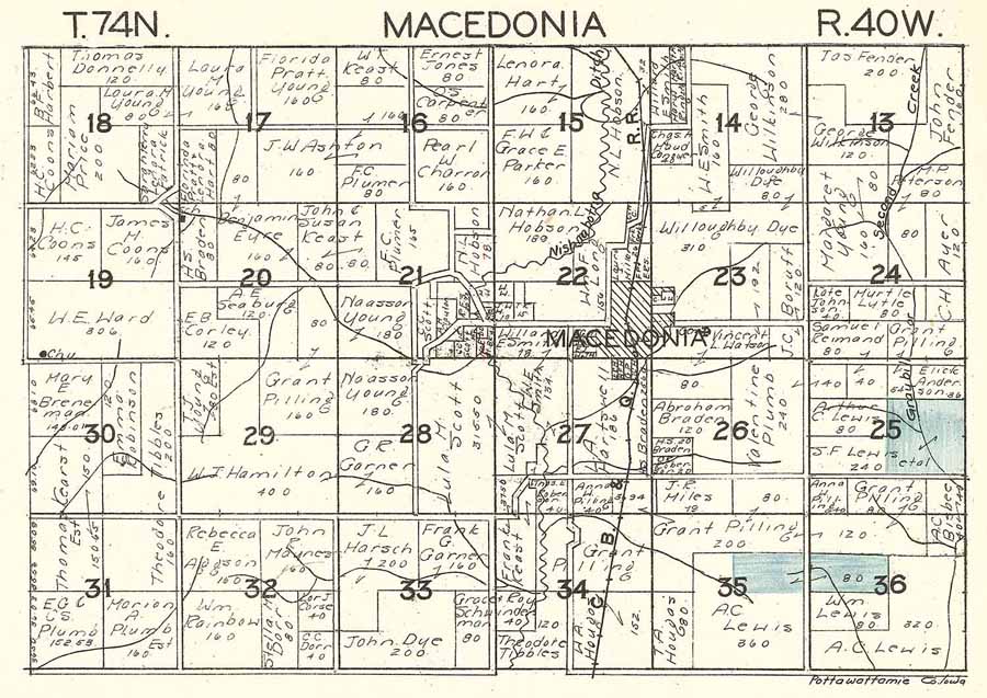
Macedonia
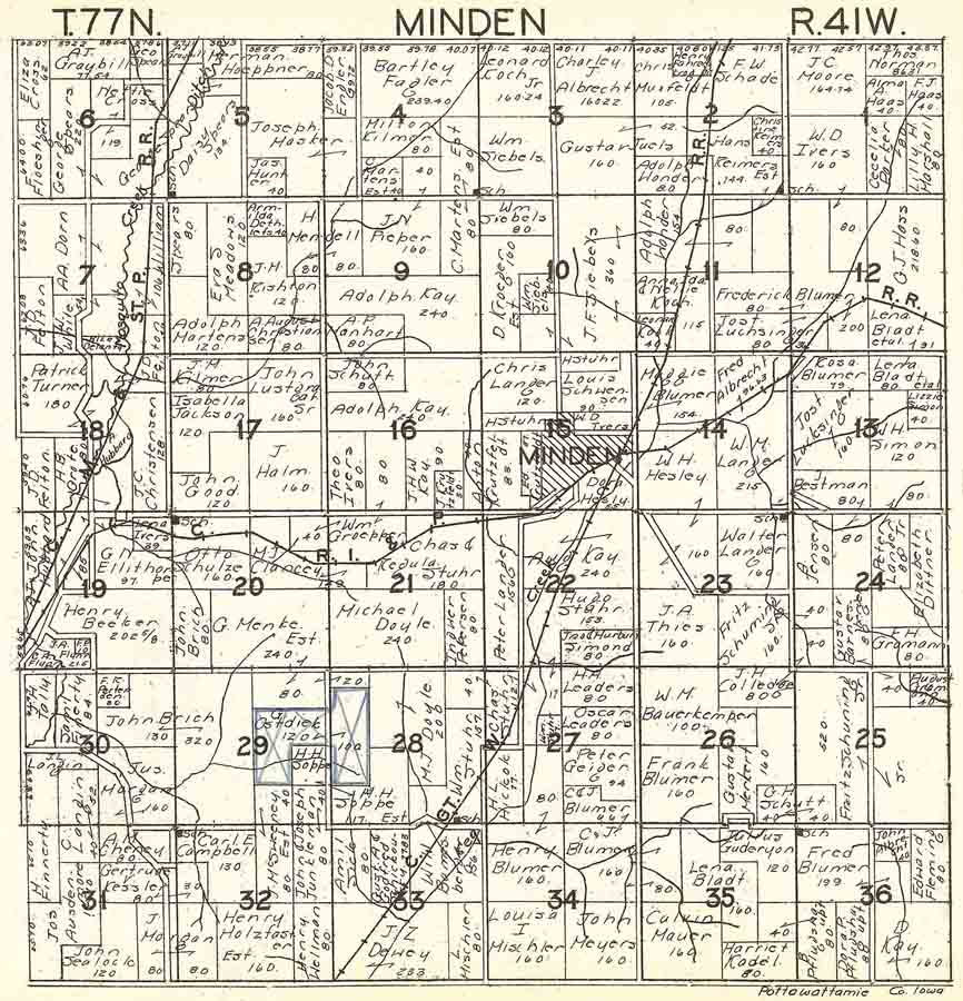
Minden
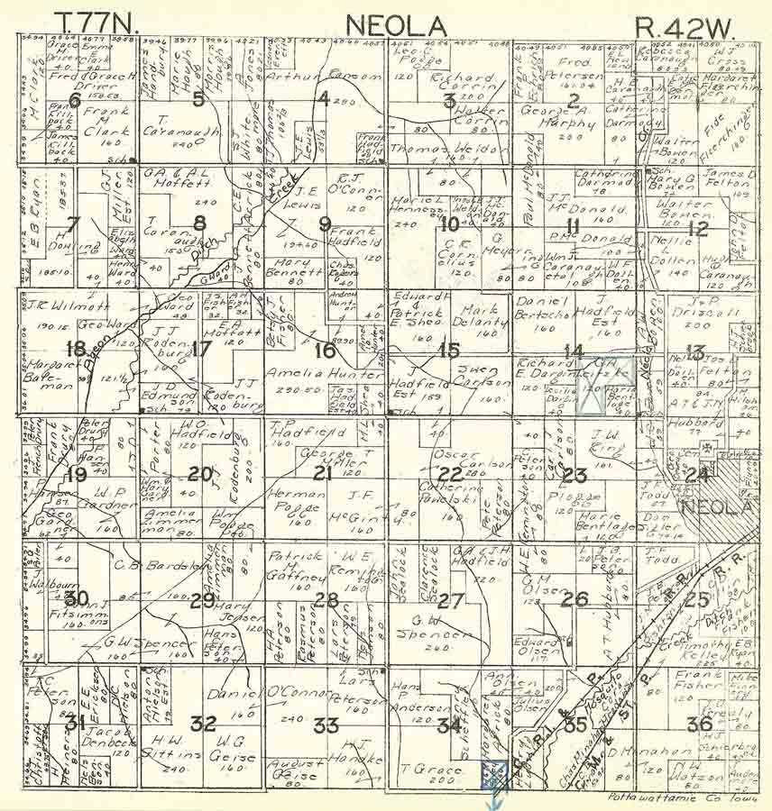
Neola
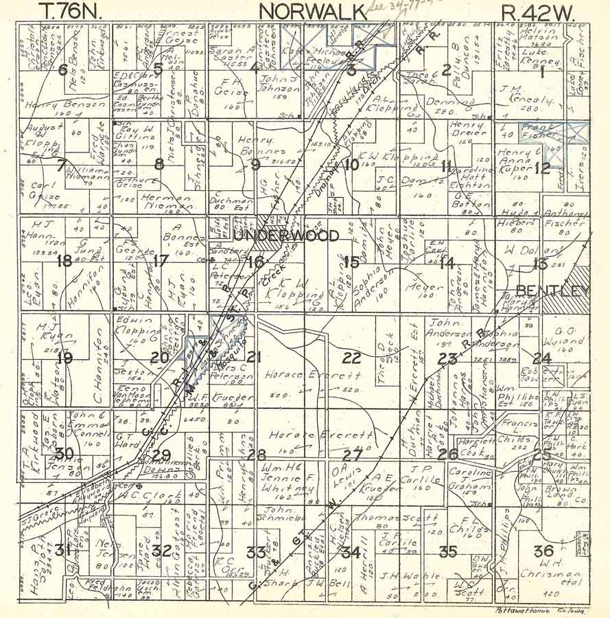
Norwalk
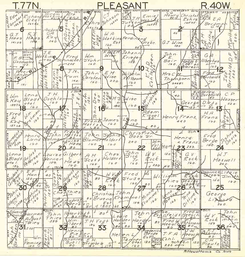
Pleasant
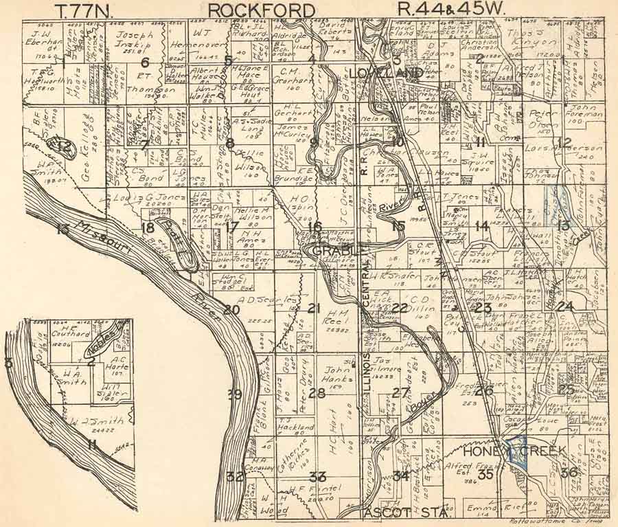
Rockford
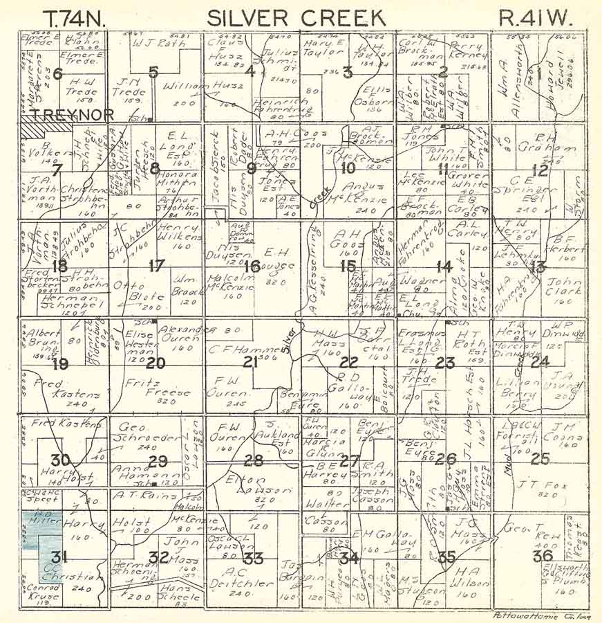
Silver
Creek
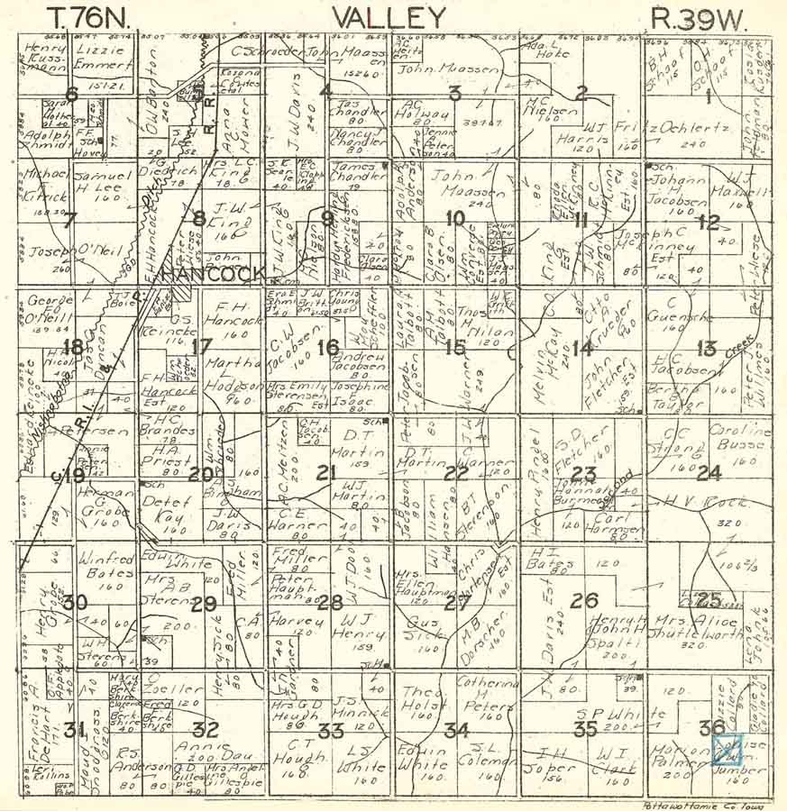
Valley
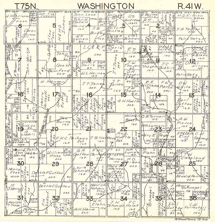
Washington
Waveland
Wright
York
W.W. Hixson&Co.'s1930platbook of
Pottawattamie
County, Iowa. Available through the Iowa Digital Library
at:http://digital.lib.uiowa.edu/cdm/ref/collection/hixson/id/1478, Used with
permission of the University of Iowa Libraries