|
1875
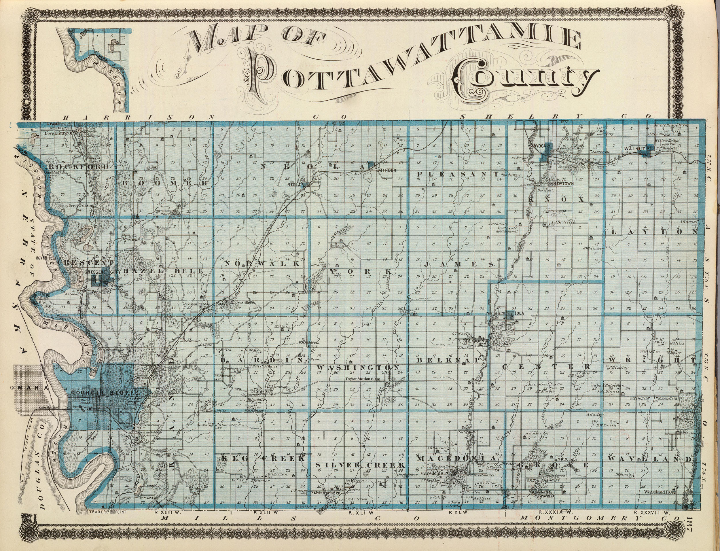
Map of Pottawattamie County
Colored lithographed map. Shows farm houses, landowners,
schools, churches, mills, blacksmith shops, roads, railroads, proposed
railroads, timber, swamps, bluffs, etc.
Map of Pottawattamie County. (Published by the Andreas Atlas Co.,
Lakeside Building, Chicago, Ills.
Engraved & printed by Chas. Shober & Co., Props. of Chicago
Lithographing Co.). 1875.
(Double click map to enlarge.)
|
|
|
|
|
|