|
1875
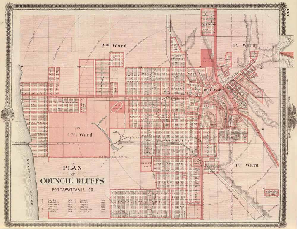
Plan of Council Bluffs
Colored lithographed map. Shows wards, tracts, block
numbers, radial distances from court house, etc. Relief shown by
hachures.
Plan of Council Bluffs, Pottawattamie Co., State of Iowa. Chas. Shober
& Co., props., Chicago Lith. Co.
(Published by the Andreas Atlas Co., Lakeside Building, Chicago, Ills.
Engraved & printed by Chas. Shober & Co., Props. of Chicago
Lithographing Co.). 1875.
(Click to enlarge. Use your
browser's Back button to return.)
|
|
|
|
|
|