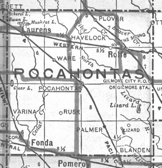
Pocahontas County
The county in 1918
The following information was abstracted from a 1918 Atlas of Pocahontas County, Iowa, Tim Meyer the previous county coordinator.

Part one: Topographical Maps
Click on the desired township to view a map of said township.
The map could indicate the locations of railroads, schools, churchs, creeks and towns.

Part two: Owners/Renters of Farms
It appears a type of questionaire was sent to the residents and they supplied their name
and co-owner/renter, if any; their spouse; their children; the name of their farm;
the type of animals raised/bred; the owner of farm, if rented;
and number of years they have resided in the county.

Click on the township to view the names of the residents and their families
the other information is not provided in this abstract.
The information listed below is the owner/renter of the property,
their spouse and their children.
Part Three: Township map of 1918
Below is a township map dating from 1918 showing the towns at the time
The thickest lines on the map are major roads.

Redesigned and uploaded 08 May 2014
![]()
![]()
![]()
