Mills County, Iowa

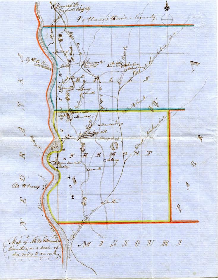
Earliest Known Map of Mills County

The map shown was found in the archives of the Fremont County Historical Society by Harry Wilkins.
It is believed to be one of earliest known maps of Fremont and Mills Counties.


Fremont County Notes:
This map was drawn by Rev. John Todd in 1854. John Todd, and George Gaston, left Ohio in 1847 and arrived in the Civil Bend (now Percival) area Oct 1848. There they established a church, and school, but when the Missouri river flooded the area in 1851, they decided to move to higher ground settling the area now known as Tabor.

They constructed what became known as the 'Todd House' and later Tabor College. Besides being some of the earliest settlers in the area they were abolitionists who supported the 'underground railroad' and assisted John Brown in moving slaves to freedom.

Contributed by Bob Jenkins, Fremont County Historical Society


Return to Atlases

Return to Mills County Home Page

Page updated May 15, 2023 by Karyn Techau
Copyright © IAGenWeb 1996-2023 The submitters & IAGenWeb
Please read the IAGenWeb Terms, Conditions & Disclaimer
~ all of which applies to the complete Mills co. IAGenWeb website. ~