Mills County, Iowa
Plat Maps
(Andreas Atlas of Iowa, 1875)
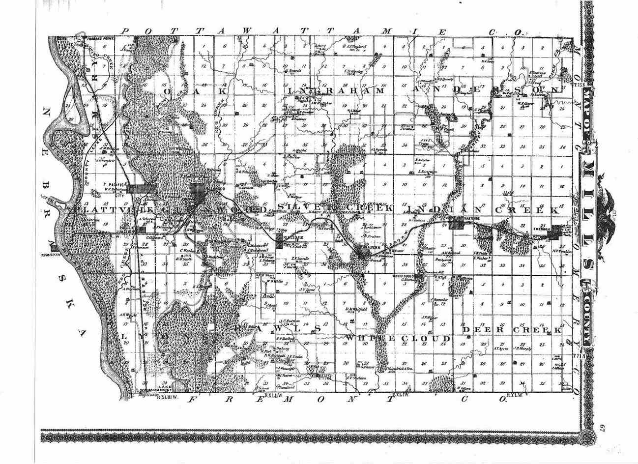
Source: Photo of Map, donated by Pat O'dell, 2013
Patron's Directory
(Surname, business, nativity, year to the state, P.O.) |
Townships
(Surname, business, nativity, year to the state, P.O.) |
A. T. Andreas, Illustrated Historical
Atlas of the State of Iowa - 1875, was the most monumental Iowa history, and reference tool of its time.
Since 1875, nothing has been printed that would begin to include, as does Andreas, the
varied aspects of the Iowa scene from the beginnings of the white settlement to 1875.
There are 596 pages in this colossal undertaking, 361 pages are
pictorial. The remaining 233 pages are divided as: Biographical
Sketches 31;
Iowa, Topography, Geology, Climate, 4; State History
26; County Histories 84; Patrons of the Atlas 56; Business Directory of Patrons 18.
(Between 1865 and 1885
Andreas published, approximately thirty county and state atlases. The listings in the Patrons Directory show those of Mills County.)
|