
| LOUISA COUNTY, IOWA |  |
|
| LOUISA COUNTY, IOWA | |
HISTORY of
LOUISA COUNTY IOWA
Volume I
BY ARTHUR SPRINGER, 1912
Submitted by Lynn McCleary, November 16, 2013
APPENDIX.
CHARTERS, GRANTS, TREATIES AND LAWS AFFECTING LOUISA COUNTY
pg 418
It may not be long until the land owner who wants to sell will find it necessary to furnish an abstract of title reaching back to "the beginning of things" on this continent. Desiring that the subscribers to this work shall be fully prepared for such an emergency, we have been at some pains to prepare a list of the various charters, grants, treaties, and organic acts, which have, from time to time, been granted or enacted relating to or affecting the territory comprising Louisa county, with a list and brief mention of laws wihch have special or local application.
April, 1492
Grant by Ferdinand and Elizabeth to Christopher Columbus, making him "Admiral Vice-Roy and Governor" of the Islands and Continents he should discover.May, 1493
Pope Alexander Sixth issued a Bull conceding to Spain all the continents, inhabited by infidels, which had been discovered by Spain.March, 1496
King Henry Seventh granted Letters Patent of discovery and trade to John Cabot and his sons, Lewis, Sebastian and Santius, they to pay to the king the fifth part "of the capital gaine so gotten."November, 1620
King James I granted to the "Councill established at Plymouth in the County of Devon for the planting, ruling, ordering and governing of New England in America" "all that Circuit, Continent, Precincts, and Limitts in America, lying and being in Breadth from Fourty Degrees of Northerly Latitude, from the Equinoctiall Line, to Fourty eight Degrees of said Northerly Latitude, and in length by all the Breadth aforesaid throughout the Maine Land, from Sea to Sea, &c."1630 and 1631
The "Council" at Plymouth granted to the Earl of Warwick in 1630 a tract of country south of Massachusetts. On March 19, 1631, the Earl transferred his grant to Lords Say and Seale, Burke and others. This grant included all of Louisa county.pg 419
June, 1635
The Council established at Plymouth surrendered its charter to King Charles.1662
Charles II granted a Charter to John Winthrop and associates, to the same territory included in the Warwick grant of 1630, Winthrop and his associates having purchased the rights of those holding under the Warwick grant.June, 1673
Marquette and Joliet "discovered" this part of the country for France.April, 1682
La Salle claimed for France a large part of the Mississippi valley, including all of the present State of Iowa.October, 1691
William and Mary of England, promulgated an instrument by which they did "Will and Ordayne that the Territories and Collnyes called or Known by the names of Collony of the Massachusetts Bay and Collony of New Plymouth" and other colonies named "be erected United and incorporated" into "one reall Province by the name of Our Province of Massachusetts Bay in New England."1762 and 1763
England, France and Spain agreed that the boundary between the Provinces of England and France in America should be fixed as the middle of the Mississippi River, from its source to the Ibervilles.France also ceded Louisiana to Spain, and the lands now included in Iowa were a part of the province of Louisiana, and thus came under Spanish dominion.
1800 and 1801
By the treaty of San Ildefonso, made between France and Spain on October 1, 1800, Spain agreed, upon certain conditions to re-cede Louisiana to France. This was confirmed by a second treaty, between the same powers, made at Madrid, March 21, 1801. and we thus again came under French dominion.April 30, 1803
A treaty was concluded between the President of the United States and "the first consul of the French Republic, in the name of the French people," ceding the province of Louisiana to the United States; ratifications were exchanged at Washington, October 21, 1803.October 31, 1803
Act of Congress authorizing the President to take possession of "the territories ceded by France to the United States" by the treaty of April 30th last, and providing that, until the expiration of the present congress, unless provision for a temporary government should be sooner made by congress, the government thereof should be vested in such persons and exercised in such manner as the President should direct.pg 420
March 26, 1804
Act of Congress dividing "that portion of the country ceded by France to the United States, under the name of Louisiana" so that all that part south of the territory of Mississippi and south of 330 of north latitude should constitute the territory of Orleans, and the "residue of the province of Louisiana" should be called the district of Louisiana and be under the government and jurisdiction of the governor and judges of Indiana territory.March 3, 1805
Act of Congress declaring that the "district of Louisiana" should thenceforth be known as the Territory of Louisiana and providing for its government by a governor and three judges.February 20, 1811
Act of Congress to enable the people of Louisiana to form a state government, and prescribing limits which extended no further north than 300 north latitude.April 8, 1812
Louisiana admitted as a state.June 4, 1812
Act of Congress providing that the "Territory heretofore called Louisiana shall hereafter be called Missouri," and providing for a territorial government consisting of a governor, a legislative council and a house of representatives.September 10, 1819
Act of the Governor and Judges of the territory of Michigan to regulate ferries. Section 2 provides, that the County Court shall grant licenses for keeping ferries in their respective counties, which shall continue in force for one year and no longer.March 6, 1820
Act of Congress authorizing the people of Missouri to form a state government, with boundaries as follows: Beginning at the middle of the Mississippi river on the parallel of thirty-six degrees north latitude; thence west along that parallel of latitude to the Saint Francois river; thence up, and following the course of that in the middle of the main channel thereof, to the parallel of latitude of thirty-six degrees and thirty minutes; thence west along the same to a point where the said parallel is intersected by a meridian line passing through the middle of the mouth of the Kansas river, where the same empties into the Missouri river; thence from the point aforesaid, north, along the said meridian line, to the intersection of the parallel of latitude which passes through the rapids of the river Des Moines, making the said line to correspond with the Indian boundary line; thence east, from the point of intersection last aforesaid along the said parallel of latitude to the middle of the channel of the main fork of the said river Des Moines; thence down and along the middle of the main channel of the said river Des Moines to the mouth of the same where it ...
pg 421
... empties into the Mississippi river; thence due east to the middle of the main channel of Mississippi river; thence down and following the course of the Mississippi river, in the middle of the main channel thereof, to the place of beginning.June 12, 1820
The Constitution of the State of Missouri was adopted by a convention held at St. Louis; this constitution fixes the northern boundary line of Missouri as follows: from "the intersection of the parallel of latitude which passes through the rapids of the river Des Moines, making the said line correspond with the Indian boundary line, thence east from the point of intersection last aforesaid, along the said parallel of latitude, to the middle of the channel of the main fork of the said river Des Moines; thence down and along the middle of the main channel of the said river Des Moines to the mouth of the same, where it empties into the Mississippi river; thence due east to the middle of the main channel of the Mississippi river, etc.March, 1821
Joint resolution of congress providing for the admission of the state of Missouri on a certain condition, approved March 2, 1821.August, 1821
Proclamation of President Monroe, dated August 10, 1821, declaring that Missouri had complied with the condition made by congress, and declaring the admission of Missouri into the Union to be complete.February 13, 1833
Treaty with the Sac and Fox Indians made at Fort Armstrong September 1832, and proclaimed February 13, 1833. This is the Treaty known as the "Black Hawk Purchase," or "Scott's Purchase," and included all of the present Louisa county except such as was contained in the "Keokuk Reserve." This reserve extended from the mouth of Smith creek northwest, on both sides of the Iowa, to and beyond the county line.June 28, 1834
Act of Congress attaching to the territory of Michigan "all that part of the territory of the United States bounded on the east by the Mississippi river, on the south by the State of Missouri and a line drawn due west from the northwest corner of said state to the Missouri river; on the southwest and west by the Missouri river and the White Earth River falling into the same; and on the north by the northern boundary of the United States," for purposes of temporary government.(The territory of Michigan was formed by Act of Congress, approved January 11, 1805, dividing the Indiana Territory into two separate governments and provided that it should have "a government in all respects similar to that provided by the ordinance of congress, passed on the 13th day of July one thousand, seven hundred and eighty-seven, for the government of the territory northwest of the river Ohio; and by an act passed on the seventh day of ...
pg 422
... August one thousand, seven hundred and eighty-nine, entitled "An act to provide for the government of the territory northwest of the river Ohio." This act was amended February 16th, 1819, March 3rd, 1823, February 5th, 1825. and January 27th, 1827.)September 6, 1834
By act of the territorial council of Michigan, the county of Demoine was established, containing all of what is now the State of Iowa south of a line drawn due west from the lower end of Rock Island in the Mississippi River. This act took effect October 1, thereafter. It also provided "said county shall constitute a Township, and be called Flint Hill."July 3, 1836
Act of Congress establishing the territorial government of Wisconsin, approved April 20, 1836, to take effect "from and after the 3rd day of July next." The Territory of Wisconsin included all of the present State of Iowa. This act provided that "The people of the said territory shall be entitled to, and enjoy, all and singular the rights, privileges, and advantages, granted and secured to the people of the United States northwest of the Ohio river, by the articles of the compact contained in the ordinance for the government of the said territory, passed on the thirteenth day of July, one thousand, seven hundred and eighty-seven; and shall be subject to all the conditions and restrictions and prohibitions in said articles imposed upon the people of the said territory."July 3, 1836
The Act of Congress approved April 20th, 1836, established the Territory of Wisconsin, the act took effect "the third day of July next." The new Territory of Wisconsin included all of the present State of Iowa. September, 1836Proclamation of Henry Dodge, governor of Wisconsin, dated September 9, 1836, in pursuance of the act organizing the Territory of Wisconsin. This proclamation refers to the fact that the governor had caused a census of the territory to be taken and apportions the members of the council and house of representatives as follows: Des Moines county, seven members of the house, and three members of the council; Dubuque county, five members of the house and three members of the council, and the other four counties, all east of the Mississippi, had fourteen members of the house and seven members of the council. This proclamation ordered that the first election for members should be held on the 2d Monday of October thereafter.
October, 1836
Governor Henry Dodge issued two proclamations, both dated October 25, 1836, to declare and make known the gentlemen who were duly elected to the council and house. We give the names of those from Des Moines county only. In the council were Jeremiah Smith, Jr., Joseph B. Teas and Arthur B. Inghram; in the house were Isaac Leffler, Thomas Blair, Warren L. Jenkins, John Box, George W. .Teas, Eli Reynolds, and David R. Chance.pg 423
November 15, 1836
Act of the first session of the legislative assembly of the Territory of Wisconsin, provided that the counties of Dubuque and Des Moines should constitute the Second Judicial District, and that David Irvin, Associate Justice of the Supreme Court of Wisconsin, should perform District Court duties in the Second District, and that Court should be held in Des Moines County on the first Monday in April and the first Monday in September.November 17, 1836
Act of the Territorial Legislature of Wisconsin, providing that the bonds of the Sheriffs of the several counties, may hereafter be approved by the judges of the District Courts of the proper county, or by any two Justices of the Peace of the same county.November 17, 1836
Act of the Territorial Legislature of Wisconsin authorizing the judges of the Supreme Court for the several counties within the territory to appoint a Clerk of each Court of their respective districts previous to the holding of the first term of Court, said Clerks to hold their several appointments until the first term of the Court for which they shall be respectively appointed, and until their successors are appointed and qualified.December, 1836
Act of the Wisconsin Territorial legislature providing that the supervisors of each county could grant licenses "for any time not less than one year, for groceries, victualing houses, and ordinaries, with permission to sell spirituous wines and liquors in small measure," and every person thus licensed was to pay to the treasurer of the county the sum of $108. This act also provided that the duties of county clerks in the courts of Michigan Territory, concerning the assessment and collection of territorial taxes, should be performed by the clerks of the boards of supervisors in Wisconsin Territory.December, 1836
Act of the Territorial Legislature of Wisconsin, approved December 6, 1836, as follows: "An act to amend the several acts hereinafter mentioned, to wit: An act entitled An .Act Relative To The Duties And Privileges of Townships, approved 17th of April, 1833, also an act entitled An Act To Provide For The Assessment And Collection Of Township And County Taxes, approved 226 of April, 1833. Also an act entitled An Act To Provide For the Defraying of Public and Necessary Expenses in the Respective Counties of This Territory, and For Other Purposes, approved March 6, 1833, also an act entitled An Act to Regulate Highways, approved April 17, 1833."Section 1. Be it enacted, etc., that each county within this territory now organized or that may be hereafter organized, be and the same is hereby declared one township for all the purposes of carrying into effect the above recited acts, and that there shall be elected at the annual town meeting in each county, three supervisors, who shall perform in addition to the duties heretofore as- ...
pg 424
... signed them as a county board, the duties heretofore performed by the township board.Section 2. There shall be elected in each county one township clerk, who shall in addition to the duties heretofore performed by him, perform the duties of clerk to the board of supervisors.
December 7, 1836
An act to locate and establish a territorial road west of the Mississippi. It provides that Abel Galland and Soloman Perkins, Benjamine Clark, Adam Sherrill, William Jones and Henry L. Lander, be and the same are hereby appointed commissioners to make and lay out a territorial road west of the Mississippi, commencing at Farmington on the Des Moines river, thence to Moffit's Mill, thence the nearest and best route to Burlington in Des Moines County, thence to Wapello, thence by the nearest and best route to Dubuque, and thence by the nearest and best route to the ferry opposite Prairie Du Chien.Section 4 provides that the engineers within one month from the completion of the survey shall make a correct plat and field notes, one copy to be filed in the office of the Clerk in each county through which the contemplated road shall pass.
Section 8 provides that the commissioners within three months from the completion of the survey shall make a report of the manner in which they have discharged their duties, including an estimate of the probable cost of constructing the necessary bridges, with any other remarks deemed pertinent, one copy to be filed with the Clerk of the District Court for the counties through which the road may pass.
December 7, 1836
Act of the Territorial Legislature of Wisconsin dividing the County of Des Moines into several new counties. This act establishes the counties of Lee, Des Moines, Van Buren, Henry, Louisa, Musquitine and Cook.Section 5 of the Act relates to Louisa County, and establishes the boundaries as follows:
"Beginning at the Mississippi river at the northeast corner of Des Moines, thence up said river twelve miles above the mouth of Iowa, thence west to the Indian boundary line, thence with said boundary line to the northwest corner of Henry and with the line of the same to the northwest corner of the county ot Des Moines; thence east with the line of the same county of Des Moines to the beginning."
(See map showing Louisa County as originally established.)December 8, 1836
Act of the Territorial Legislature of Wisconsin concerning the Supreme and District Courts and defining their jurisdiction and powers. Section 7 is as follows:
Be it further enacted that the District Courts established by an act of the Legislative Assembly of the Territory of Wisconsin entitled "An Act to establish ...
pg 425... Judicial Districts for the Territory of Wisconsin and for other purposes, approved the 15th of November, 1836, shall have original jurisdiction within their respective districts in all civil cases at law and in equity when the balance due or the thing demanded shall exceed $50.00 and shall have an appellate jurisdiction in all cases in the several districts from the probate courts and the decisions of the Justices of the Peace, and the said courts in term time and the Judges thereof in vacation shall have power to award through the territory and returnable in the proper County, writs of injunction, ne exeat, habeas corpus, and all other writs and processes that may be necessary to the due execution of the powers with which they are vested. And the said Courts shall respectively have power and authority to determine all cases of treason, felony, crimes and misdemeanors of whatever kind that may be committed within any county or place within their respective districts, and they may be brought before them by any rules or regulations provided by law.
December 8, 1836
Act of the Wisconsin Territorial Legislature provides that the existing laws of Michigan as declared in full force by the Act of Congress which included the Territory of Wisconsin, be taken and construed liberally and beneficially for the purpose of giving said laws full force and effect, etc., and that whenever in said acts which are declared in force by this act, the word "Michigan" occurs, the word "Wisconsin" shall be substituted, and whenever by the said act powers are conferred and duties are imposed on the Supreme Courts or the Judges thereof, or County Courts or Judges thereof, the same shall be executed and performed by the District Courts and the Judges thereof in their respective Districts.December 9, 1836
Act of the Territorial Legislature of Wisconsin, authorizing the Supervisors of each County to Grant licenses for not less than one year for groceries, victualing houses and ordinaries with permission to sell spirituous liquors and wine by small measure under such regulations as they may deem expedient.February 27, 1837
Treaty with Sac and Fox Indians made September 28, 1836, and proclaimed February 27, 1837. The treaty ceded to the United States, the 400 square miles reserved by the treaty proclaimed February 13, 1833, known as "Keokuk's Reserve."By this treaty, the Indian title (if there ever was any) was extinguished so far as all Louisa County land was concerned, not embraced in the "Black Hawk Purchase."
December 20, 1837
Act of the Territorial Legislature of Wisconsin, provides for the organization of a board of County Commissioners, consisting of three qualified electors, the first election to take place on the first Monday in March next, and thereafter at the general elections.pg 426
January 18, 1838
An Act to establish the boundaries of the Counties of Lee, Van Bureri, Des Moines, Henry, Louisa, Muscatine and Slaughter, to locate seats of Justice and for other purposes.Section 5 relates to Louisa County, and is as follows: The boundaries of Louisa County shall be as follows, to-wit: "Beginning at the northeast corner of Des Moines County, thence west to the northwest corner of said County, thence north with the range line between ranges four and five west to the township line dividing townships 75 and 76 north, thence east with said line to the Mississippi river, thence down the same to the place of beginning, and the seat of Justice of said county is hereby established at the town of Lower Wappello." By this Act all of Louisa County west of Range 4 was attached to a new county named Slaughter. This left all of the present township of Elm Grove, the greater part of Columbus City, and all of Union and Oakland in Slaughter county. The present site of Columbus City was in Slaughter county.
January 19, 1838
Act of the Territorial Legislature of Wisconsin, providing that in actions of trespass and for possession of real estate when any person may settle on any of the public lands in this territory where the same have not been sold by the general government his, her or their possession shall be construed on the trial as extending to the boundaries imposed by the claim of such person or persons, so as to enable him, her or them to have and maintain either of the aforesaid actions without being compelled to prove the actual enclosure, provided that such claim shall not exceed in number of acres the amount limited to any one person according to the custom of the neighborhood in which such land is situated, and shall not in any case exceed in extent 320 acres.January 23, 1838
Act of the Territorial Legislature of Wisconsin, providing that the counties of Louisa and Slaughter shall form the 13th Electoral District, and shall be entitled to elect one member of the House of Representatives.July, 1838
Act of Congress making appropriations for certain roads in the Territory of Wisconsin. One provision of this act is as follows: "For the survey of the Des Moines and Iowa rivers, with a view to the improvement of their navigation, a sum not exceeding $1,000."July, 1838
Proclamation by William B. Conway, acting governor of Iowa Territory, dated July 25, 1838, dividing the territory into judicial districts; the counties of Scott, Musquitine, Louisa, Slaughter and Johnson, were made the second judicial district, which was assigned to Hon. Joseph Williams.1838
There is in the office of the secretary of state at Des Moines the manuscript (not dated nor signed, but purporting to be issued by William B. Conway, "acting governor") of a proclamation fixing the date of the election for the second ...
pg 427
... Monday in September following, and dividing the territory into electoral districts, and apportioning the members of the council and house. It declares that the counties of Louisa, Muscatine and Slaughter, and the country lying west and attached to Slaughter for judicial purposes, shall form the fifth legislative district and elect one member of the council and four members of the house.July 3. 1838
The Act of Congress approved June 12, 1838, established the Territory of Iowa, and took effect from and after "the third day of July next," it included "all that part of Wisconsin, which lies west of the Mississippi river, and west of a line drawn due north from the head waters or sources of the Mississippi to the territorial line."Act of Congress, approved March 3, 1839, "to aher and amend the organic law of the Territories of Wisconsin and Iowa."
Act of Congress approved March 3, 1839. "to authorize the election or appointment of certain officers in the Territory of Iowa, and for other purposes."
(The Act of establishing the Territory of Iowa and the two subsequent acts relating to it are published in the "prefix" to the Code of Iowa.)
July 25, 1838
Proclamation of William B. Conway signing himself as "acting governor of the Territory of Iowa" (and who had been duly appointed secretary of the Territory), in pursuance of the act establishing the Territory of Iowa, defined the Judicial districts of the territory and assigned the Judges of the Supreme Court to their respective districts. The Second District was composed of the counties of Scott, Musquitine, Louisa, Slaughter and Johnson, and Judge Joseph Williams was assigned to hold District Court therein, and the Court term in Louisa County was to begin on the third Monday in October.About the same time as the last proclamation was issued William B. Conway fixed the electoral districts of the new Territory of Iowa, and provided that the counties of Louisa, Muscatine and Slaughter, and the country lying west of and attached to Slaughter should form the Fifth Legislative District, and elect one member of the council and four members of the house of representatives.
August, 1838
Proclamation of Governor Robert Lucas, dated August 15, 1838, in pursuance of Section 4, of Act of Congress, of June 12, 1838. establishing the Territory of Iowa. This proclamation apportions the "numbers" of the council and house of representatives, fixing the membership of the council at thirteen and of the house at twenty-six, and gives to Louisa, Musquitine and Slaughter, and the country lying west and attached to Slaughter, for judicial purposes, one member of the council and four members of the house of representatives.October, 1838
Governor Robert Lucas on October 18, 1838, issued a proclamation reciting that by virtue of the authority of the act of June 12, 1838 (the organic act of Iowa), he had declared by proclamation the apportionment of members of the ...
pg 428
... council and house and "had caused an election to be held in the territory on September 1oth last;" he gives the names of the members elected and, among others, states that James M. Clark had been elected member of the council from the counties of Muscatine, Louisa and Slaughter, and that John Frierson, Wm. L. Toole, Levi Thornton and S. C. Hastings had been elected members of the house from said counties.December, 1838
Act of Iowa territorial legislature for the organization of a board of county commissioners, consisting of three qualified electors, the one having the highest vote to serve three years, the next highest two, and the next one year, and thereafter one to be elected each year to serve three years.December, 1838
An Act establishing a territorial road commencing at the town of Black Hawk in Louisa county; thence the nearest and best route to Wapello in said county; thence to Mt. Pleasant and Bentonsport; thence to the southern line of Van Buren county "in a direction to Jefferson City in the state of Missouri." S. S. Gourley of Louisa county, was appointed as one of the commissioners to locate it.December 29, 1838
Act establishes at the town of Wapello a seminary of learning to be called the "Wapello Seminary" and provides that "John Gilleland, Samuel Kirkpatrick, Hiram Smith, William Milligan, S. S. Gourley, Daniel Brewer, James M. Clark, John Eagen, Thomas England, Thomas Stoddard, Robert Williams, Wilson Isett, Joel Bronson, Veasey Bunnel, Mason Wilson, William H. R. Thomas, R. S. Searls, John Ronalds, W. L. Toole and their associates and successors will be a body politic incorporate by the name of the "Wapello Seminary."January 4, 1839
An Act to organize a Territorial Militia, and dividing the territory into three divisions, the second division consisting of the counties of Louisa, Slaughter, Keokuk, Johnson, Linn, Cedar, Scott and Muscatine.January 12, 1839
An Act of the Territorial Legislature of Iowa, fixing the boundaries of Louisa county as follows:
"Beginning at the main channel of the Mississippi river on the line dividing townships 72 and 73 north, thence west on said township line to the line dividing Des Moines and Henry counties; thence north on said line to the line dividing townships 73 and 74 north; thence west on said township line to the range line between 5 and 6 west; thence north with said line to the township line dividing townships 76 and 77 north; thence east with said line to the line of Muscatine county; thence south with said county line to the line dividing townships 75 and 76 north; thence east on said township line to the Mississippi river; thence down the main channel of said river to the place of beginning."
By this act the county regained townships 74 and 75 in range 5. and got in addition, township 76, range 5, which had not before been a part of the county.
This act provided for an election for the county seat to be held on the first Monday in March, 1839.
pg 429
January 21, 1839
Louisa county was made a part of the Second Judicial District, and terms of the district court were to be held on the second Monday in June and October, and Judge Joseph Williams of the Supreme court was assigned to the Second District as district judge thereof.January 21, 1839
On this day two acts were passed relating to the seat of government of the territory; the first one provided for the appointment of three commissioners, one from each judicial district, they to be appointed by joint ballot of the council of the house of representatives to locate and establish a permanent seat of government in Johnson county, and the second was entitled, "A supplementary act" relating to the same matter, and it provides that the town selected as the seat of government should be called Iowa City, and that Chauncey Swan, John Ronalds and Robert Ralston should be the commissioners.January 21, 1839
An Act to district the territory of Iowa into electoral districts. It declared that the counties of Louisa and Slaughter should form an electoral district and be entitled to two members of the House of Representatives.January 24, 1839
Section 7 of this act provides for the location and establishment of a Territorial road commencing at the Ferry landing opposite Oquawka, Illinois; thence by the nearest and best route by way of Florence and Wapello to Napoleon in Johnson county. The act names William Brewer (meant for Daniel Brewer), and Jacob Rinearson of Louisa county as two of the commissioners.January 24, 1839
An act to incorporate the Burlington and Iowa River Turnpike Company. The Louisa county incorporators were: James Guest, Israel Trask, Jonathan Parsons, James Erwin, Elisha Hooke, William Creighton, John H. Benson, M. Eastwood, Elias Keever, Daniel Brewer, James Gordon, Wm. L. Toole, Joshua Swank and Alvin Clark.March, 1839. An Act of Congress to authorize the construction of a road from Dubuque in the Territory of Iowa to the northern boundary of the state of Missouri, and for other purposes. This act appropriated $1,500 to defray the expense of a survey of the Red Cedar river within the territory of Iowa, with a view to the improvement of the navigation thereof above the town of Moscow, and the connection of the said navigation with the river Mississippi by a canal extending from the vicinity of said town to some suitable point in or near the town of Bloomington.
July 24, 1840
An Act provides as follows: "That the first territorial road from the ferry landing opposite Oquawka in Illinois to Napoleon in Johnson County, laid out and established by Daniel Brewer and Jacob S. Rinearson of Louisa County in the ...
pg 430
... summer of 1829, shall be as valid as though it had been located and boundaries thereof made by the persons whose names appeared as commissioners in the act establishing it."It will be noticed that while the name of Daniel Brewer is correctly given, a mistake is made by fixing the date as 1829 instead of 1839.
July 30, 1840
Repeals all of the Acts of the Territory of Michigan and the Territory of Wisconsin which were in force in the Territory of Iowa on the 4th of July in 1838, and provides that none of the statutes of Great Britain shall be considered as the law of this territory, and also provides that this appeal shall not extend to any Wisconsin law which is private in its nature.January 7, 1841
An Act to relocate that part of the road leading from Oquawka to Napoleon by way of Florence and Wapello that lies between Florence and Oquawka; appoints Davie E. Blair, William Waddle and William Walter as commissioners.January 9, 1841
An Act providing for the location and establishment of certain territorial roads in Louisa County. One is from the mouth of the Iowa river through Harrison and Fredonia to the territorial road from Oquawka to Iowa City, and appoints G. W. Austin, J. R. Rockafeller and William Thompson as commissioners. Another road is from Black Hawk by way of Grandview to intersect the territorial road from Burlington to Iowa City, in Township 77 north, Range 5 west in Johnson County, and Gabriel Walling of Louisa County is appointed as one of the commissioners.Another road was to commence at Florence, thence to the residence of George Key, thence to the residence of William Buffington, Sr., and to intersect at the Washington County line the road running from Washington to Wapello. Phillip B. Harrison John Mintun and Joseph Buffington were appointed commissioners.
Another road was to begin at Black Hawk, thence to the court house of Louisa County, crossing the Iowa river directly opposite said court house, thence to the county line by way of Hope farm, intersecting the territorial road from said county line by way of Mt. Pleasant to the Missouri line. George Humphrey. Perry Morrison and Joseph Newell were appointed commissioners.
This Act also in Section 5 authorized the county commissioners of Louisa county "if they think it expedient" to establish a ferry across the Iowa river where the last mentioned road should cross it, to be kept in operation under the direction of the county commissioners, and over which all citizens of the county, with their horses, teams, etc., should be ferried free of charge.
January 13, 1841
An Act providing for the establishment of a territorial road from Burlington to the town of Black Hawk, commencing on the north end of Water street in the upper end of Burlington, thence to the house of James Clark, thence to the town of Black Hawk. Dr. Fullenwider and Wesley Swank, and James Clark ...
pg 421
... were appointed commissioners. Wesley Swank may have been a resident of Louisa County at the time, but the other two lived in Des Moines County.January 15, 1841
An Act to locate a territorial road from Columbus City in Louisa County to Smith's Mills in Henry County, Smith's Mills being on the Skunk river, George Key of Louisa County was one of the commissioners.January 5, 1842
An Act to legalize the election of George L. Coe, as Probate Judge of Louisa County, because at the time he was elected to fill a vacancy, there wasn't time between the happening of the vacancy and the day of holding the election to give the required notice of a special election.February 16, 1842
Vacates all that part of the town of Toolsborough situated west of Mound street, blocks 45 and 49 excepted.February 17, 1842
An Act,�appoints James W. Isett, Thomas Stoddard and' Samuel Woodside commissioners to relocate, if they deem it expedient all that part of the territorial road lying between the town of Fredonia and Port Allen, in Louisa County.February, 1842
An Act for the encouragement of agriculture. Date of approval not given, but the act immediately before it was approved February 17th, and the act immediately after it was approved February 18th. This act appropriates "for the promotion of agriculture and household manufactures in this territory certain sums to various counties, ranging from $20.00 to $140.00, the amount appropriated for Louisa County being $45.00.'January 26, 1843
An Act legalizing the establishment of the road, from the mouth of the Iowa River through Harrison and Fredonia, under act approved January 9, 1841.January 24, 1843
An Act incorporating a seminary of learning in Grandview, to be called the Grandview seminary. The incorporators names are: Henry Rockafellow, William Thompson, John Ronalds, Spencer Wilson, Robert Childers, Gabriel Walling, George Humphrey, Alexander Ross, Martin Gray and Clark Alexander.January 24, 1843
An Act legalizing the official acts and proceedings of Jacob Mintun who was appointed Justice of the Peace in the Spring of 1842, by the Trustees of Wapello township.February 6, 1843
An Act to incorporate the Iowa Medical Society. Among the members named as incorporators are. John Bell, Jr., and John Bell, Sr.pg 432
February 10, 1843
An Act authorizing Ezra F. Dennison and Newton B. Dennison of Louisa County to establish a ferry across the Mississippi at or near the mouth of the Iowa River, and gives them the exclusive right to ferry for twenty years, along the west bank of the Mississippi, extending one mile on either side of the middle of the channel of the Iowa River.February 13, 1843
An Act vacating the original plat of the town of Port Allen, Louisa County, excepting certain blocks therein named, and legalizes the relocation of that part of the territorial road from the Mississippi river by way of Black Hawk and Fredonia to Iowa City which lies between Fredonia and Port Allen, made by Thomas Stoddard and James W. Isett under a previous act.February 16, 1843
An Act to divorce a number of persons; the act contains twenty sections. The only sections of local interest are 15 and 16 which provide that the marriage contract between Elizabeth Ridgeway, and William C. Ridgeway is dissolved, and Elizabeth Ridgeway shall be known by the name of Elizabeth Hurley, and that the name of the infant child of said parties shall be Joseph Newell Hurley. This bill was vetoed by the Governor, but passed both houses by a two-thirds majority.February 16, 1843
An Act to locate a territorial road from Richmond in Washington county to Columbus City. Samuel Bell of Louisa county was one of the commissioners.1843
Chapter 68, Revised Statute of 1843. provides for the election in each county of three county commissioners, a sheriff, coroner, recorder, treasurer, collector, judge of probate, surveyor and county commissioners' clerk; the treasurer, collector and county commissioners and members of the house of representatives to be elected on the first Tuesday of October, 1843, and on same day each year thereafter; delegate to congress and county surveyor to be elected on first Tuesday in October, 1843, ancI on same day every second year thereafter; the election of members of the council, sheriff, commissioners' clerk, coroner and recorder, the first Tuesday of October, 1844, and every second year thereafter; and the election for judge of probate, on the first Tuesday in October, 1843, and every third year thereafter.February 12, 1844
An Act to provide for the expression of an opinion of the people of the territory upon the subject of the formation of a State Constitution. This act provides for a vote of the people on "convention or no convention," and that if a majority of the votes were for a convention, the convention should consist of seventy members, and that Louisa County should be entitled to three members.January 4, 1844
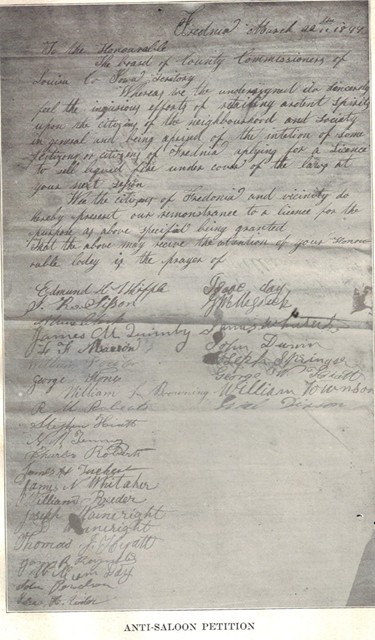
An Act to legalize the official acts of Isaac Parsons, Coroner of Louisa County, and acting Justice of the Peace of Jefferson township.Photo of document Anti-saloon Petition.
pg 433
January 27, 1844
An Act providing for the location of a territorial road from Wapello in Louisa County to Augusta in Des Moines County and names Thomas Stoddard and Merit Jamison of Louisa County as two of the commissioners.February 7, 1844
An Act to incorporate the Grandview Literary and Philosophical Society, and names Alexander McCall, Lewis Kinsey, Robert Childers. Spencer Wilson and Abraham McCleary as incorporators.February 7, 1844
An Act to incorporate the "Toolesborough Manufacturing Company," and . names William Shepherd, Daniel West, H. D. Smith, Ezra F. Dennison, Jonathan Parsons and William L. Toole as incorporators. The capital stock was limited to $40,000 in shares of $100.00 each, and the company was authorized to take from the Iowa river sufficient water for their purposes at a point on said river nearly opposite Iowa Town, and convey the same over or through any suitable grounds by means of a canal, race or water-way to a point at or near Toolesborough.February 12, 1844
An Act authorizing Thomas J. Jamison and Edwin Jones, administrators of the estate of John Jones, deceased, to execute fee simple deeds for two lots in Grandview, known as lots number one and two in block number four. Deeds to be executed to the Trustees of the Grandview Seminary and their successors in office.February 14. 1844
An Act to perfect the collection of taxes in Louisa County. The act legalizes the proceedings of the sheriff in the collection of taxes on the tax duplicate for the year 1843, and provides for his payment over to the Treasurer of the money collected by him, etc. (It would seem from this that the Sheriff had been exercising the duties properly belonging to the collector of taxes.)February 14, 1844
Act approved February 14, 1844, provides that Alvin Clark, of Louisa County is authorized to cause a complete and legal plat of Fredonia to be made out according to the survey made by John Gilliland in 1840 and to have the same duly recorded within 90 days from the passage of this act, and that all deeds, mortgages and other contracts in writing relating to lots in Fredonia shall be as legal and binding as if a complete plat had been made out and recorded prior to the execution of such deed, mortgage or contract.February 15, 1844
An Act amending the act establishing a seminary of learning at Grandview, by making the shares of stock consist of $5.00 instead of $10.00, and provides that each share holder shall be entitled to one vote only, instead of one vote for each share.pg 434
February, 1844
Act of Iowa territorial legislature providing for a vote on the question of constitutional convention and giving Louisa county three members of the convention.June 19, 1844
An Act relating to the collection of taxes in Louisa County and authorizing the Board of County Commissioners to give the collector of taxes such further time to complete the collection as may be necessary.March 3, 1845
Act of Congress for the admission of the State of Iowa and Florida into the Union. The boundaries of Iowa were fixed as follows:
"Beginning at the mouth of the Des Moines river, at the Middle of the Mississippi, thence by the middle of the channel of that river to a parallel of latitude passing through the mouth of the Mankato, or Blue Earth river, thence west along the said parallel of latitude, to a point where it is intersected by a meridian line, seventeen degrees and thirty minutes west of the meridian of Washington City: thence due south to the northern boundary line of the State of Missouri; thence eastwardly following that boundary to the point at which the same intersects the Des Moines river, thence by the middle of the channel of that river to the place of beginning."
May 28, 1845
Repeals so much of the act to vacate a part of the town plat of Port Allen approved February 13, 1843, as vacates that portion of Water street on the Iowa and Cedar rivers, and provides that said Water streets fronting on the Iowa and Cedar rivers opposite the town plat of Port Allen and within the bounds are declared public highways.June 10, 1845
An Act appropriating $50.00 to Martin Harless of Louisa County for extra services as Sheriff in the year 1838.January 19th, 1846
An Act changing the electoral districts, and providing that the Sixth District, composed of the counties of Louisa, Washington, Keokuk, Mahaska and Marion shall be entitled to one member of the council, and three members of the House of Representatives, and that the County of Louisa shall elect one member, and the counties of Washington and Keokuk shall elect one member, and the counties of Mahaska and Marion shall elect one member.January, 1846.
Act of Iowa territorial legislature providing for a constitutional convention giving Louisa county one member, passed January 17, 1846.January 12, 1846
An Act authorizes C. Whipple & Co. to keep a ferry across the Iowa and Cedar rivers at the junction of said rivers opposite to the town of Fredonia, ...
pg 435
... where the road leading from Columbus City to Bloomington crosses said Iowa river, and where the road leading from Fredonia to Iowa City crosses the Cedar river.January 17, 1846
An Act providing for the election of delegates to a convention to form a Constitution, and provides that the convention shall consist of thirty-two members, and Louisa county is given one member.January 17, 1846
An Act to locate a territorial road from Wapello in Louisa County to Augusta in Des Moines County, and names Joshua Marshall of Louisa County as one of the commissioners.January 17, 1846
Joint resolution of the Territorial Legislature, requesting our delegate in Congress, Honorable A. C. Dodge to have a mail route established from Monmouth, Illinois, by way of Keithsville (Keithsburg) Illinois, Wapello, Columbus City and Port Allen in Louisa County, to Iowa City.Joint resolution of territorial legislature approved January 17, 1846, requesting Hon. A. C. Dodge, delegate in congress, to use his exertions to procure an appropriation of five thousand dollars to improve the territorial road across the Mississippi bottom between Toolesboro and the Mississippi river.
August 4, 1846
Act of Congress supplemental to the act for the admission of the State of Iowa and Florida into the Union. This act, among other things, provides "that section numbered sixteen in every township of the public lands, and where said section has been sold or otherwise disposed of, other lands equivalent thereto, and as contiguous as may be, shall be granted to the State for the use of Schools."August 4, 1846
Act defining the boundaries of Iowa, and repealing so much of the act of March 3, 1845, as relates to the boundaries of Iowa. This act fixes the boundaries of the State of Iowa as follows:
"Beginning in the middle of the main channel of the Mississippi river, at a point due east of the middle of the mouth of the main channel of the Des Moines River; thence up the middle of the main channel of the said Des Moines river to a point on said river where the northern boundary-line of the State of Missouri as established by the constitution of that state adopted June twelfth, eighteen hundred and twenty, crosses the said middle of the main channel of the said Des Moines river; thence westwardly, along the said northern boundary line of the State of Missouri as established at the time aforesaid; until an extension of said line intersects the middle of the main channel of the Missouri river; thence up the middle of the main channel of the said Missouri river to a point opposite the middle of the main channel of the Big Sioux River according to Nicollet's ...
pg 436... map; thence up the main channel of the said Big Sioux River, according to said map, until it is intersected by the parallel of forty-three degrees and thirty minutes north latitude; thence east along said parallel of forty-three degrees and thirty minutes until said parallel intersects the middle of the main channel of the Mississippi river; thence down the middle of the main channel of said Mississippi river to the place of beginning."
December 28, 1846
Act of Congress recites that whereas the people of Iowa did, on May 18, (846, by a convention assembled for that purpose form a constitution and state government, etc. etc., and provides that the state of Iowa is admitted into the Union on an equal footing with the original states.1846.
The constitution of 1846 apportioned the members of the general assembly, and gave to "the counties of Louisa and Washington one senator jointly, and one representative each." This constitution was adopted by the convention May 18, 1846, and ratified by the people August 3, 1846; and the governor appointed Monday, October 26, as the day for holding the first election under it. Act of Congress admitting Iowa as a state became a law, by the approval of President Polk, on December 28, 1846.January 24, 1847
An Act in relation to common schools, containing 47 sections. Section 36 provides that at the next annual township election in every organized county in the State, there shall be elected a School Fund Commissioner for the County, who shall hold his office for two years, etc.February 2, 1847
Joint resolution of the Iowa Legislature requesting our representatives in Congress to use their best exertions to obtain an appropriation, either of land or money, sufficient to improve the navigation of the Iowa river from its mouth to Iowa City.February 3, 1847
A joint resolution instructing our representatives in Congress to use their best endeavors to obtain an appropriation either of land or money, to improve the navigation of the Cedar River, from its mouth or where it empties into the Mississippi after its junction with the Iowa river to the commonly called Forks of said river in Black Hawk county.February 4, 1847
An Act to divide the State of Iowa into Judicial Districts. The First District was composed of Lee, Des Moines. Louisa, Washington and Henry Counties.February 8, 1847
An Act locating a State road from Wallings Landing by way of Grandview. Fredonia, Columbus City and Crawfordsville to Washington, and appointed Spencer ...
pg 437
... Wilson. Aaron D. Hawley (Hurley) of Louisa County, and Joseph Neal of Washington County as commissioners.February 12. 1847
An Act to locate a State road from VYallings Landing to Columbus City, and appoints Benjamin Stoddard, Jeremiah Fish, and Aaron D. Hawley as commissioners to locate the road.February 22, 1847
An Act providing for laying off counties into County Commissioner Districts.February 22, 1847
An Act dividing the State into Congressional Districts, the Second District was composed of the counties of Clinton, Dubuque. Delaware, Johnson, Clayton, Jones, Linn, Powesheik, Benton, Iowa, Jackson, Cedar, Scott, Muscatine. Washington, Louisa and Des Moines and all the country north of a line from the northwest corner of the county of Polk running west to the Missouri River.January 22, 1848
Joint resolution asking our delegation in Congress to use their endeavors to obtain a grant of 10.000 acres of land fo1 the improvement of Muscatine Island on the Mississippi river.January 22, 1848
An Act to review a part of the state road from Walling's Landing to Columbus City, and appointing Benjamine Stoddard and Zachariah Kurts and Aaron D. Hawley as commissioners.January 24. 1848
An Act authorizing David Sterrett, his heirs and assigns to construct a canal or Mill race not exceeding in width one hundred feet from anv logical point of the Pittsburg chute of the Iowa River to intersect said Iowa River at a point at or near England's Addition to Wapello running through a part of Block 17 and the northern part of Water street in England's addition, with the privilege of constructing a dam across Pittsburg Chute, and the right to use the water power acquired thereby, and the right of way into and upon any land along the line of said race for said purpose. Provision was also made for the payment of damages to land owners, amount to be determined by the District Court.January 25, 1848
An Act to authorize A. W. Thompson to establish a ferry across the Mississippi river at a point in Louisa County opposite Keithsburg.December 16, 1848
A memorial adopted by the Iowa Legislature to Congress asking an appropriation of lands to aid in the construction of a canal from Iowa City to the mouth of the Iowa River.December 27, 1848
An Act to establish a State road from Mrs. Feslers in Johnson County to Columbus City in Louisa County.January 15, 1849
An Act to lay out and establish a State road from Grandview in Louisa County to Bloomington in Muscatine County and appoints Alexander Ross and Elias Thornton of Louisa County as two of the commissioners.pg 438
January 15, 1849
Wesley W. Garner of Louisa County was allowed $9.00 for three day's service as official clerk of the General Assembly.January, 1849
Act approved January 25, 1849, providing for the election of school fund commissioners on the first Monday in April, 1850, and biennially thereafter. See also Code of 1851, Sections 1089 to 1106.September 28, 1850
Act of Congress relating to the Swamp Lands, provides as follows: "That to enable the State of Arkansas to construct the necessary levees and drains to reclaim the swamp and overflowed lands therein, the whole of those swamp or overflowed lands made unfit thereby for cultivation which shall remain unsold at the passage of this act, shall be, and the same are hereby granted to said state." It is further provided that the secretary of the Interior shall make out and transmit to the governor of Arkansas a list of such lands, and cause same to be patented to the State, which patent shall vest the fee simple title in said state subject to the disposal of the legislature.It is further provided "that the provisions of this act be extended to, and their benefits be conferred upon, each of the other states of the Union, in which such swamp and overflowed lands, known and designated as aforesaid, may be situated." (See Act of February 5, 1851, and Act of February 2, 1853, and also Act of Congress of March 3, 1855.)
January 21, 1851
An Act granting the Toolesboro and Burlington Plank Road Company a right of way, not exceeding 60 feet in breadth.February 4, 1851
An Act granting the Burlington and Louisa County Plank Road Company a right of way.February 5, 1851
An Act granting the Burlington, Wapello & Virginia Grove Plank Road & Bridge Company, a right of way.February, 1851
The code of 1851, approved February 5 of that year, provides for the election at the August election of 1851, of a county judge for four years, and a sheriff, coroner, recorder, surveyor and supervisor of roads, for two years each. Prosecuting attorneys and clerks of the court were to be elected in 1852 at the general election, each for the term of two years.pg 439
February 5, 1851
An Act in relation to the swamp lands, provides that the commissioner of the State Land Office may take steps to secure to the State the swamp lands granted by the act of Congress of September 28, 1850. It also authorizes the commis^ sioner to dispose of any of the swamp lands of the state for such prices as he may think them worth.February 5, 1851
An Act to reapportion the State, provides that the counties of Louisa and Washington shall have two representatives each, and one senator jointly.January 22, 1853
An Act vacating so much of the town of Toolesboro, as is north of the Main street and east of Mound street in said town, except block number 43.January 22, 1853
An Act in relation to certain State roads. Section 42 of it provides that Samuel Lucas of Muscatine County and J. R. Sisson of Louisa County, and Jonathan Wilson of Washington County are appointed commissioners to locate said road on the nearest and best grounds from Muscatine to Washington.January 22, 1853
Resolution of the General Assembly in regard to mail facilities, instructing and requesting our senators and representatives to use their influence to procure additional mail facilities. A large number of mail routes are asked for including one from Port Allen by way of Hawk Eye and Black Hawk to Muscatine three times a week.January 24, 1853
An Act reapportioning the state into representative districts, and makes Louisa County the 14th District and entitled to one representative.January 24, 1853
An Act appointing William H. Miller of Muscatine County and John C. Lockwood of Louisa County,'agents and superintendents of the construction of the necessary levees and drains to reclaim the swamp lands situated on the Muscatine Island and on the borders of the Muscatine slough within Muscatine and Louisa Counties.February 2, 1853
An" Act to dispose of the swamp and overflowed lands within the state, provides that all the swamp and overflowed lands granted to the State of Iowa by Act of Congress approved September 28, 1850, there shall be granted to the counties respectively in which the same may lie or be situated for the purpose of constructing the necessary levees and drains to reclaim the same, and the balance of said lands, if any there shall be after the same are reclaimed, shall be applied to the building of roads and bridges when necessary, through and across said lands, and if not needed for this purpose, to be expended in building roads and bridges within the country.pg 440
January, 1855
Act approved January 24, 1855, for a convention to revise or amend the constitution and making the number of delegates correspond to the number of senators in the general assembly, thus giving Louisa county one delegate.January 13, 1855
Joint resolution of the Iowa General Assembly asking for, additional mail facilities. One route mentioned is from Muscatine to Oskaloosa by way of Columbus City, Washington and Sigourney, in coaches six times a week.January 23, 1855
An Act to annex so much of fractional lot six in Section II, Township 73. Range 2 in the State of Iowa as is surveyed into town lots to the town of Toolesboro, Louisa County, Iowa.January 25, 1855
An Act to apportion the State and to define the boundaries of the senatorial and representative districts. The County of Louisa is made the 13th district and is entitled to one senator, and is made the 17th representative district, and entitled to one representative. And the counties of Louisa and Washington were made the 19th District, and entitled to one representative. This latter was called a "floating," or "factorial" district.March 3, 1855
Act of Congress approved March 3rd, 1855, authorizing the issue of patents to individuals who had purchased swamp lands, and providing also for the payment by the United States, to the State, of indemnity for such lands, properly a part of the swamp land grant, as had been sold by the government. (The Act of 1850, as originally reported by the committee granted only such lands, as were designated on the government plats of surveys as "swamp" or "unfit for cultivation;" but amendments were adopted making it apply to swamp or overflowed lands, without reference to the description on the surveyor's plats. In 1851, Secretary of the Interior Stuart had decided that the swamp land act of 1850 was a grant in praesenti, and vested title in the states to all swamp or overflowed lands. Many conflicts arose, because of entries by and sales to, individuals of lands which afterward were found to be swamp lands: the act of March 3d, 1855, was passed to settle these conflicting claims.)July 15, 1856
An Act authorizing the levy of a tax upon the lands upon Muscatine Island and upon adjoining lands to construct levees and to preserve said lands from overflow.pg 441
July 15, 1856
An Act to incorporate the City of Wapello.July, 1856
Act approved July 15. 1856, vacates the alley in Block 14 in the town of Grandview, and in Block 16 and 25 in Springer's Addition to Grandview.January 21, 1857
An Act to amend the act to incorporate the City of Wapello.January 22, 1857
An Act providing that all that part of the original town plat of the town of Toolesboro in Louisa County, Iowa, heretofore vacated by acts approved February 16, 1842, and January 22, 1853, and being east of Fort street in said town be restored and made a part of said town, and the streets and alleys made public highways. The act is to take effect from and after its publication in the Wapello Intelligencer and the Burris Commercial.January 24, 1857
An Act authorizing Wesley W. Garner, James M. Robertson and William L. Toole of Louisa County to sell Oat Lot Number 4, Columbus City, and to execute conveyance therefor. It provides that they shall first apply the proceeds of said sale or so much thereof as may be necessary to the payment of the debts created by the trustees of the Columbus City Seminary, and if any money shall remain after the payment of such debts and expenses of sale, it shall be invested in books for the use of some public library in Columbus City.January 27, 1857
An Act to apportion the State into representative Districts. Section 31 provides that the County of Louisa shall constitute the 31st representative district and have one representative. Section 32 provides that the county of Des Moines shall constitute the 32nd representative district, and shall have two representatives.Section 33 provides that the counties of Des Moines and Louisa jointly, shall constitute the 33rd representative district, and have one representative. The latter was also a floating district.
January 28, 1857
An Act providing for the location of certain State roads. Section 11 provides that Evan J. and Samuel M. Hallowel of Henry County, and A. D. Hurley of Louisa County should be the commissioners to locate a State road from Mt. Pleasant to Wapello.January 28, 1857
An Act in relation to State roads. Section 17 provides that Christian Hershe, R. H. W. Rrent and Ananias Simpkins of Muscatine County be appointed commissioners to locate a State road from Muscatine to Grandview.January 28, 1857
An Act to incorporate the City of Burris in Louisa County, Iowa, to take effect from and after its publication in the Wapello Intelligencer and the Burris Commercial.March 16, 1858
An Act to provide for levying a tax on certain lands to build a levee on Muscatine Island, and for the election of levee commissioners.pg 442
March 20, 1858
An Act creating the first Judicial District and defining the boundaries. Section 2 provides that the Counties of Lee, Henry, Des Moines and Lucas shall constitute the First District. The name "Lucas" here is undoubtedly intended for Louisa. Lucas county is also included in the 2nd District.March 22, 1858
An Act apportioning the State into representative Districts, makes Louisa County the 18th District, and entitled to one representative.March 23, 1858
An Act ordering a special election throughout the State on the 4th Monday of June, 1858, to submit to the people the question whether or not an act entitled, an act authorizing general banking in the State of Iowa passed by the Seventh General Assembly, should go into effect and be in force, and also whether an act entitled, an act to incorporate a State Bank of Iowa, passed by the Seventh General Assembly should go into effect and be in force.March 25, 1858
Joint Appropriation Act. From this it seems that one dollar was paid to the Wapello Intelligencer, and fifty cents to the Wapello Gazette.March 3, 1860
An Act authorizing the owners of land subject to overflow situated on the Iowa and Mississippi river bottom in Des Moines and Louisa Counties to raise a tax upon said lands, for the purpose of repairing, continuing and extending the levee now commenced.March, 1860
Act creating a county board of supervisors, approved March 22d and took effect July 4th. April 2, 1860 An Act apportioning the State into representative districts makes Louisa County the 16th District, and entitled to one representative.April 5, 1862
An Act repealing the act which provided for levying a tax to complete and keep in repair the levee on Muscatine Island, etc.March 5, 1862
An Act apportioning the State into Senatorial Districts makes Louisa County the 14th District and entitled to one Senator.pg 443
April 8, 1862
An Act for the relief of Jacob Mintun, recites that during his term of office a number of judgments were rendered and entered on his docket which have not his signature thereto, and authorizes him to sign the judgments rendered by him and making them legal and binding.April 8, 1862
An Act to divide the State into Six Congressional Districts, the First District being composed of Lee, Van Buren, Davis, Jefferson, Henry, Des Moines, Louisa and Washington Counties.April 8, 1862
An Act apportioning the State into representative Districts, leaving Louisa County still as the 17th District, and entitled to one representative.September 11, 1862
An Act to enable the qualified electors of this state in the military service to vote at certain elections.March 28, 1864
A new apportionment act was passed as to representative Districts but makes no change as to Louisa County.March 30, 1866
An Act to legalize an election held by the legal voters of the town of Morning Sun to form an independent School District, etc.April 2, 1866
An Act apportioning the State into Senatorial Districts, makes Louisa County the 14th Senatorial District, and entitled to one senator.1866
The 11th General Assembly passed a resolution favoring the tri-weekly mail route from Burlington Ononwa by way of Port Louisa and Grandview.April 2, 1866
An Act making appropriations for the per diem and expenses of the 11th General Assembly, and other purposes. Section 71 appropriates for the expenses in relation to the sickness and funeral of Honorable N. T. Brown (who was a representative from Louisa County), the sum of $211.65, as follows:
Railroad and stage fare to and from Des Moines of Mrs. Brown and her son $41.00 Incidental expenses 5.00 Medicine and Board 24.30 Shroud, crape, etc 11.60 Burial lot in the cemetery of the state 19.73 Coffin and hearse 36.00 Two carriages 9.00 For draping hall 9.50 Digging grave 5.00 Dr. Robertson, 10 day's attendance 25.00 Dr. Boomer, 10 day's attendance 25.00 pg 444
January 31, 1868
An Act to correct an error caused by omitting Louisa County in the distribution of railroad taxes due in the years 1863, 1864 and 1865.April 2, 1868
An Act to enable public corporations to settle their indebtedness, and for this purpose altering and amending existing charters and laws.April 2, 1868
An Act to legalize certain judgments rendered by Lienjamine Furnace, a Justice of the Peace in Louisa County, Iowa, because of his failure to sign the same at the time they were rendered.April 3, 1868
An Act establishing Circuit and General term courts and defining their powers and jurisdiction. The Counties of Henry and Louisa constitute the Second Circuit in the First Judicial District.April, 1868
Act approved April 7, 1868, created the office of county auditor and providing that at the general election preceding the expiration of the term of office of the present county judge in any county, and every two years thereafter, there should be elected in each organized county in this state, a county auditor, whose term of office shall commence on the 1st of January following his election. The act further directed that the county judge in each county should be ex-officio auditor after January 1, 1869, and until an auditor was elected and qualified and thereafter the office of county judge should cease.April 7, 1868
Apportionment act for representative districts, makes Louisa County the 27th District and entitled to one representative.April 8, 1868
Senatorial apportionment act makes Louisa County the 14th Senatorial District, and entitled to one Senator.April 2, 1868
Memorial and Joint Resolution of the Iowa Legislature asking Congress to declare the Iowa River Unnavigable from the City of Wapello in Louisa County North.April 13, 1870
There was a new apportionment for representative districts, but no change as to Louisa County.April 14, 1870
An Act providing that on and after January 1, 1871, the Board of Supervisors should consist of three persons.pg 445
April 16, 1870
A senatorial apportionment act, makes Louisa County the 14th Senatorial District, and entitled to one Senator.May, 1870
Act of Congress in relation to the Iowa river in the state of Iowa, approved May 6, 1870, provides that so much of the Iowa river in the state of Iowa as lies north of the town of Wapello shall be declared not a navigable river or public highway.March 11, 1872
A joint resolution giving certain authority to the State Auditor in respect to credits claimed by the counties of Harrison, Howard, Marion, Jasper, Louisa, Bremer for State revenue alleged to have been stolen from said counties. In the preamble there is a statement of the special amounts claimed to have been stolen from the several counties, and the amount stated from Louisa County belonging to the general revenue of the State is, $4,592.28.The Joint resolution authorizes the Auditor of State to receive and consider documentary or other evidence in writing which may be submitted to him, prior to the meeting of the next General Assembly in behalf of either of said counties touching the facts aforesaid as recited in the preamble, and in every case in which such averments may be sustained by such proof to his satisfaction, he is authorized and directed to give the proper corresponding credits to said counties, and report such action to the next General Assembly.
April 27, 1872
Representative apportionment act makes Louisa County the 28th District, with one representative, and the Senatorial apportionment act passed on the same day, provides that the counties of Louisa and Washington shall constitute the 15th District, and be entitled to one senator.March 23. 1874
Representative apportionment Act; no change as to Louisa County.March 17, 1876
Senatorial apportionment act constitutes Washington and Louisa Counties as the 14th Senatorial District, and entitled to one Senator.March 17, 1876
Representative apportionment act, makes Louisa County the 30th District and entitled to one representative.March 26, 1878
Representative apportionment act, makes Louisa County the 30th District and entitled to one representative.August, 1882
Act of Congress making appropriations for the construction, repair and preservation of certain works on certain rivers and harbors, etc. This act directs ...
pg 446
... the secretary of war at his discretion to cause examinations or surveys, or both, and estimates of cost of improvements at a great many places. Among others is the Iowa river from Wapello to its mouth.March 23, 1880
Senatorial apportionment. Louisa and Washington counties made the 11th District, and entitled to one Senator.March 23, 1882
Congressional apportionment, the First Congressional District made to consist of the following counties: Lee, Des Moines, Henry, Van Buren, Jefferson, Washington and Louisa.March 24, 1880
Representative apportionment. Louisa County made the 30th District, and entitled to one Representative.April 1, 1882
Representative apportionment. Louisa County made the 31st District, and entitled to one representative.February 27, 1886
An Act to legalize the proceedings of the Board of Supervisors of Muscatine and Louisa Counties in locating and constructing a levee on Muscatine Island, and to provide for the payment of the costs thereof.March 19, 1886
An Act to legalize the acts and ordinances of the town council of the incorporated town of Morning Sun.April 5, 1886
At establishing the office of county attorney.April 10, 1886
Representative apportionment. Louisa County made the 22nd District and entitled to one representative.April 19, 1886
Senatorial apportionment. Muscatine and Louisa County made the 20th Senatorial District and entitled to one Senator.July, 1892
An Act of Congress making appropriations for the construction, repair and preservation of certain public works, etc., directs the secretary of war to cause examinations to be made at a great many localities. Among others is the "Mississippi river, Iowa side, from mouth of Iowa river to Bloomington, to determine the best method of removing the bars and deepening the channel."pg 447
August, 1894
Another river and harbor bill, approved August, 1894, similar to the last one, provision of which is as follows: "So much of the Iowa river within the state of Iowa as lies between the town of Toolesboro and the town of Wapello, in the county of Louisa, shall not be deemed a navigable river or public highway, but dams and bridges may be constructed across it." This act further provides for dredging the channel of the Mississippi river at Quincy, Illinois, and for continuing the improvement of the Mississippi river from the mouth of the Missouri to Minneapolis, and appropriates the sum of $15,000, and further provides that out of said appropriation he shall cause a survey to be made on the west side of the Mississippi river, commencing at the mouth of Flint creek, in Des Moines county, state of Iowa, and running along the west bank of the river to the mouth of Iowa river, and along the east bank of the Mississippi river from the city of Warsaw to the city of Quincy, with a view to improving the navigation by preventing the water from overflowing the natural and artificial banks along those parts of the river, and deepening the channel.March, 1895
Act of Congress, approved March 2, 1895, making appropriations for sundry civil expenses of the government for the year ending June 30, 1896, and for other purposes. This act appropriates $85,000 to commence the work under the direction of the secretary of war from the mouth of Flint creek, in Des Moines county, state of Iowa, and running along the west bank of the river to the mouth of the Iowa river, with a view to improving the navigation etc.February 14, 1896
An Act to legalize the proceedings of the Board of Supervisors of Louisa County relative to restraining stock from running at large. Because of doubt as to legality of the notice.February 17 1896
Joint resolutioon of the Iowa Legislature favoring appropriation by Congress for the reconstruction and repair of the Muscatine Island Levee.March 19, 1896
An Act to legalize the ordinances of the City Council of the City of Wapello, granting a franchise to W. H. Prescott and his associates as the Wapello Electric Light & Power Company.April 20, 1896
Provides that the counties of Des Moines, Henry and Louisa shall constitute the 20th Judicial District, and be entitled to two Judges.June, 1896
Act of Congress, approved June 3, 1896, making appropriations for rivers and harbors. This act among other things appropriates $75,000 for the purpose of continuing the work of constructing artificial banks between the mouth of Flint ...
pg 448
... river (Flint creek), in Des Moines county, Iowa, and running along the west bank of the Mississippi river to the mouth of the Iowa river.June, 1897
Act of Congress, approved June 4, 1897, making appropriations for sundry civil expenses of the government, etc., appropriates $50,000 for continuing the work of constructing artificial banks between the mouth of Flint "river" and running along the West bank of the Mississippi river to the mouth of the Iowa river.July, 1898
Act of Congress, approved July 6, 1898, making appropriations for sundry civil expenses of the government, etc., appropriates $40,000, or so much of it as may be necessary to complete the construction of the levee from Flint creek to the Iowa river.March, 1899
Act of Congress, approved March 3, 1899, making appropriations for sundry civil expenses of the government, etc., appropriates $50,000, or so much thereof as may be necessary for the completion of a levee on the west bank of the Mississippi river from the mouth of Flint creek, in Des Moines county, to the mouth of the Iowa river, in Louisa county.February 14, 1906
An Act empowering the Governor and Secretary of State to make quit claim deeds conveying to the grantees of S. Dunham the interest of the state in certain lands in Sections 28 and 29. Township 73, North, Range 1 west.March 17, 1911
Act to legalize the incorporation of the town of Grandview, the election of its officers, the passage of its ordinances, etc., etc.Approved March 17, 1911. Became a law by publication March 23, 1911.