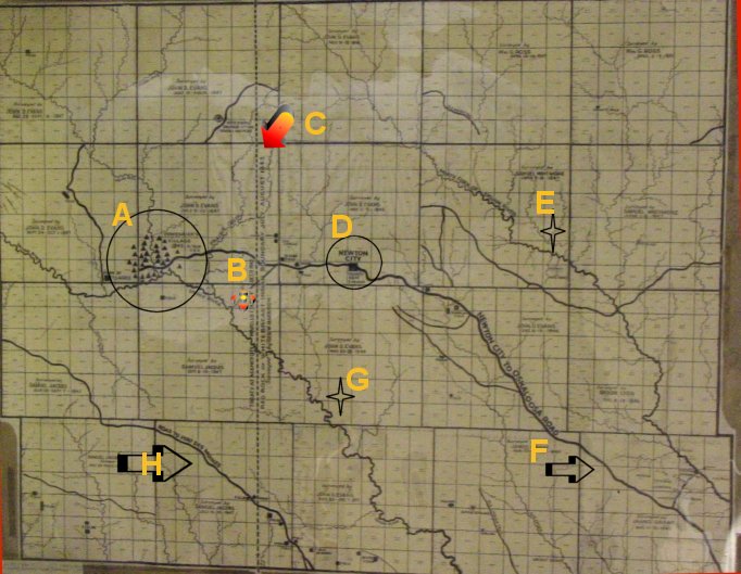
Key to Map

Key to Map
|
A - Large Indian Village of Chief Poweshiek |
B - Approximate location of current S. G. Cemetery |
|
C - Treaty Line that whites couldn't settle until
after 1847 when the Indians had to be moved on west. |
D - Newton City - it had five houses |
|
E - North Skunk River |
F - Newton City to Oskaloosa Road |
|
G - South Skunk River |
H - Road to Fort Des Moines |
Return to Metz Page
Created July 2001 by Barbara Lane Hug.