Click
on map to enlarge and
click again to see
map detail.
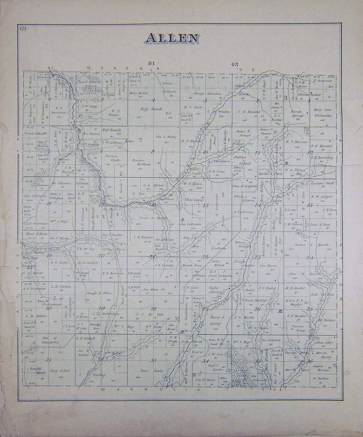
ALLEN
|
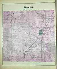
BOYER
|
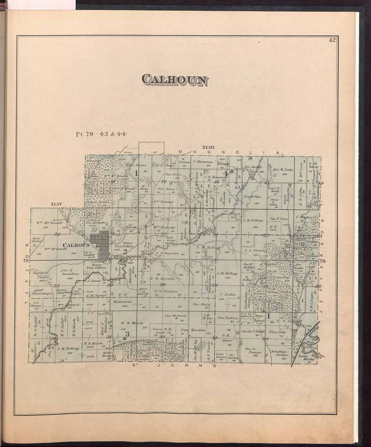
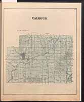
CALHOUN
|
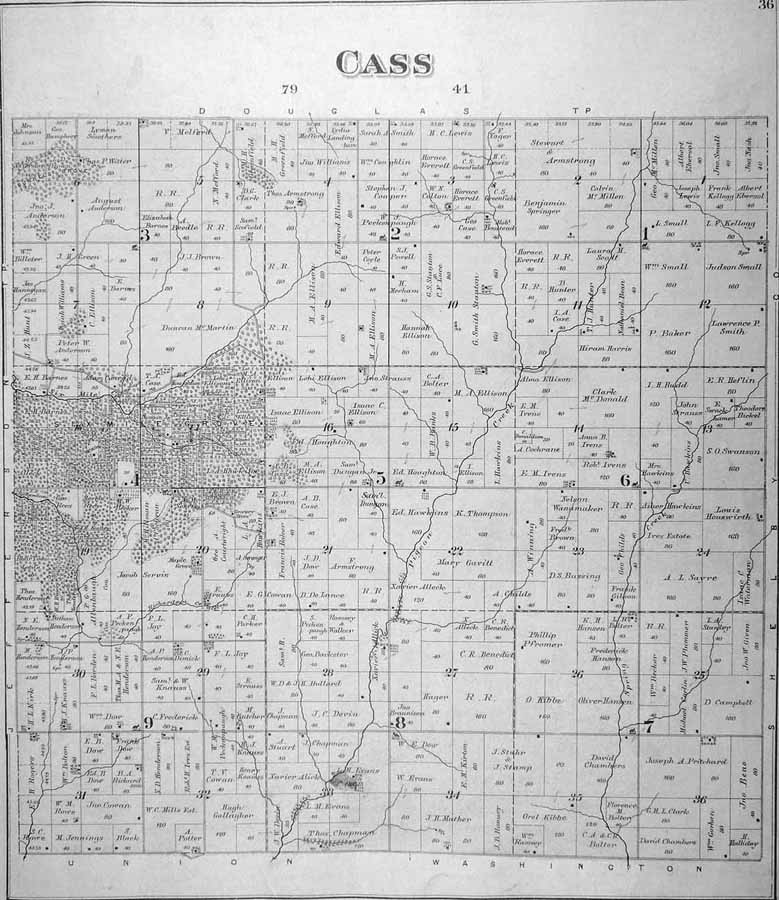
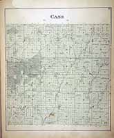
CASS
|
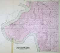
CINCINNATI
|
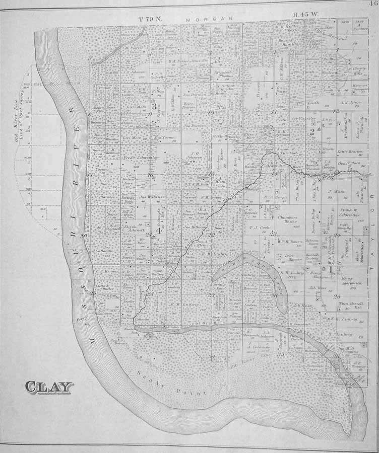
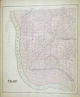
CLAY
|
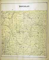
DOUGLAS
|
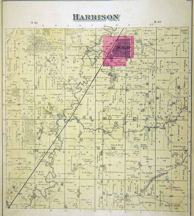
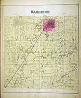
HARRISON
|
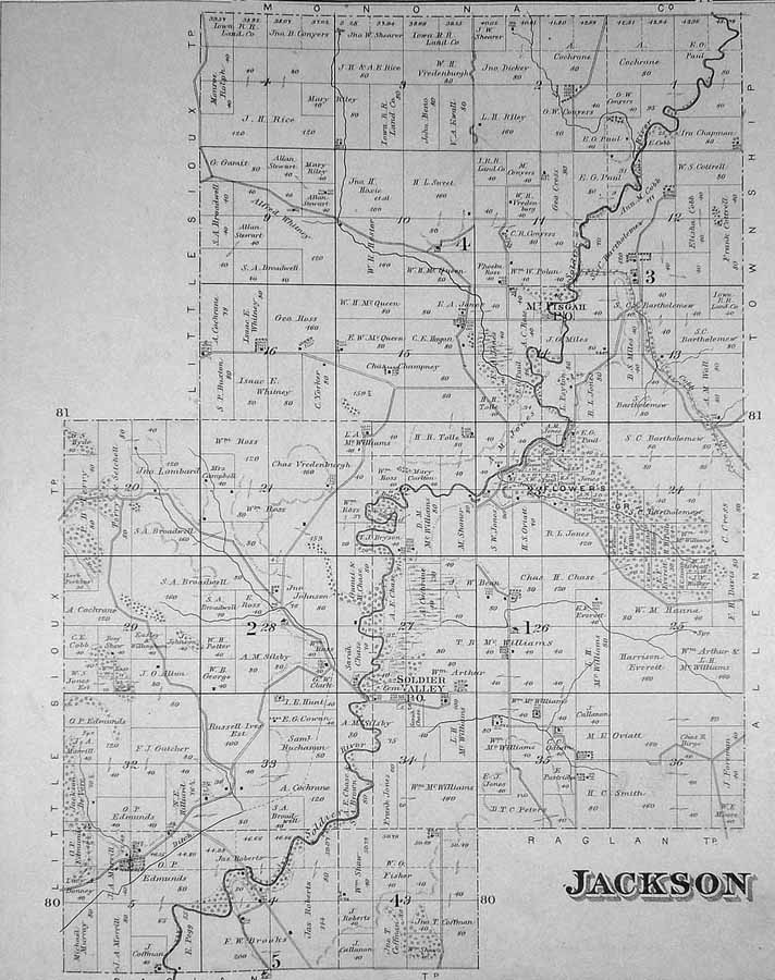
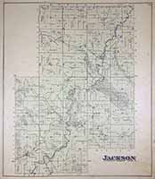
JACKSON
|
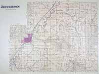
JEFFERSON
|
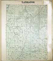
LA
GRANGE
|
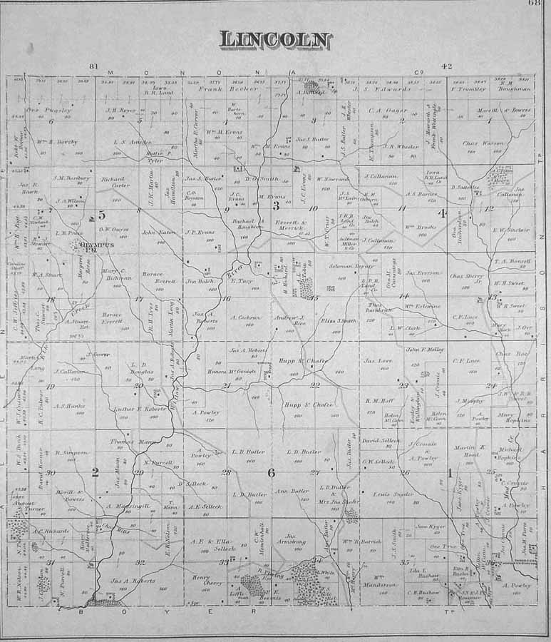
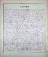
LINCOLN
|
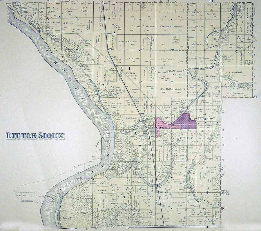
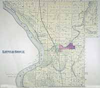
LITTLE
SIOUX
|
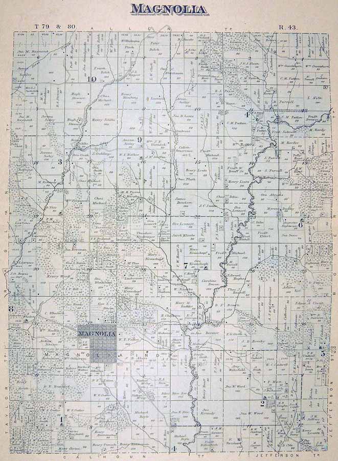
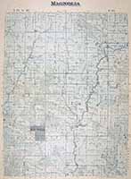
MAGNOLIA
|
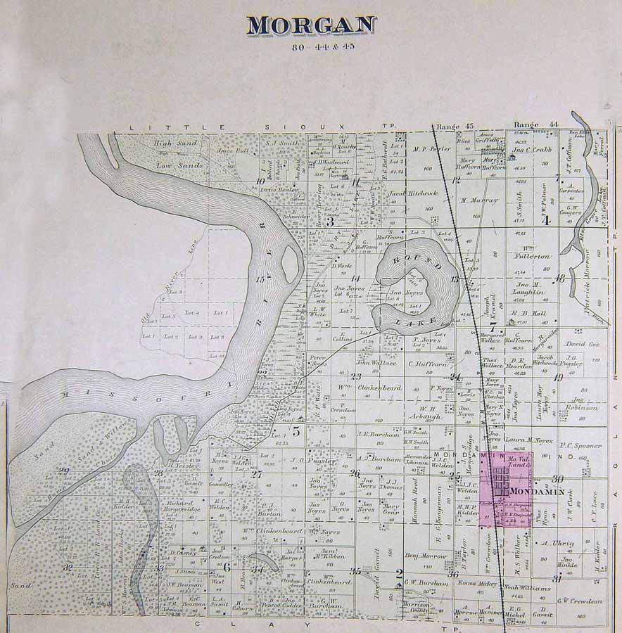
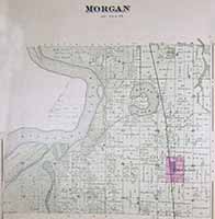
MORGAN
|
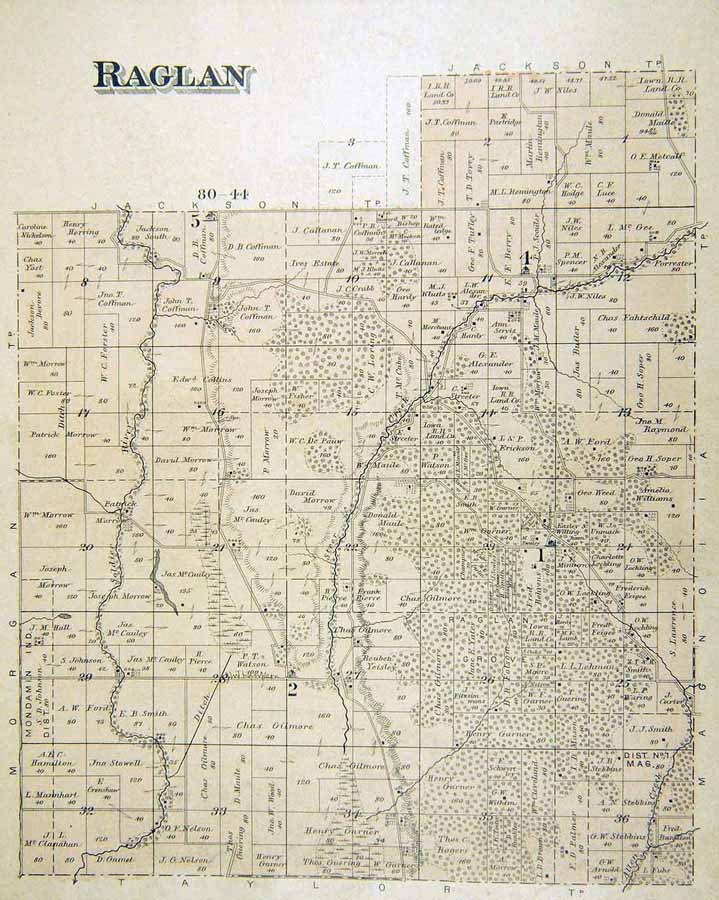
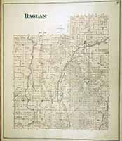
RAGLAN
|
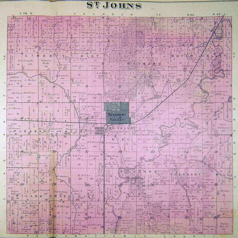
ST.
JOHN

|
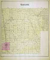
TAYLOR
|
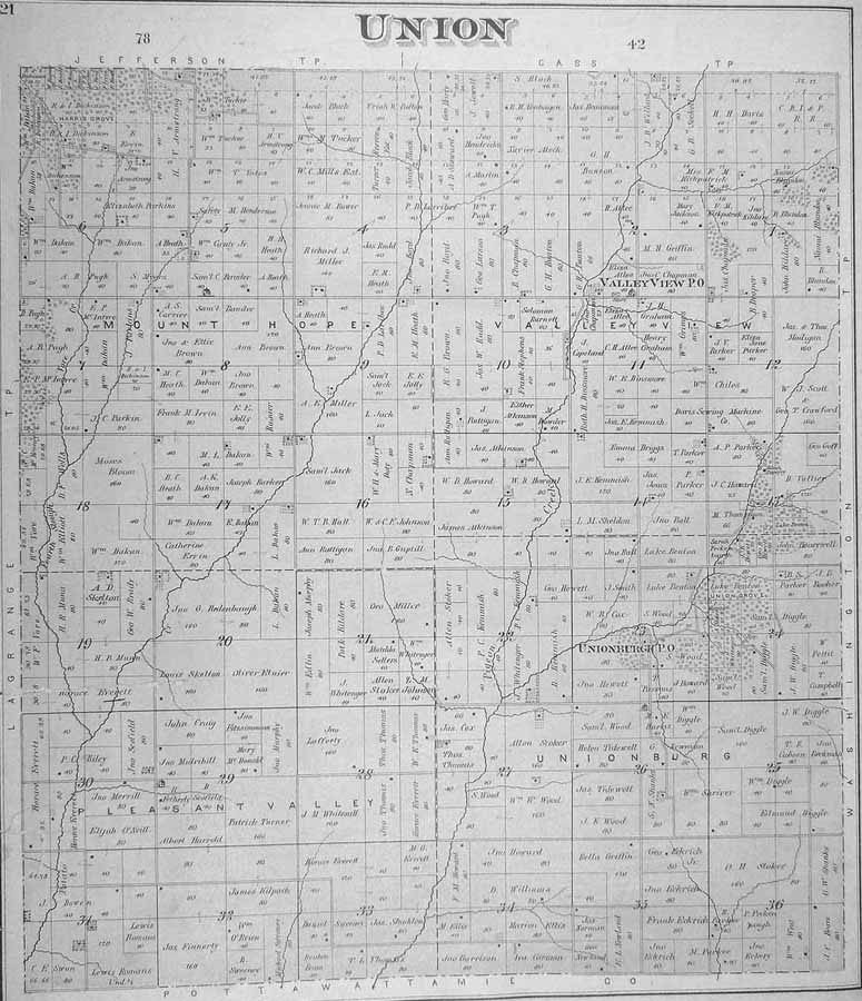
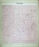
UNION
|
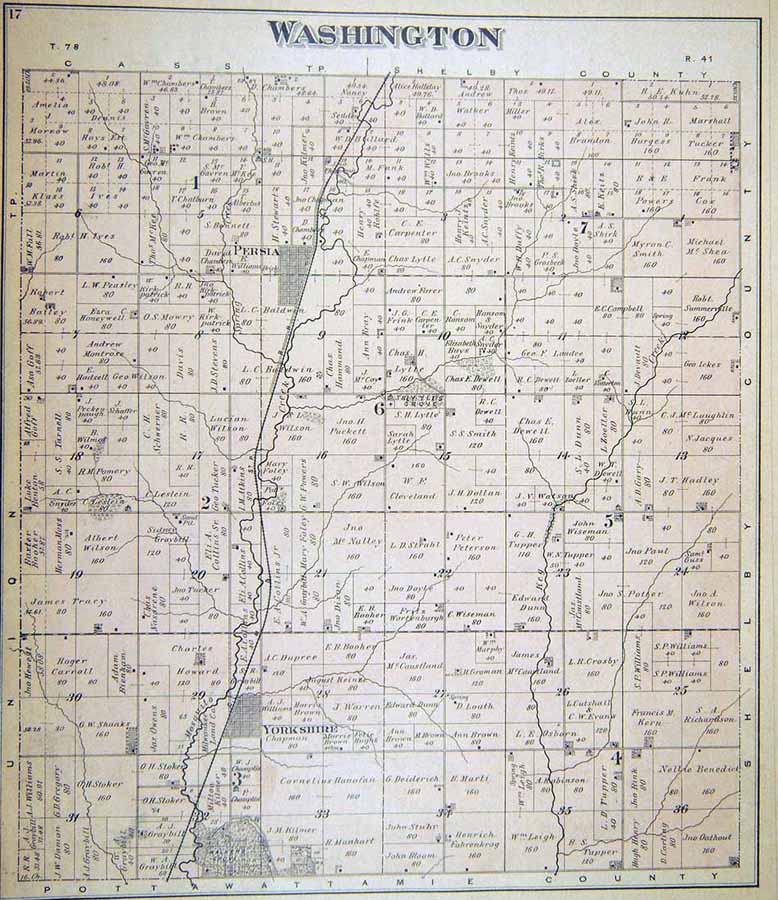
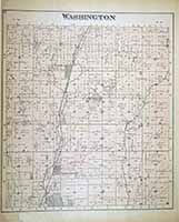
WASHINGTON
|
Illustrated
Atlas of Harrison County, Iowa. Council Bluffs: C. R. Allen, 1885, in
the State Historical Society of Iowa (Iowa City) Collection. Available
through the Iowa Digital Library at:
http://digital.lib.uiowa.edu/cdm/ref/collection/atlases/id/6299.
|