 |
Harrison County Iowa Genealogy |
CITY MAPS
1884
*******************************************
| Click
on map to enlarge and click again to see map detail and landowner's name. |
|||
Calhoun |
California
Junction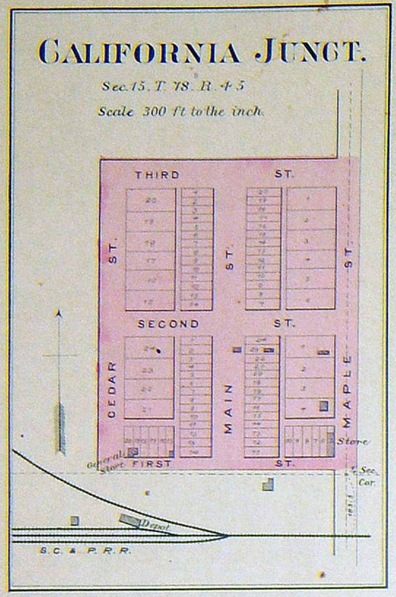 |
Dunlap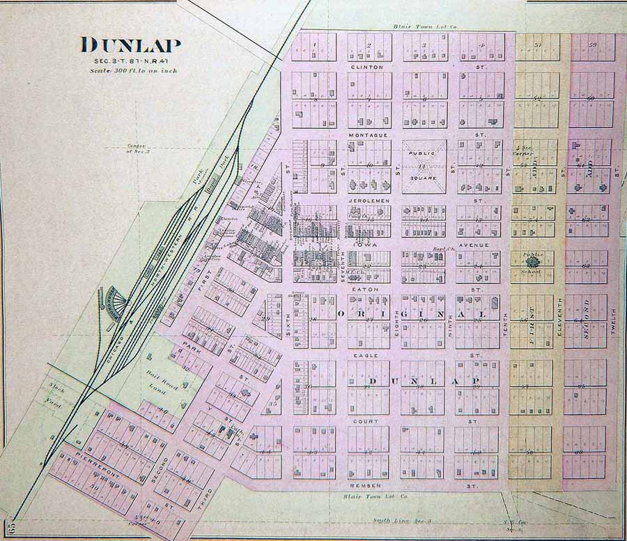 |
Little
Sioux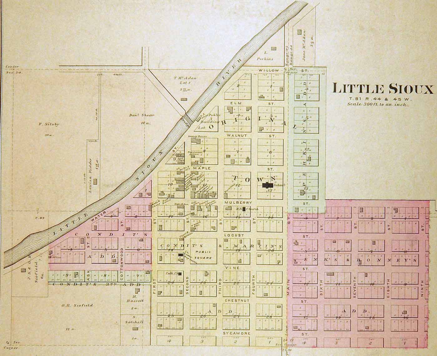 |
Logan |
Magnolia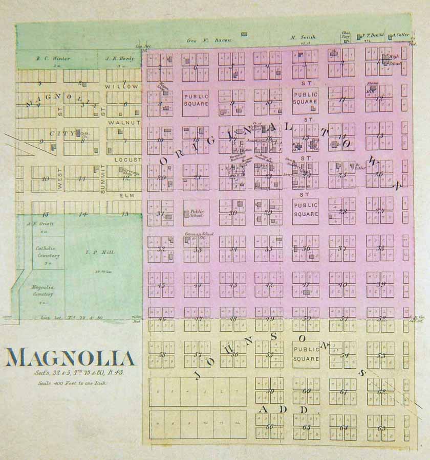 |
Missouri
Valley |
Modale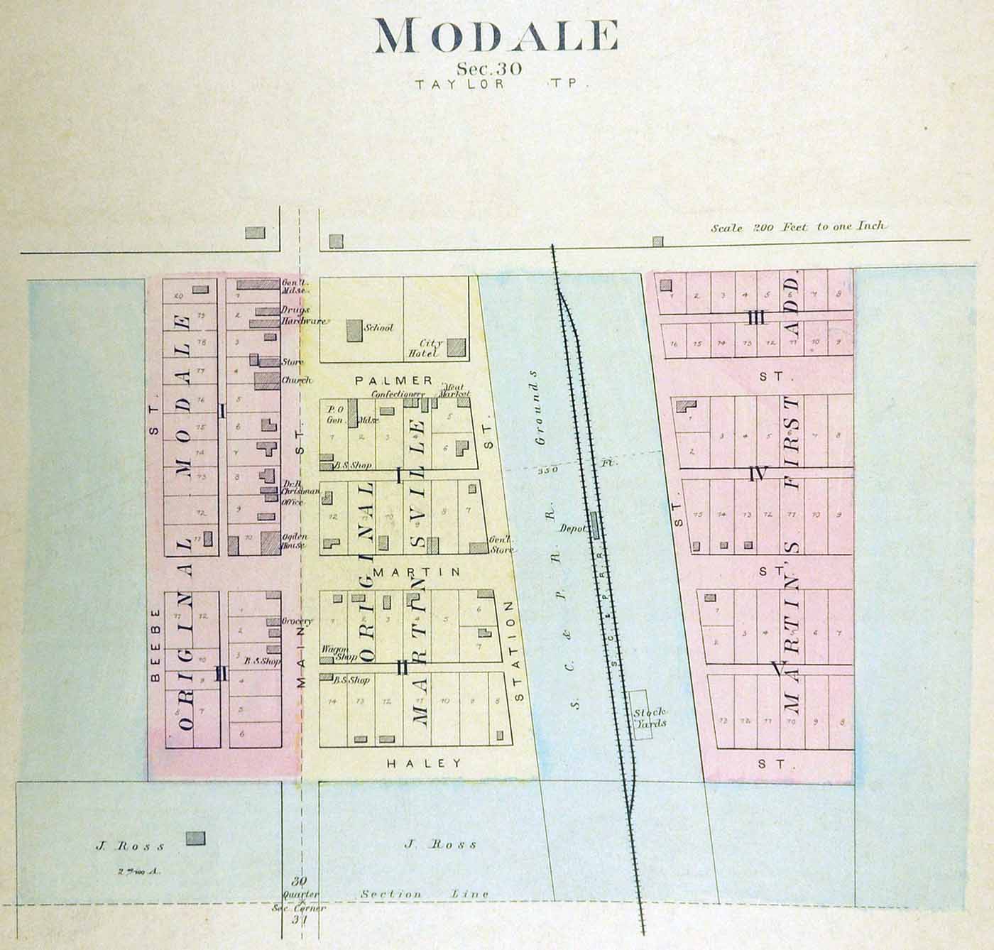 |
Mondamin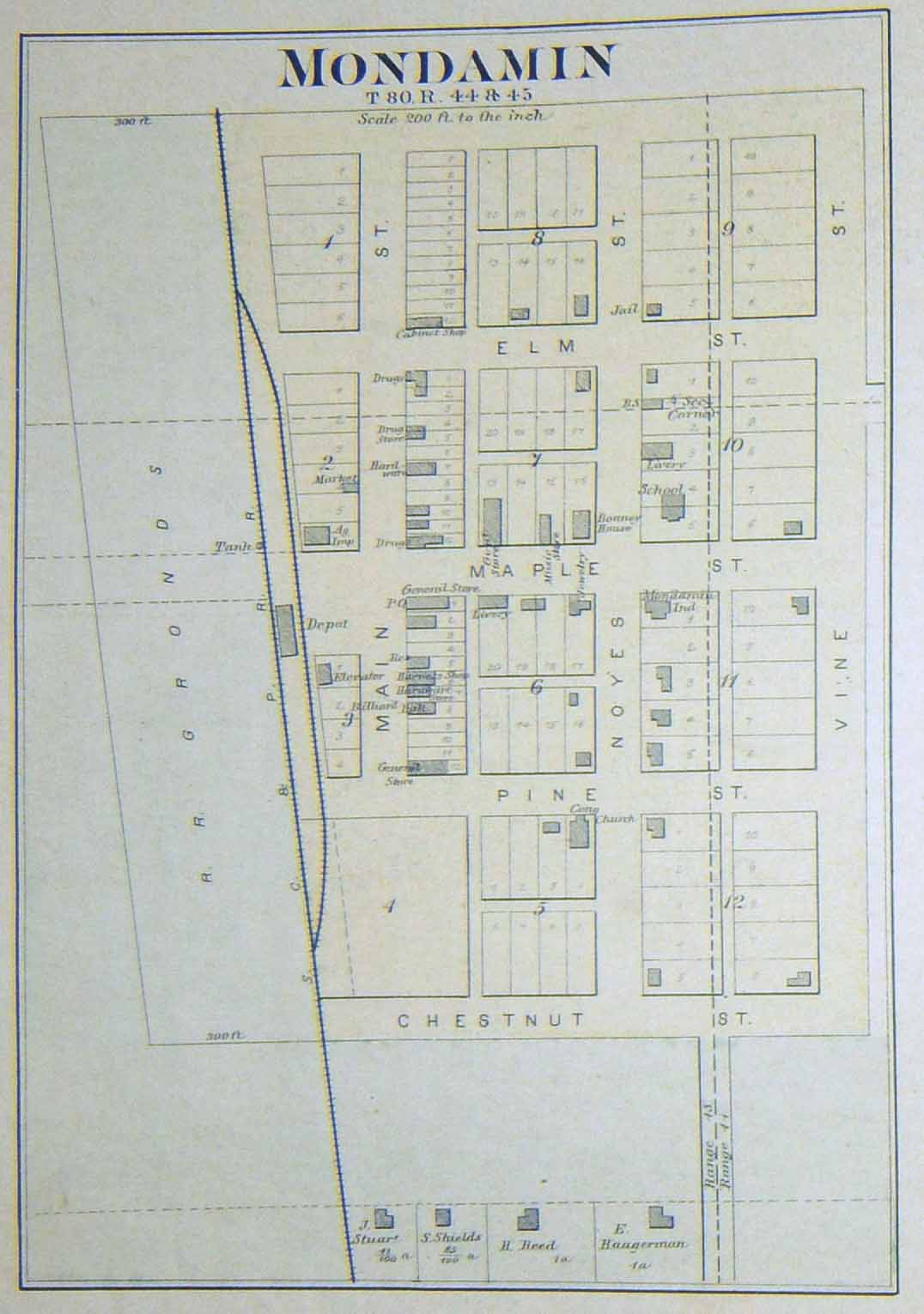 |
River
Sioux |
Persia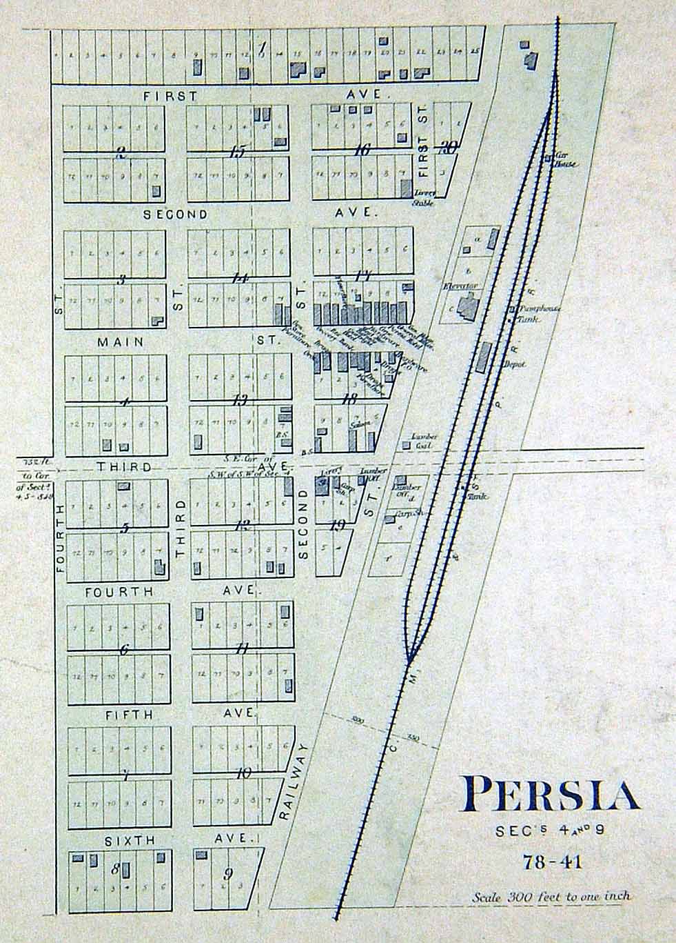 |
St.
John's |
Woodbine |
Yorkshire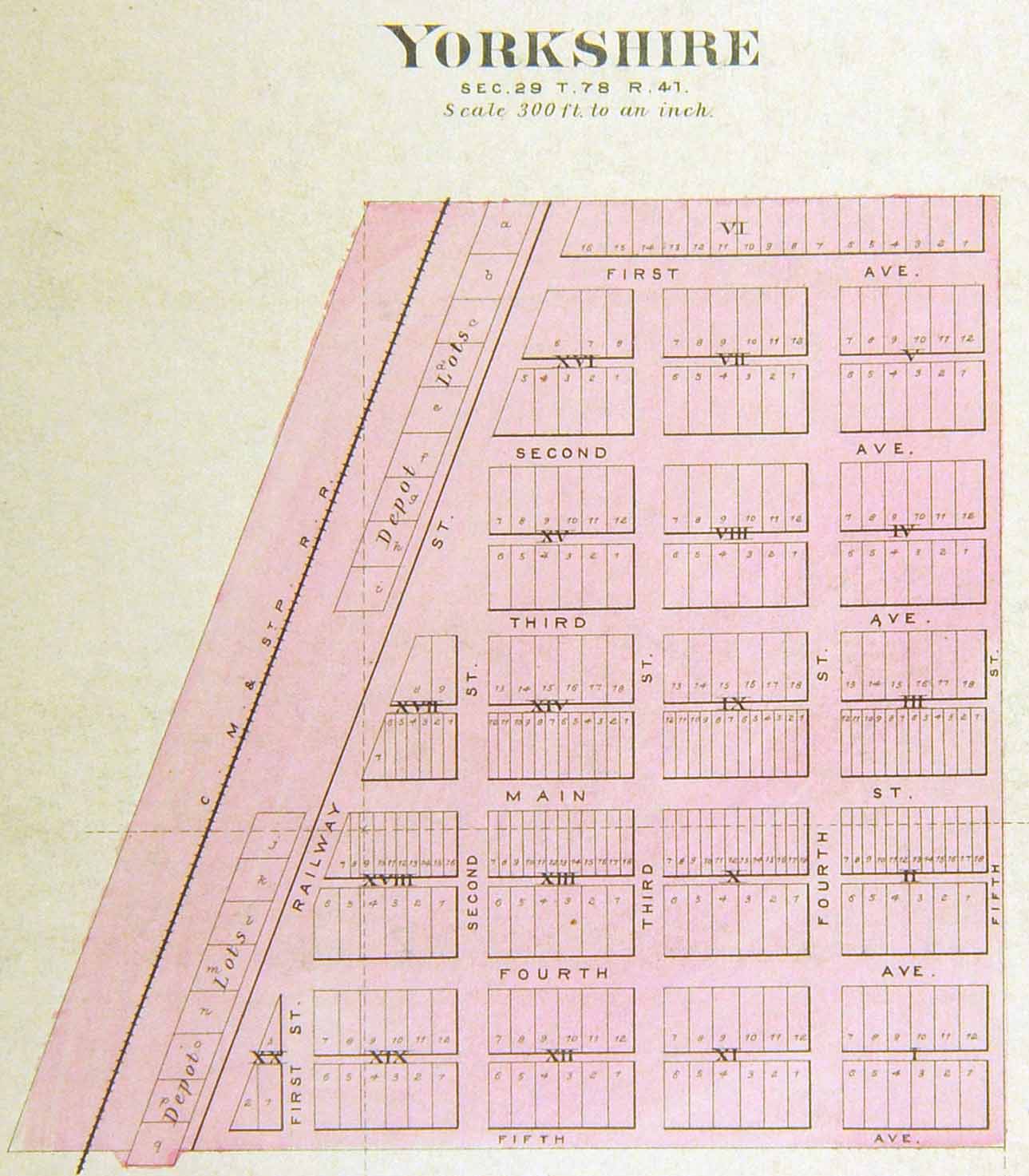 |
||
Return to Harrison County Home Page