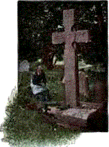
| |
| Bernard J. Albers . Memorial ID167337539 |
| 19 Jan 1870 - 7 Jun 1948 |
| |
| Katherine Peters Albers . Memorial
ID167337557 |
| 30 Nov 1875 - 15 Mar 1960 |
| |
| Don Eugene Alldredge Memorial ID167282837 |
| 25 Nov 1931 - 11 Apr 2004 |
| |
| Marlys Elizabeth Pitts Alldredge . Memorial
ID230076245 |
| 2 Mar 1936 - 16 May 2021 |
| |
| Anna E. Rupp Bauer Memorial ID167366121 |
| 10 Apr 1868 - 16 Oct 1922 |
| |
| Elizabeth May Glassmaker Bauer . Memorial
ID139350387 |
| 24 Sep 1907 - 18 Apr 2004 |
| |
| Frederick Mathias "Fred" Bauer Memorial
ID167366109 |
| 1870 - 3 Nov 1946 |
| |
| Frederick Vincent Bauer VVeteran . Memorial
ID99690888 |
| 22 Nov 1840 - 1 Mar 1920 |
| |
| John H. Bauer Memorial ID271550497 |
| 5 Mar 1879 - 12 Aug 1952 |
| |
| Louis John Bauer Memorial ID174497967 |
| 11 Jun 1900 - 4 Sep 1972 |
| |
| Maria Fisch Bauer . Memorial ID99690934 |
| 8 Aug 1850 - 18 Feb 1919 |
| |
| Stella Mary Zimmer Bauer Memorial
ID196672942 |
| 24 Apr 1887 - 6 Apr 1957 |
| |
| Vernon Bauer Memorial ID174497696 |
| 4 Jul 1929 - 26 Dec 2016 |
| |
| Donald Norbert Baum . Memorial ID167319100 |
| 25 Aug 1928 - 18 Nov 1986 |
| |
| Edward J. Baum Memorial ID167325252 |
| 1892 - 1956 |
| |
| Frank W. Baum Memorial ID167325244 |
| 1890 - 1919 |
| |
| Gerald Eugene Baum Memorial ID167318996 |
| 16 Dec 1929 - 25 Dec 1999 |
| |
| Kathleen Mavoureen McCord Baum Memorial
ID271550523 |
| 25 May 1903 - Nov 1974 |
| |
| Kathryn Mary Baum Memorial ID30295685 |
| 25 Nov 1896 - 7 May 1980 |
| |
| Dora Elizabeth Pinkerton Baum-Rooney
Memorial ID176818518 |
| 16 Nov 1931 - 25 Feb 2017 |
| |
| Michael Earl Bechtel . Memorial ID235600851 |
| 6 Jan 1950 - 2 Jan 2022 |
| |
| Catherine Ann Kohn Becker Memorial
ID167359994 |
| 25 Sep 1883 - 13 Feb 1948 |
| |
| Helen Claire Robinson Becker Memorial
ID167359541 |
| 10 Feb 1917 - 27 Jan 1991 |
| |
| John B. Becker Memorial ID123352977 |
| 20 Dec 1912 - 7 Jan 2000 |
| |
| Joseph N. Becker Memorial ID167361084 |
| 18 Sep 1876 - 13 Jan 1931 |
| |
| Margaret Umhoeffer Begler Memorial
ID99690663 |
| 5 Aug 1857 - 24 Jan 1923 |
| |
| Peter Begler Memorial ID99690593 |
| 16 Mar 1855 - 18 Aug 1907 |
| |
| Joan Marie George Benson . Memorial
ID76587393 |
| 26 Aug 1939 - 14 Sep 2011 |
| |
| Infant Biegler Memorial ID167324848 |
| 1899 - 1899 |
| |
| John B. Blair VVeteran Memorial ID18352840 |
| 28 Feb 1929 - 11 Jan 2005 |
| |
| Ivan Louis Bobolz Memorial ID271548964 |
| 4 Jun 1942 - 28 Sep 2015 |
| |
| Anna Amelia Kirchoff Bush . Memorial
ID167337308 |
| 11 Dec 1894 - 3 Nov 1974 |
| |
| Donald Charles Bush . Memorial ID167337146 |
| 13 Sep 1933 - 12 Apr 1960 |
| |
| Eileen Mae Begnoche Bush Memorial
ID165372410 |
| 9 Sep 1932 - 15 Jun 2016 |
| |
| Elizabeth "Lizzie" Bush . Memorial
ID99687464 |
| 1 May 1872 - 28 Apr 1879 |
| |
| Erma Kathryn Cecelia Delores Ruden Bush
Memorial ID217600828 |
| 18 Jul 1931 - 21 Oct 2020 |
| |
| Frank Bush . Memorial ID91302084 |
| 28 Feb 1879 - 1 May 1881 |
| |
| Jacob Charles "Jake" Bush . Memorial
ID91302146 |
| 7 May 1890 - 23 Jul 1945 |
| |
| James Francis "Jim" Bush Memorial
ID165373197 |
| 3 Dec 1929 - 20 Mar 2013 |
| |
| Jared F. Bush Memorial ID167314746 |
| 23 Dec 1966 - 24 Dec 1966 |
| |
| John L Bush Memorial ID99690706 |
| 22 Aug 1962 - 31 Jan 2001 |
| |
| Joseph Francis Bush . Memorial ID167337292 |
| 17 Oct 1893 - 29 Aug 1960 |
| |
| Kenneth Joseph Bush Memorial ID99690823 |
| 21 Mar 1967 - 14 Oct 1984 |
| |
| Leland Joseph Bush . Memorial ID18578424 |
| 12 Jul 1924 - 19 Dec 2005 |
| |
| Lester W. Bush . Memorial ID166611449 |
| 7 Apr 1921 - 28 Feb 1999 |
| |
| Lizbeth Kay Bush Memorial ID99690753 |
| 23 Feb 1974 - 24 Feb 1974 |
| |
| Louise Sophia Kirchoff Bush Memorial
ID32514064 |
| 19 Feb 1897 - 11 Dec 1976 |
| |
| Mary Ann Nilles Bush . Memorial ID165373952 |
| 2 May 1919 - 9 May 2010 |
| |
| Michael John Bush . Memorial ID65521987 |
| 3 May 1955 - 7 Mar 1981 |
| |
| Ormand Joseph Bush . Memorial ID219626827 |
| 11 Oct 1916 - 20 May 1919 |
| |
| Wayne M Bush Memorial ID271549410 |
| 28 Feb 1954 - 5 Jan 2023 |
| |
| Wilfred John Bush . Memorial ID32513726 |
| 10 Aug 1895 - 21 Jun 1950 |
| |
| Wilmer Bush Memorial ID32515252 |
| 1915 - 1973 |
| |
| Lillian Horesta Kirchoff Bush-Peck .
Memorial ID91302211 |
| 1892 - 1969 |
| |
| Adam Corzilius Memorial ID100168316 |
| 1842 - 31 May 1896 |
| |
| Agnes E. Kohn Corzilius . Memorial ID8569107 |
| 20 Feb 1920 - 23 Mar 2004 |
| |
| Barbara Corzilius Memorial ID100149040 |
| 1879 - 1927 |
| |
| Edmund Corzilius . Memorial ID100159099 |
| 16 Oct 1919 - 9 Feb 2004 |
| |
| Hilda Corzilius Memorial ID100153304 |
| 6 Dec 1911 - 21 Apr 2008 |
| |
| John Joseph Corzilius . Memorial ID100148857 |
| 27 Dec 1877 - 1967 |
| |
| Josephine Hecket Corzilius . Memorial
ID100148789 |
| 1884 - 1961 |
| |
| Mary Peters Corzilius Memorial ID100168275 |
| 1849 - 15 Nov 1900 |
| |
| Mary M Corzilius Memorial ID100148978 |
| 1907 - 1931 |
| |
| Mathias Corzilius Memorial ID100168449 |
| unknown - 23 Nov 1890 |
| |
| Joseph Wayne "Joe" Cronin . Memorial
ID28967858 |
| 5 Mar 1924 - 4 Apr 2008 |
| |
| Marie Louise George Cronin . Memorial
ID213446212 |
| 25 Dec 1924 - 22 May 1988 |