
Adair County Iowa

|
| Adair County Iowa |
|
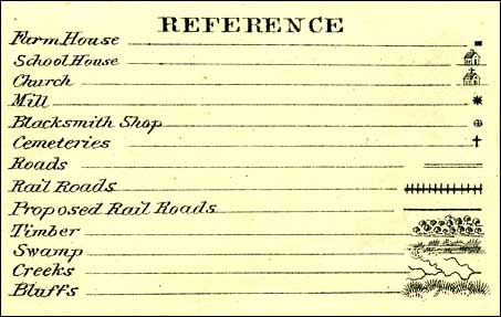
These images of Adair County Townships come from a plat map from a 1875 Andreas Iowa Plat Map Book. They show the locations of churches, schools, farmhouses, mills, blacksmith shops, cemeteries, railroads, proposed railroads, swamps, timber and bluffs. The 1875 Greenfield town map is at this link. I have now added the 1904 maps. |
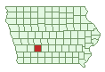
Adair County TownshipsClick a link to go to an 1875 or 1904 map of that Township. The townships are located in the correct position. For instance Summit Township is in the upper north west corner of Adair Co. | |||
Summit | Walnut | Jefferson | Lincoln |
Eureka | Prussia T76N R32W | Grove T76N R31W | Harrison T76N R30W |
Jackson T75N R33W | Summerset T75N R32W | Greenfield(Lee) T75N R31W | Grand River |
Washington | Richland | Union | |